
- Home
- Projects
- Guiana Space Centre
- Sounding rocket launch complex: 680 hectares of photogrammetry for a wind study
Sounding rocket launch complex: 680 hectares of photogrammetry for a wind study
On 15 and 16 April 2026, for CNES, oblique imaging flights covered 6.77 km² around the sounding rocket launch complex: 25,928 images, a 667-million-point cloud and a 3D mesh for a wind simulation.
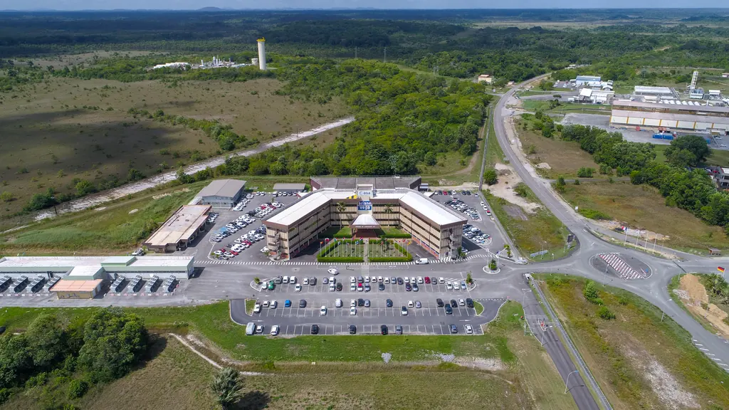
Background
CNES wanted to simulate low-level wind flow around the sounding rocket launch complex. A simulation of this kind needs a faithful 3D model of the terrain, vegetation and buildings. We knew the area: we had carried out a LiDAR survey there for CNES in 2021 and then, in November 2023, for an engineering firm, a LiDAR and photogrammetry survey of three areas including the former Diamant site, with orthophotos from 3 to 50 cm and 1 m contour lines.
What we did
The flights were flown at 120 m in oblique mode, with one vertical and four 45° inclined views at each position, 80% forward and 70% side overlap, using RTK on the Teria network. Each ground point appears on more than nine images. Processing, from 16 to 21 April on six networked workstations, aligned 99.96% of the 25,928 images. Deliverables: a 667-million-point cloud (51.5 points per m²), a textured mesh of 274 million faces, a 13.9 cm digital elevation model, a 3.48 cm orthophoto, 5 m contour lines and a mission report. Ten weeks passed between scoping and delivery, permits included. The survey images are restricted: none is published here.
2 related missions in the log
Photogrammetric survey of 680 hectares around the sounding rocket launch complex
On 15 and 16 April 2026: 25,928 oblique and vertical images at 120 m, a 667-million-point cloud, a 274-million-face mesh, a 3.48 cm orthophoto and contour lines, for a low-level wind simulation.
- 680 ha
- 25 928 images
LiDAR and photogrammetry survey of three areas, including the former Diamant site
Orthophotos from 3 to 50 cm resolution, 1 m contour lines (terrain and surface) and point clouds delivered in DWG.
Other projects
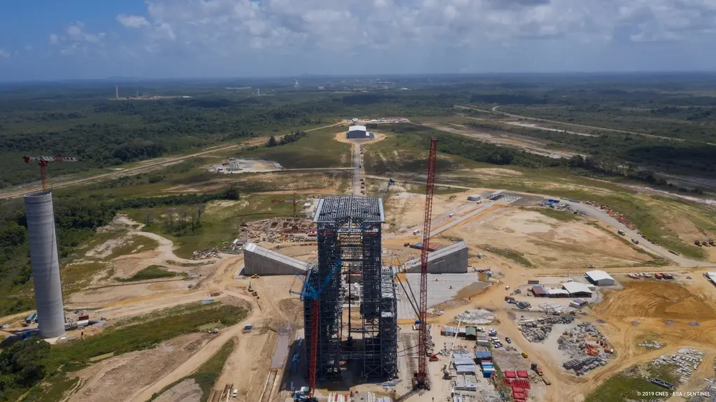
The Ariane 6 launch complex construction, filmed and photographed from 2018 to 2021
From 2018 to 2021, aerial photo and video campaigns on the ELA4 construction site: fourteen films published by the Guiana Space Centre, photos used by ESA, Espace & Exploration and Latitude 5.
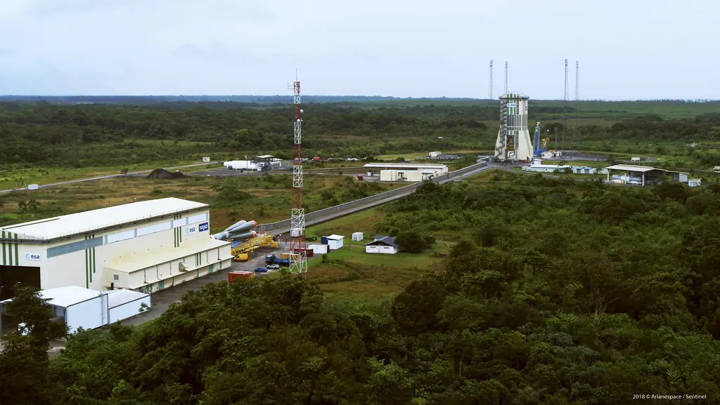
Launch campaigns: fifteen launches covered in Kourou from 2017 to 2019
Aerial photography of the launch complexes during Ariane 5, Soyuz and Vega campaigns, within the windows authorised by the base: fifteen launches from December 2017 to December 2019.
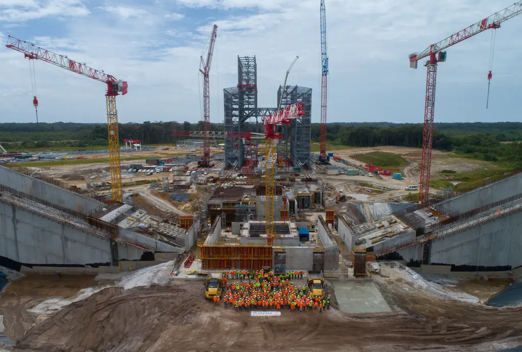
Flame trenches of the Ariane 6 launch complex: inspections and a digital twin at 1.5 mm per pixel
Since November 2023 we have photographed the inside of the two flame trenches of the ELA4, which carry the engine exhaust away at lift-off. In 2025 a photogrammetric survey turned them into a digital twin and eight orthophotos at about 1.5 mm per pixel.
Tell us about your project
Location, area or structure, expected deliverables and timing: with these details we can propose a method and a quote.
97310 Kourou
French Guiana
Route des Trois-Îlets
97229 Les Trois-Îlets
Martinique
20030-041 Rio de Janeiro – RJ
Brazil