
- Home
- Projects
Projects
From dams in Brazil to the launch complexes of Kourou, a selection of our work with its figures. Each project has its own page: the background, method, deliverables and images.
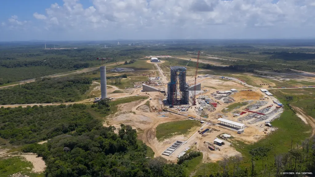
At the Guiana Space Centre
Launch campaigns, the Ariane 6 construction filmed from 2018 to 2021, post-launch inspections, networks, surveying, thermography, virtual tours: ten years of missions on the spaceport.
- 2018–2021The Ariane 6 launch complex construction, filmed and photographed from 2018 to 2021
- 2017–2019Launch campaigns: fifteen launches covered in Kourou from 2017 to 2019
- 2023–2025Flame trenches of the Ariane 6 launch complex: inspections and a digital twin at 1.5 mm per pixel
- 2024–2025Jet guide and deflector of the ELA4: inspected after the first four Ariane 6 launches
- 2021–2026Sounding rocket launch complex: 680 hectares of photogrammetry for a wind study
- 2023–2026ELA4 hydrogen burn pond: the igniters checked with a thermal camera, test after test
- 2018–2026Post-launch inspections of the Ariane 5, Soyuz and Vega zones
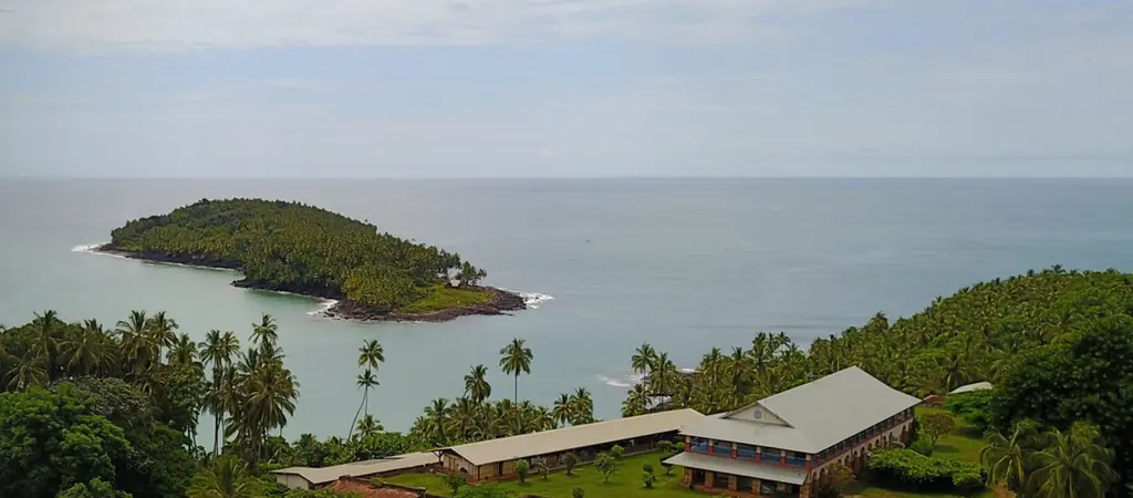
- 2023–2025Salvation Islands: LiDAR and photogrammetry of the three islands
- 2023Virtual tour of the Ariane 6 launch complex: 200 360° panoramas
- 202095 Space Centre buildings inspected in six days
- 2019–2020Tests of the P120C motor for Ariane 6 and Vega C
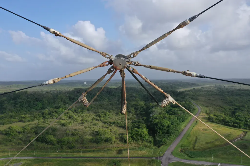
- 2019–2023Space Centre power network: 250 pylons inspected
- 2018–2019Thermal inspection of the Ariane 5 launch pad
- 2021Saint-Georges-de-l’Oyapock: 60 hectares of LiDAR to position a collimation mast
All projects
53 detailed projects. Filter by service or territory.
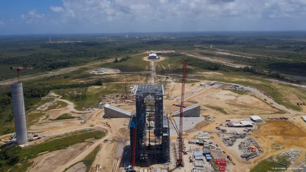
The Ariane 6 launch complex construction, filmed and photographed from 2018 to 2021
From 2018 to 2021, aerial photo and video campaigns on the ELA4 construction site: fourteen films published by the Guiana Space Centre, photos used by ESA, Espace & Exploration and Latitude 5.
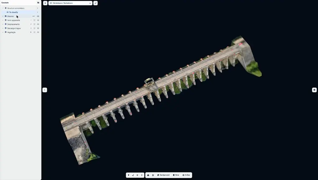
Hydroelectric plant on the São Francisco river: 2,492 anomalies mapped in three days on site
Baseline survey of a hydroelectric plant on the São Francisco river, in the state of Bahia: 11,809 photos in 33 flights, 9 orthophotos totalling 46 gigapixels, two 3D models, a virtual tour and a web interface for the operator’s engineers.
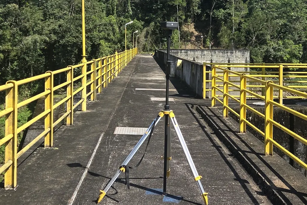
Juquiá complex: seven dams with crests of 140 to 265 m
Two-year contract signed in July 2026 with an energy producer: the seven dams flown over in August, the faces of Salto do Iporanga and then Serraria surveyed in detail, the rest scheduled for the 2027 dry season.
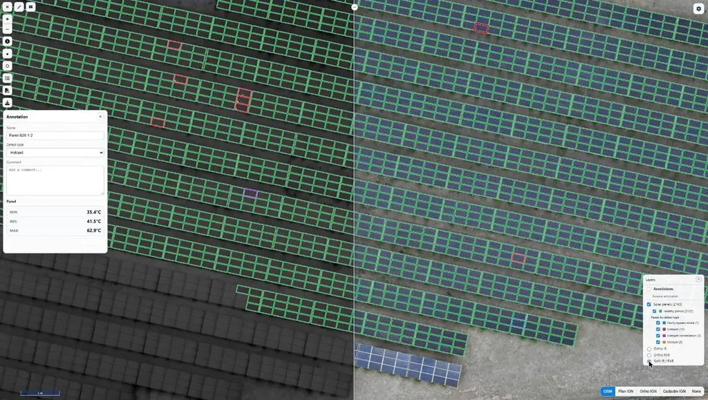
Eleven solar plants in 2026: 33,333 panels checked one by one
June to September 2026: eleven plants surveyed by thermography for Genergies in Martinique, Guadeloupe and French Guiana: 33,333 panels checked one by one.
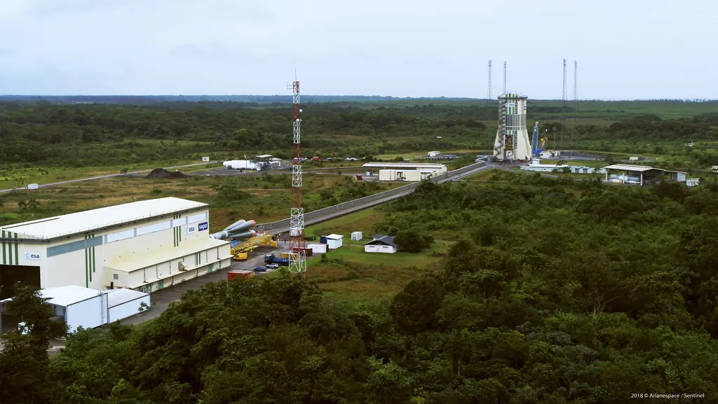
Launch campaigns: fifteen launches covered in Kourou from 2017 to 2019
Aerial photography of the launch complexes during Ariane 5, Soyuz and Vega campaigns, within the windows authorised by the base: fifteen launches from December 2017 to December 2019.
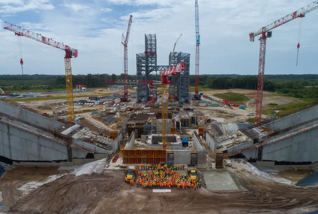
Flame trenches of the Ariane 6 launch complex: inspections and a digital twin at 1.5 mm per pixel
Since November 2023 we have photographed the inside of the two flame trenches of the ELA4, which carry the engine exhaust away at lift-off. In 2025 a photogrammetric survey turned them into a digital twin and eight orthophotos at about 1.5 mm per pixel.
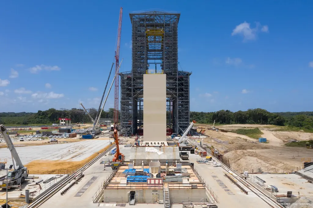
Jet guide and deflector of the ELA4: inspected after the first four Ariane 6 launches
After the maiden flight of Ariane 6 in July 2024, then after the launches of March, August and November 2025, we photographed the jet guide of the ELA4, outside and inside over its full height, together with its deflector.
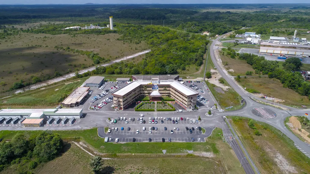
Sounding rocket launch complex: 680 hectares of photogrammetry for a wind study
On 15 and 16 April 2026, for CNES, oblique imaging flights covered 6.77 km² around the sounding rocket launch complex: 25,928 images, a 667-million-point cloud and a 3D mesh for a wind simulation.
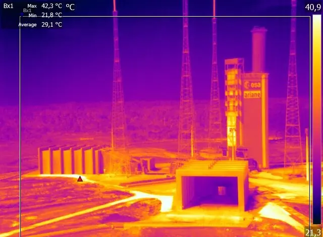
ELA4 hydrogen burn pond: the igniters checked with a thermal camera, test after test
From June 2023 to April 2026 we checked the igniters of the ELA4 hydrogen burn pond with a thermal camera: first for CNES during the Ariane 6 tests, then for Eiffage Énergie Systèmes at every launch preparation.
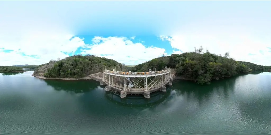
Peti dam: 4,052 cracks tracked from one campaign to the next since 2022
Four annual campaigns on an arch dam in Minas Gerais: a baseline of 4,052 cracks surveyed at 0.8 mm per pixel in 2022, then only what appears, lengthens or becomes more visible.

12,647 hectares of orthophotos at 3.5 cm for EPFA Guyane
From 4 December 2023 to 1 March 2024, eight sectors photographed at 3.5 cm per pixel, from Cayenne to Cacao: 343 flights, 184,464 photos, 50 ground control points and 26 check points. A second 6,545-hectare campaign began on 16 October 2026; its first sector was delivered on 19 October.
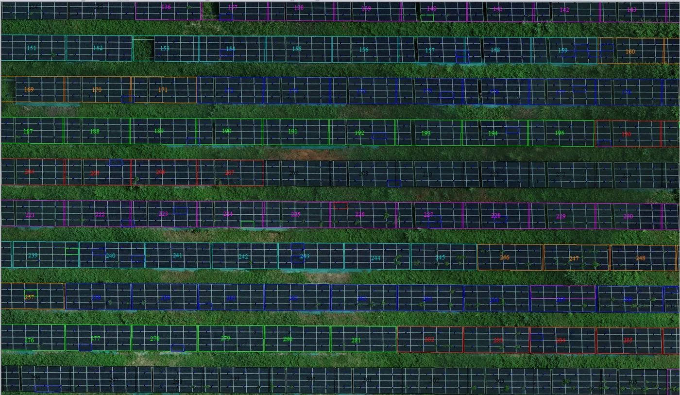
Corossony solar plant: 1,472 concrete footings surveyed at 2 mm per pixel before repowering
A 1:500 topographic plan of the plant in operation in September 2024, then the position and height of each of the 1,472 footings kept for the new structures, in December 2025.
Post-launch inspections of the Ariane 5, Soyuz and Vega zones
Since 2018, after launches, we have photographed the structures of the launch zones for their revalidation, as on the Soyuz launch zone on 4 January 2021.
Martinique coastline: three precision surveys, from 1.78 to 3.72 cm
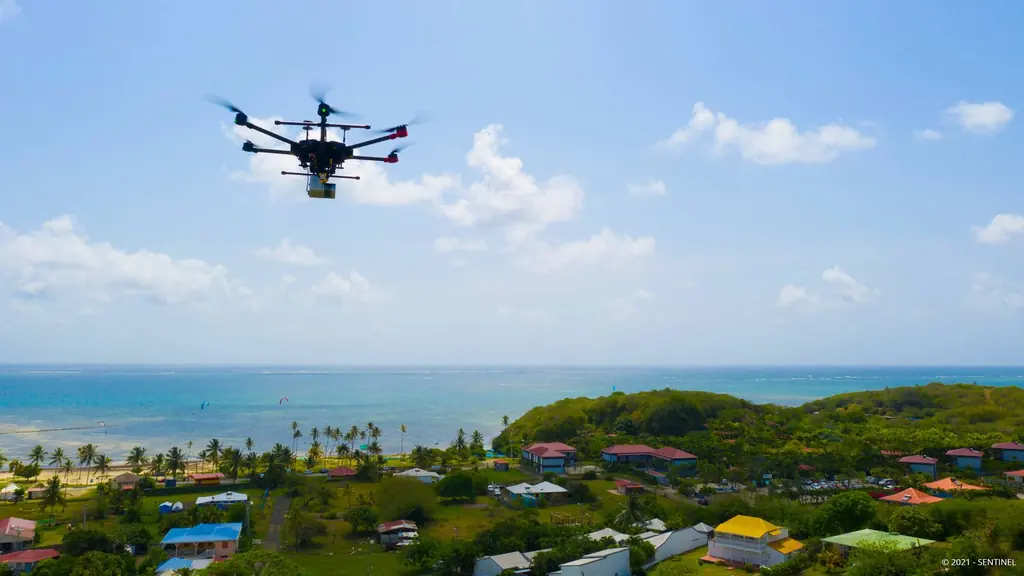
At Pointe des Sables in Le Vauclin and in Saint-Pierre for DEAL Martinique, at the mouth of the Prêcheur river for BRGM during the lahar crisis: three orthophotos whose accuracy was measured on independent targets, delivered between one and five days after the flights.
Jarry-Houëlbourg: 327 hectares of wetland in a 2.36 cm orthophoto
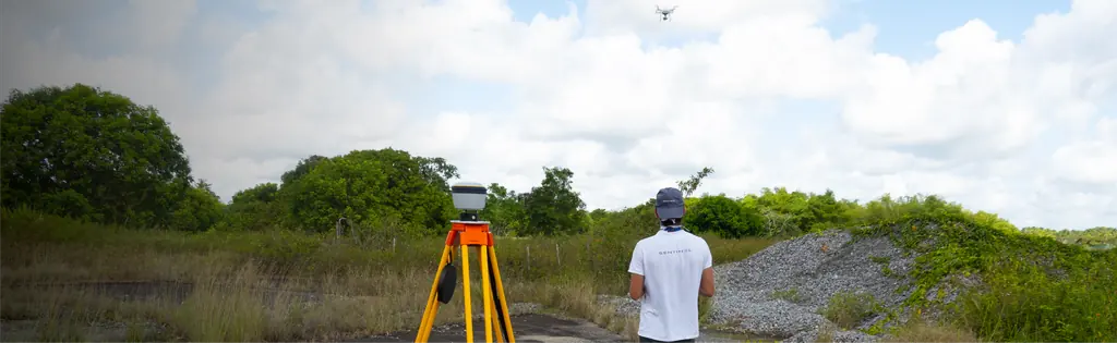
For the Conservatoire du littoral, the orthophoto and surface model of the Jarry-Houëlbourg wetland and its edge with the business district: 15,445 images taken over one weekend in February 2026, 3.64 cm root-mean-square error on six check points.
Salvation Islands: LiDAR and photogrammetry of the three islands
For CNES, which manages the site, LiDAR and photogrammetric surveys of Île Royale, Île Saint-Joseph and Devil’s Island, from 2023 to 2025.
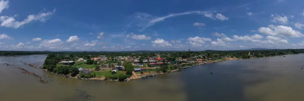
Waste in western French Guiana: eight visits in Saint-Laurent, four Maroni villages at 1 cm
Since October 2024, photos taken from the same viewpoints at every visit to the Saint-Laurent-du-Maroni waste storage facility, with a 3 cm orthophoto and a plan since December 2024; in February 2026, the waste sites of four river villages surveyed at 1 cm.
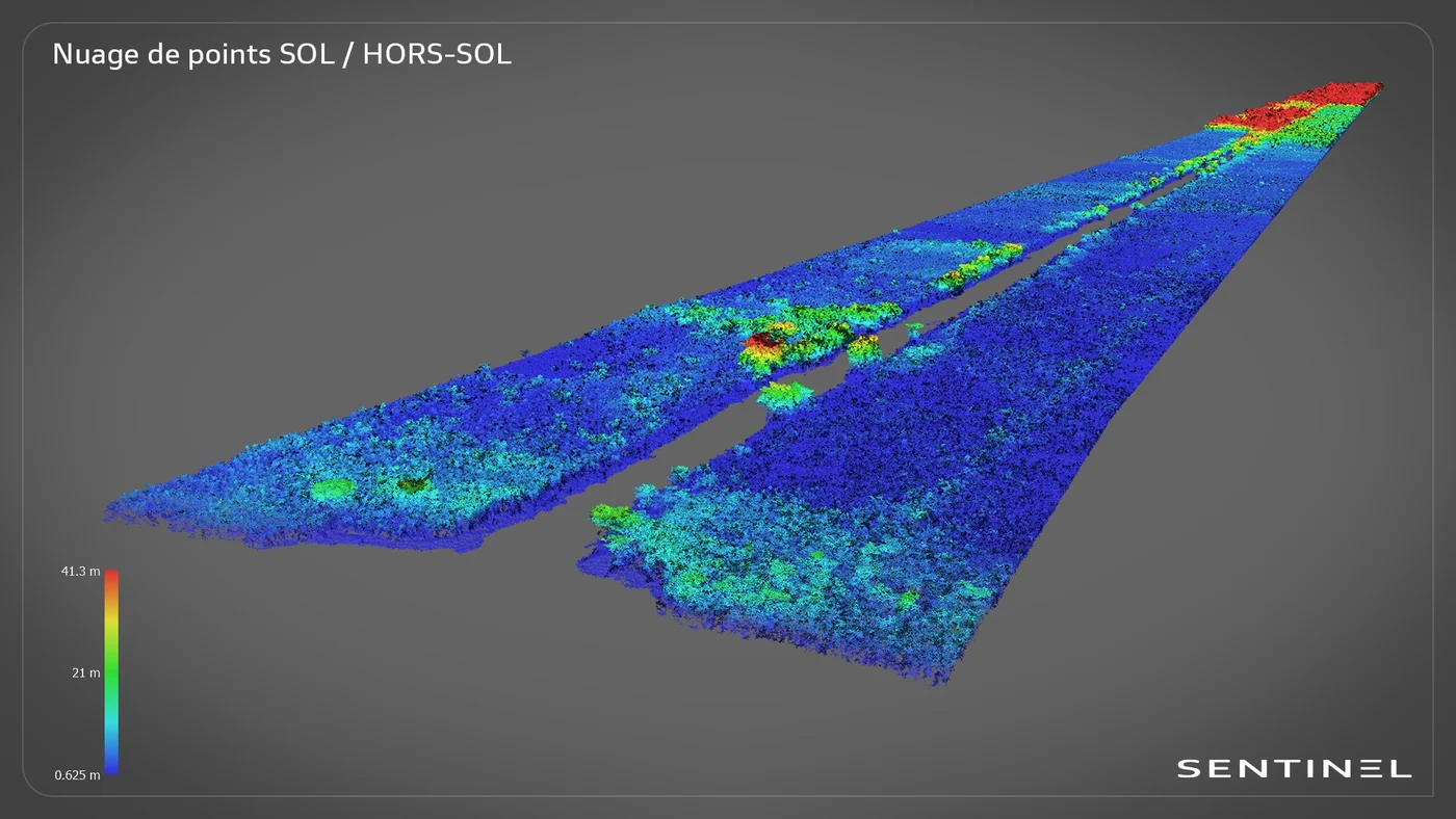
Roy canal: 7.7 km of LiDAR from a dugout canoe, in the Kaw marshes
In late June 2024, in the Kaw-Roura marshes nature reserve: a 7,700 m by 200 m corridor surveyed from the boat, 155 million points and the ground restored beneath the vegetation.
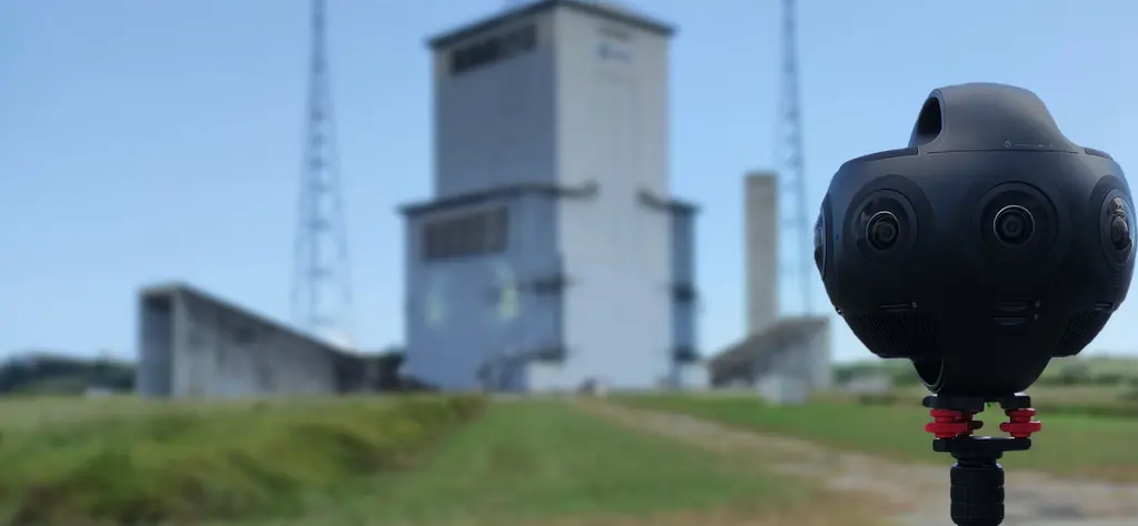
Virtual tour of the Ariane 6 launch complex: 200 360° panoramas
For CNES, a web-based virtual tour of the launch complex, to prepare Toulouse-based engineers before their mission in French Guiana and brief them on safety protocols.
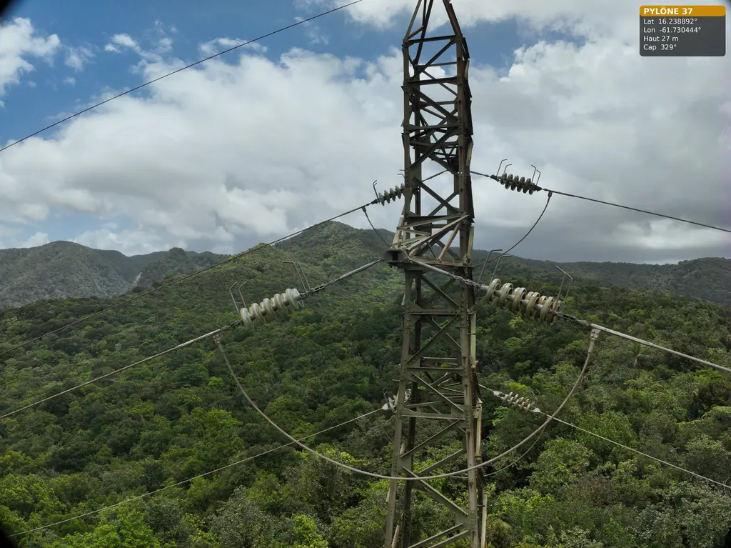
63 and 90 kV lines: three pylons in the Guadeloupe rainforest, five wooden poles in French Guiana
For Omexom, in June and July 2026: three 63 kV pylons in the Guadeloupe national park, then in French Guiana a fault check after an outage and five wooden supports of a 90 kV line.
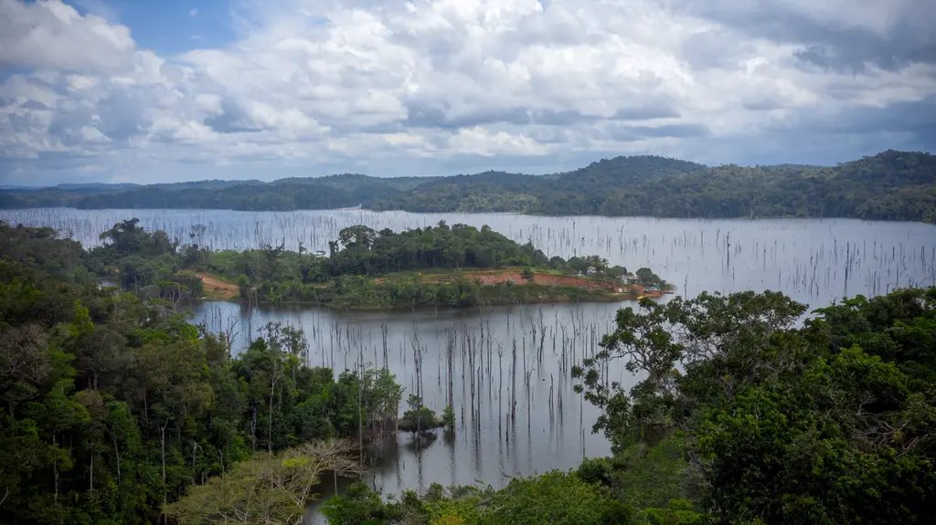
Petit-Saut sawmill: 31 monthly visits, three time-lapses and eight years of missions on the lake
For Triton, which harvests the drowned timber of the Petit-Saut lake, we photographed the lake as early as 2018, then followed the sawmill construction every month from March 2023 to September 2025. In 2026 came a virtual tour, a corporate film and stockpile volumes on the platforms.
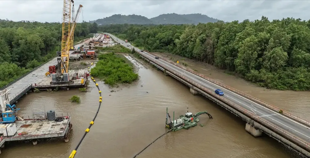
Larivot bridge: the repair of a 1,225 m bridge, filmed over eight visits
Since October 2024, aerial and ground photos and videos at each phase of the repair works on the existing bridge, and in March 2026 a four-to-five-minute film for the contractor’s convention.
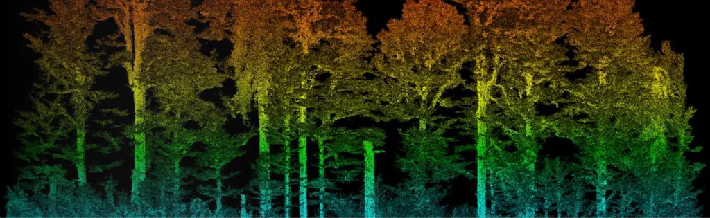
Saint-Jean-du-Maroni: 125 hectares of the relegation heritage by LiDAR
For the regional historic monuments service, a 25 cm terrain model beneath the vegetation of the former relegation camp, surveyed from 23 to 25 October 2024 to prepare the protection order.
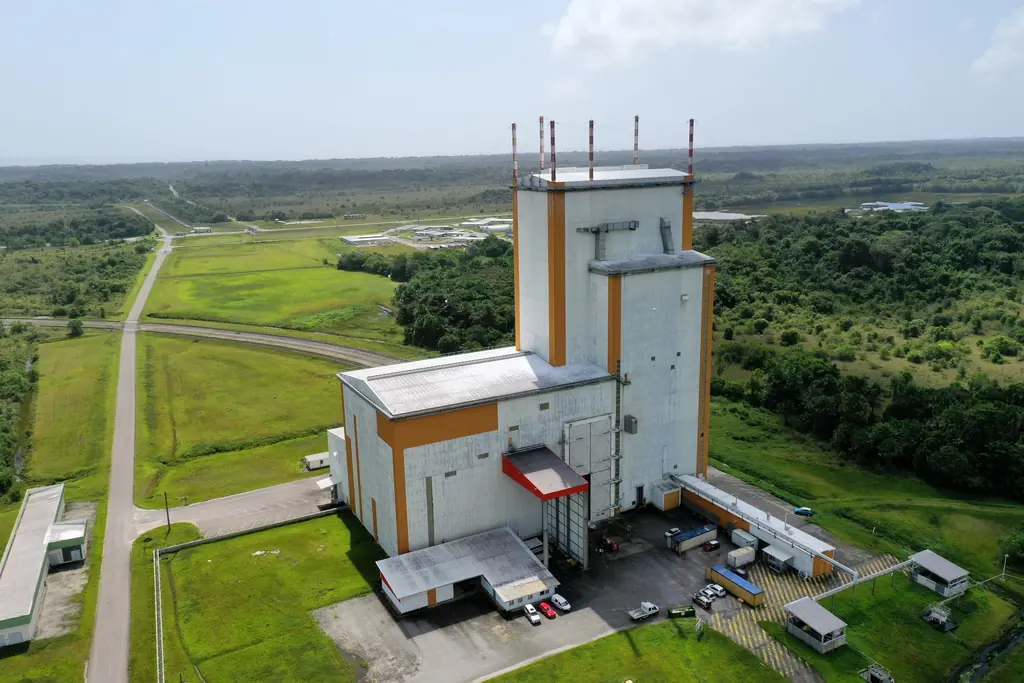
95 Space Centre buildings inspected in six days
In early June 2020, for Groupe ADF, inspection of the façades, roofs and roads of 95 buildings on the base, anchor points and welds included, in six days.
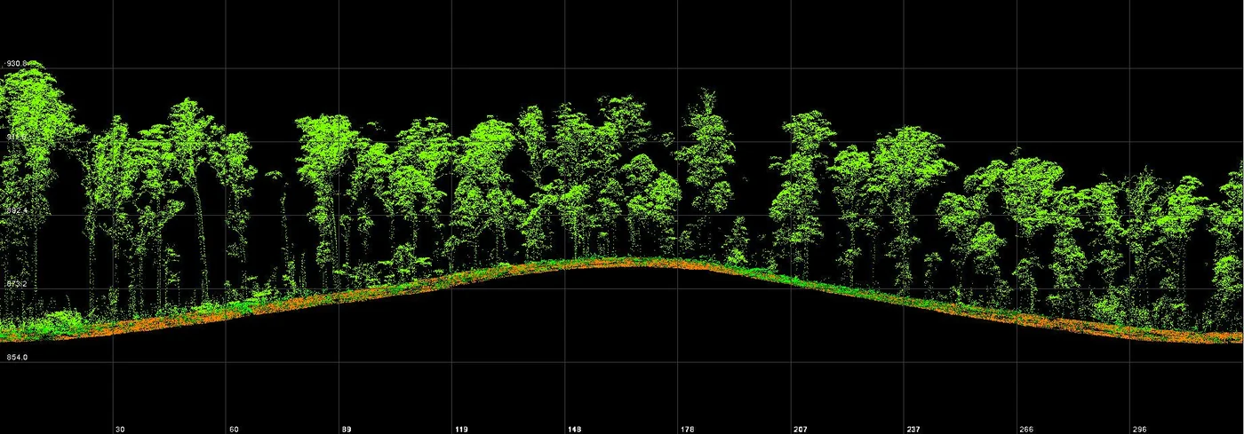
New LiDAR: two surveys of the Macouria solar plant site, with 1.95 and 2.97 cm vertical error
The fleet’s new LiDAR system, validated in June 2026 on our reference points, surveyed the site of Corsica Sole’s photovoltaic plant in Macouria twice in one month, to measure earthwork volumes.
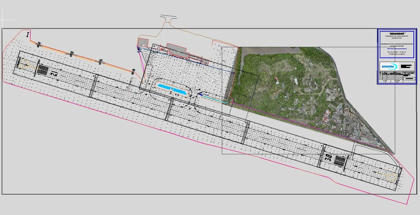
Grand-Case aerodrome: LiDAR and a 3 cm orthophoto beside an active runway
In April 2026 we surveyed by LiDAR, for the aerodrome operator, a wooded area of about 8 hectares beside the runway, at no more than 30 m above ground and in coordination with the AFIS, then re-registered the existing airfield drawing in the current reference system.
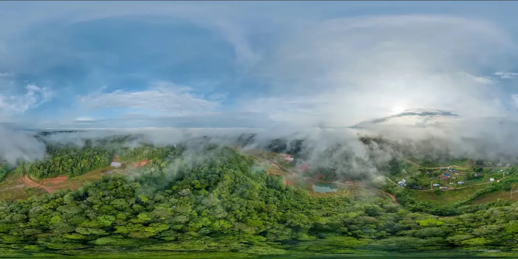
Saint-Élie: 625 hectares without a GNSS station within twenty kilometres
3.5 cm orthophoto of 625 hectares around an inland village, registered on a base and five control points measured by precise point positioning, with no reference station in range.
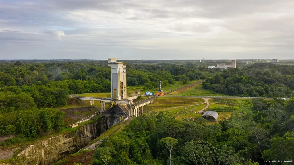
Tests of the P120C motor for Ariane 6 and Vega C
Our aerial footage of the second bench test of the P120C, on 28 January 2019, was published by CNES; in July 2020 we photographed the transfer of the third motor to the test bench.
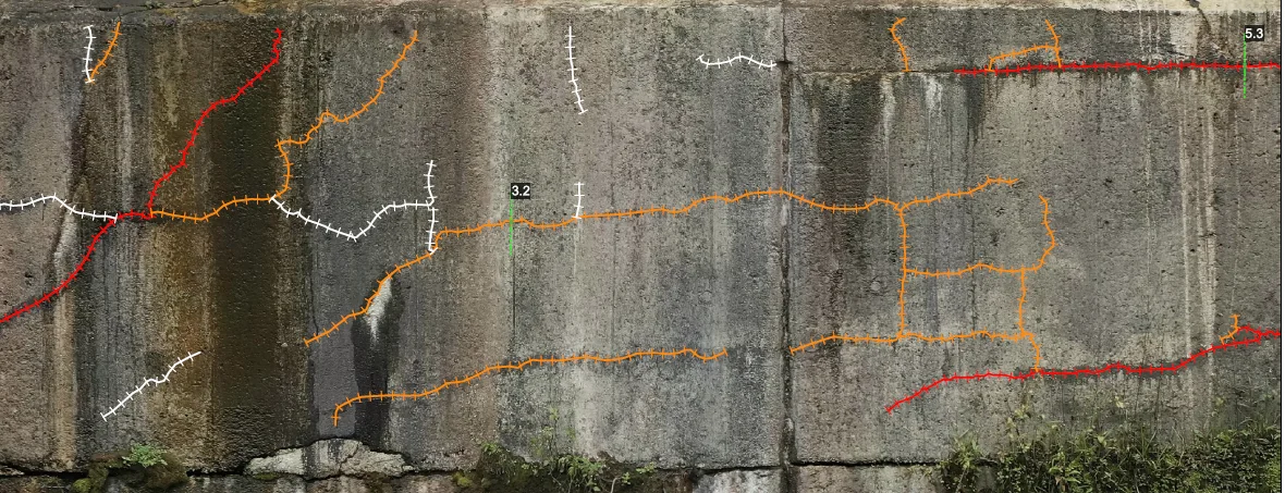
Furnas test blocks: cracks measured at 0.15 mm per pixel
For Furnas’ research programme on concrete affected by expansive reactions, face-by-face measurement of the cracks of 80 cm test cubes: 26 blocks in 2022 at 0.25 mm per pixel, 14 blocks in 2023 at 0.15 mm.
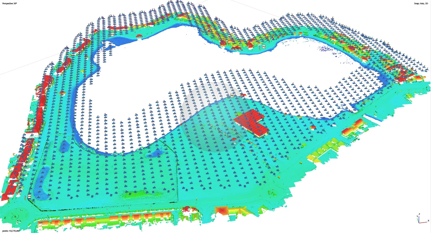
Kourou lakes: three water bodies at 13 mm, then erosion monitoring of the Canal de l’Ouest
13 mm orthophotos of the Bois Chaudat, Bois Diable and Marie-Claire lakes in November 2024; since September 2026, erosion-monitoring campaigns on Bois Chaudat lake and the Canal de l’Ouest, flown at low tide.
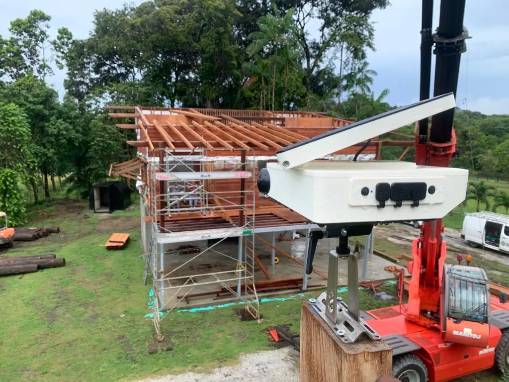
BHNS works at Balata: two time-lapse cameras for fourteen months
From 8 November 2024 to 31 December 2025, two time-lapse units and five days of aerial and ground filming on the RN2 upgrade in Matoury, for the civil works contractor.
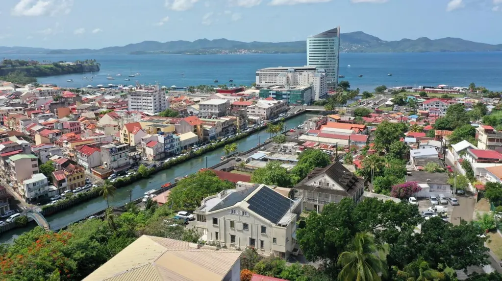
More than 1,000 rooftops surveyed since 2019 for a solar installer
Pre-installation roof surveys, 3D shading studies and thermal surveys of rooftop plants, across three territories since 2019.
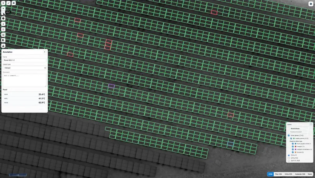
Bellefontaine: 8,996 panels surveyed by thermography under medium-voltage lines
A 4.9 MWp ground-mounted plant beneath medium-voltage lines: LiDAR survey, flights at 30 m above the terrain, 8,996 panels checked one by one.
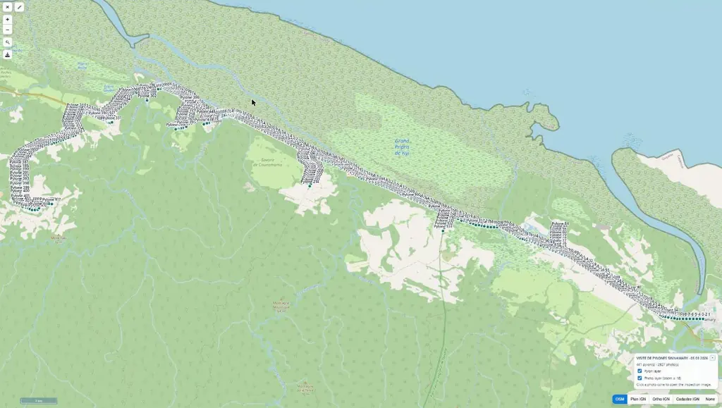
1,262 medium-voltage line supports photographed in French Guiana: 128 km in 19 flying days
Four medium-voltage feeders, from Mana to Saint-Georges: every support photographed using the operator’s method, 7,854 geotagged photos and a KML file of the lines.
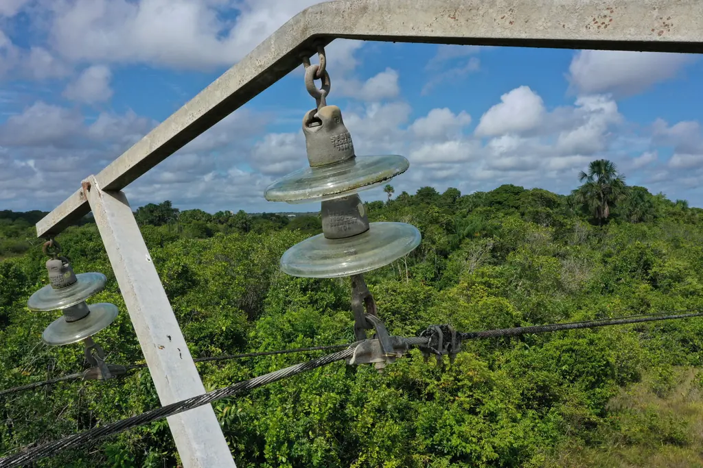
Space Centre power network: 250 pylons inspected
In August 2019, inspection of 250 pylons of the base’s power network, so that our client could assess them and plan maintenance; the line supports were reviewed again until 2023.
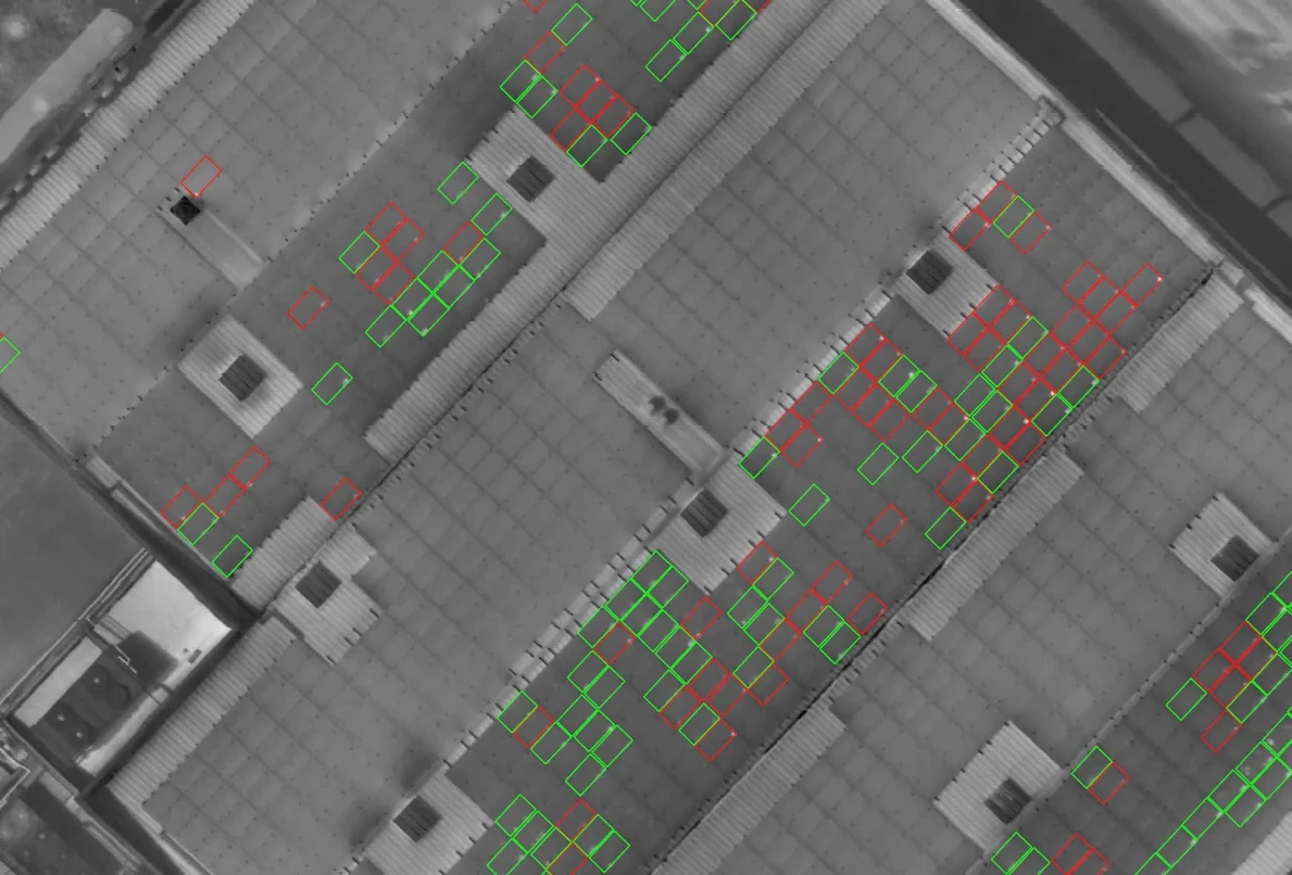
Urbasolar: five rooftop plants checked by thermography in Martinique and Guadeloupe
From March 2024 to April 2026: 4,082 modules in La Trinité, a string identification protocol, two roofs in Le Lamentin in a single morning, a campaign repeated in Jarry once the plant was producing, and a survey before rewiring.
Galisbay: 30.5 hectares by photogrammetry, then the ground by LiDAR for the earthworks
On a site next to Galisbay port, for an Albioma project: orthophoto and virtual tour in November 2024, LiDAR survey in March 2025, then in February 2026 the 15 cm ground points requested by the earthworks designer.
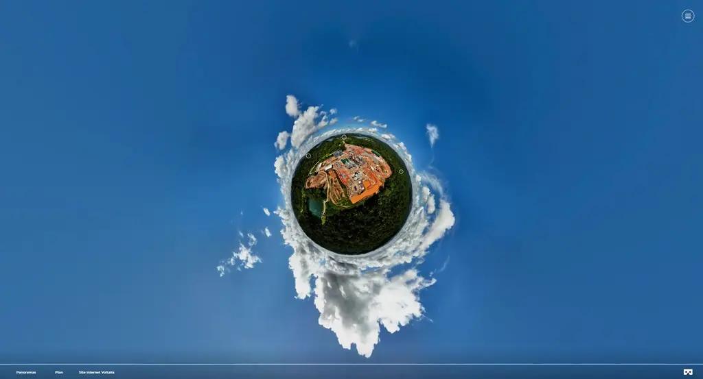
Petit-Saut: ten versions of the construction virtual tour, then 44 panoramas for the inauguration
Throughout construction of the Petit-Saut biomass plant we rebuilt the site’s virtual tour after each photo campaign, up to the tenth version in August 2025. For the inauguration on 14 October 2025 we delivered a 44-panorama tour covering both the plant and the sawmill, together with the event video.
Thermal inspection of the Ariane 5 launch pad
With Arianespace and RMT, thermal-camera check of the igniters of the launch pad’s hydrogen burn pond, from flight VA246 in December 2018.
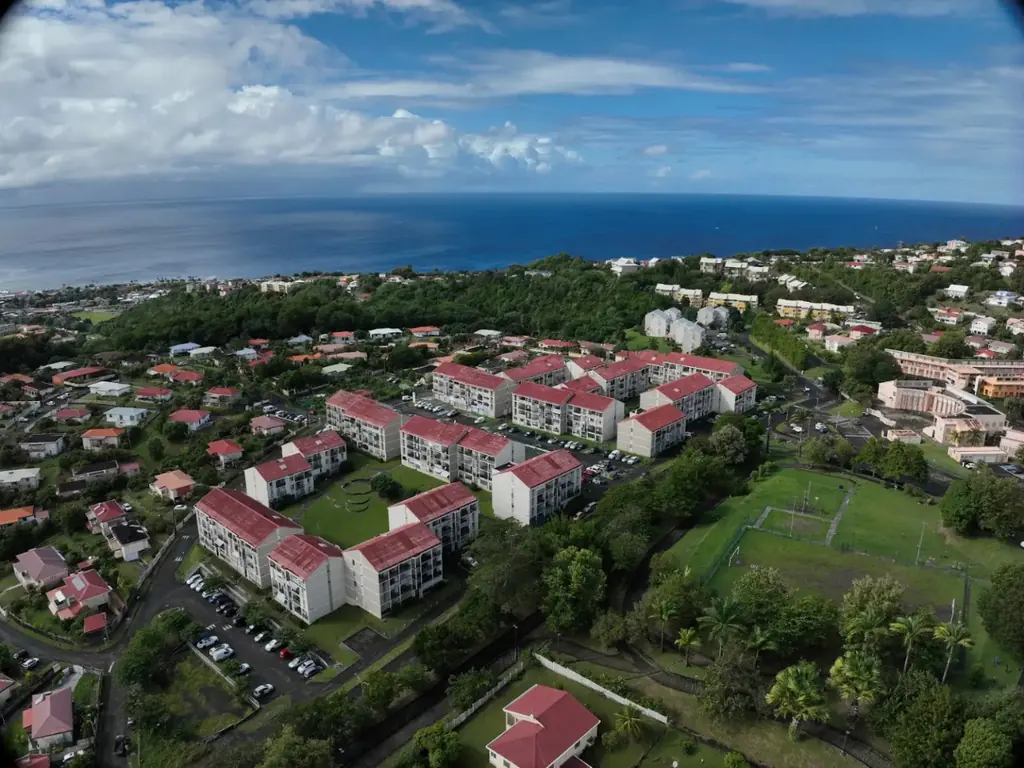
Le Robert, Ducos, Rivière-Salée: three social housing estates surveyed in 3D
From May 2024 to July 2025, for two social landlords, we surveyed three housing estates by drone: colourised point clouds split building by building, plans and roof inspection photos, delivered to the architects and engineering firms in the formats their software reads.
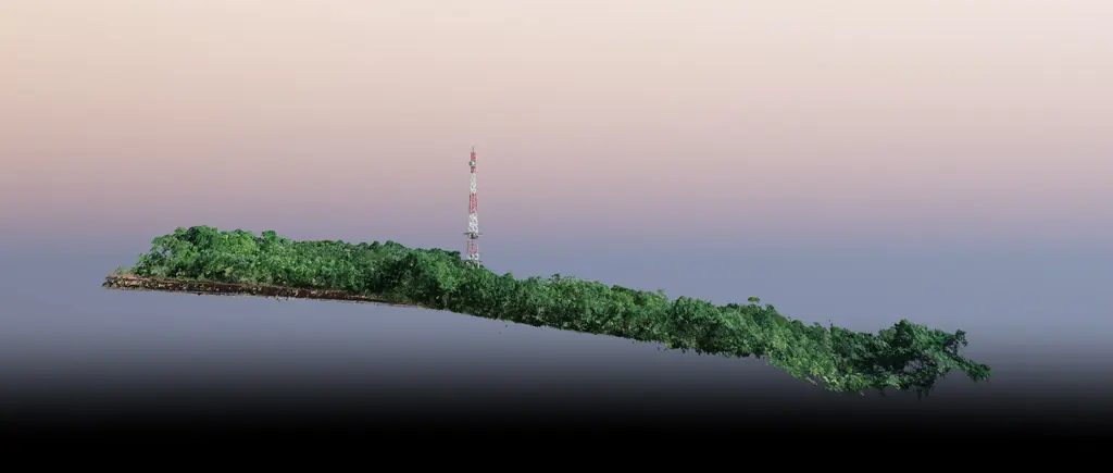
Saint-Georges-de-l’Oyapock: 60 hectares of LiDAR to position a collimation mast
For CNES, a 2 km by 300 m corridor surveyed by LiDAR to study the lines of sight between a radar and a collimation mast 2.1 km away.
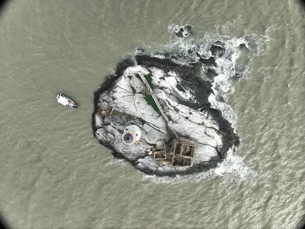
The Enfant Perdu lighthouse, inspected from a boat
On 9 December 2025, for the Lighthouses and Beacons unit of DGTM, photographic coverage of the lighthouse and its islet, with the drone taking off from a boat that stayed offshore. In March 2024 we had photographed the Île Royale lighthouse for the same department.
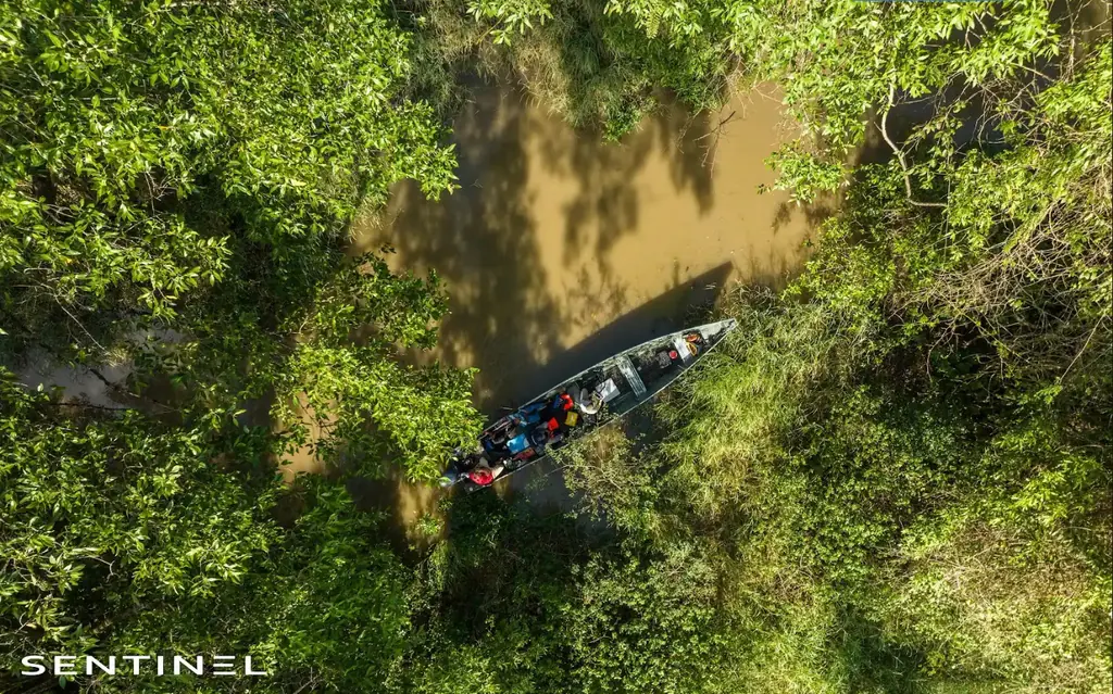
Crique Fouillée: 2.8 km of creek in 15 mm orthophoto to prepare dredging
For the urban community’s stormwater service, a condition survey of an urban creek between Cayenne and Matoury: georeferenced orthophoto, mapping of debris jams and machine access points, video of the whole stretch.
Approuague and Sinnamary forest: LiDAR and 3 cm orthophotos for the University of French Guiana
For the Espace-Dev research unit, two forest plots surveyed by LiDAR and photography: 16 hectares on the Approuague in July 2025, with take-offs from a dugout canoe, then 48 hectares in Sinnamary in October.
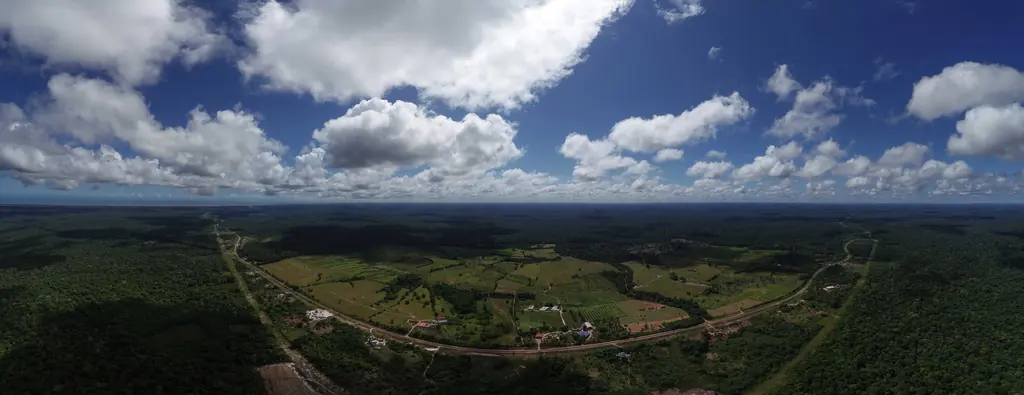
TDF sites in French Guiana: ten locations photographed at antenna height, from 18 to 60 m
Ten locations photographed at the antenna heights under study in 2023-2024, the capture of a site for its 3D model in 2025, 360° shots delivered the next day in 2026.
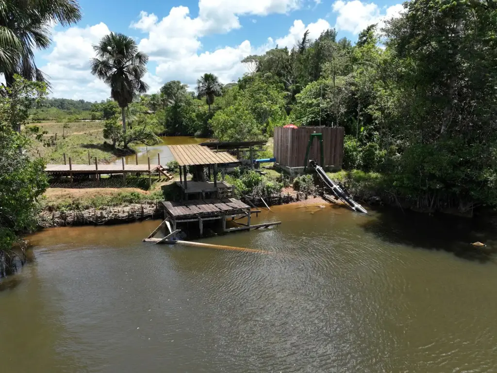
Centre Littoral urban community: the bus rapid transit works, the arrival of the buses and two drinking-water structures
In April 2024, ten sectors of the bus rapid transit works; in January 2026, the unloading of the buses at the port of Dégrad-des-Cannes; in October 2026, the Montsinéry-Tonnégrande water tower and the Comté water intake.
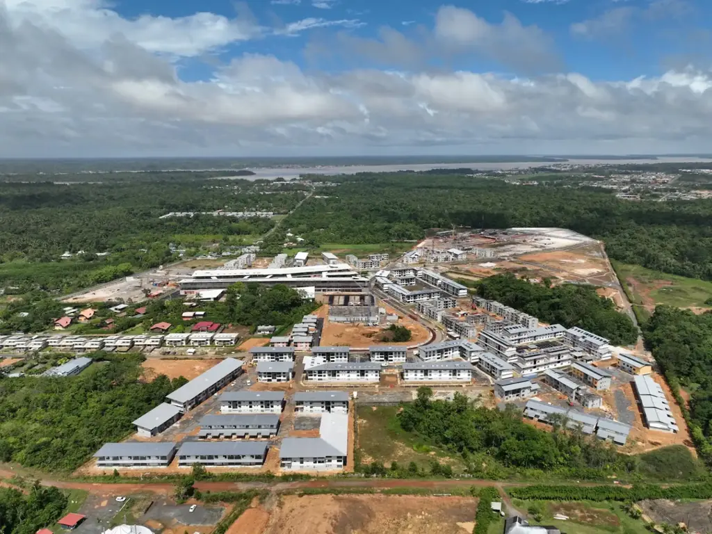
Balaté Nord: three drone visits to a housing district under construction
Aerial photos and videos of a housing scheme in Saint-Laurent-du-Maroni, from January 2025 to March 2026, with flight paths drawn by the client.
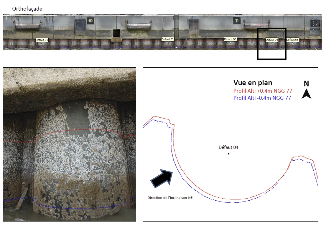
Quay no. 2 at Dégrad-des-Cannes: pile verticality from 4,410 photos
Photogrammetry under the deck, at low tide and from a boat: 3D model of the quay, ortho-façade and tilt of the piles, delivered less than a month after the flights.
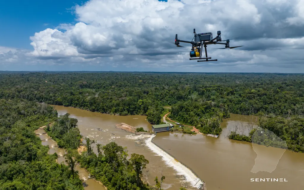
Saut Maman Valentin: seven survey campaigns on the banks downstream of the plant
Since October 2020, drone LiDAR and photogrammetry downstream of the hydroelectric plant on the Mana: point clouds, 3 cm orthophotos and differential plans of the islet from one campaign to the next.
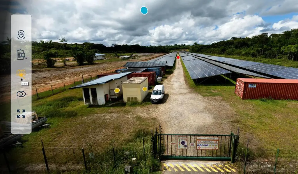
Coco Banane and Savane des Pères: two solar plants as virtual tours, 26 panoramas
In November 2025 we produced virtual tours of two operating photovoltaic plants for Voltalia from two days of capture: 12 and 14 panoramas, tours online on 10 November, 2 cm per pixel orthophotos and source files handed over on the 18th.
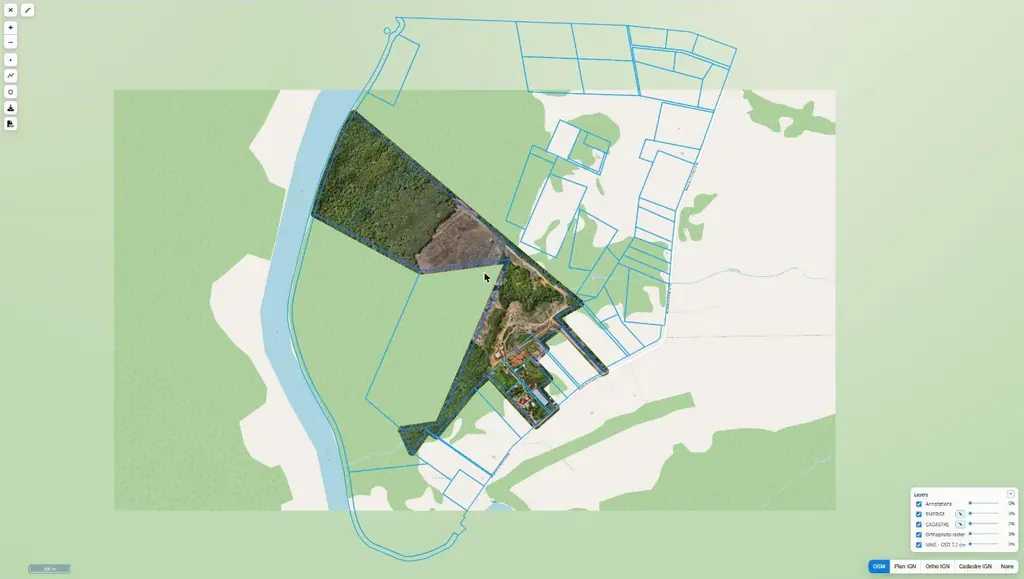
Pointe Combi: 66 hectares delivered in five days on Sentinel Cloud
Orthophoto and 7.2 cm surface model of a farm, with the footprint and cadastral parcels, available online.
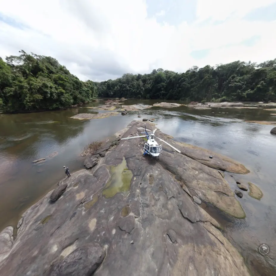
Four TDF antenna sites on the Oyapock, located and measured in 3D
In March 2019, drone photogrammetry of four sites between Saint-Georges and Camopi: 3D model, orthoplan, position and height of each antenna, delivered between 29 March and 4 April.
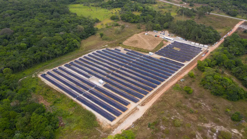
Savane des Pères solar plant: from bare ground to commissioning
Reconnaissance, mapping before earthworks, then a time-lapse throughout the assembly of a 3.8 MW plant with battery storage.
No project matches this combination.
Other work, 2019–2023
Earlier missions, written up on the blog at the time.
Verticality of quay pylons
Vertical acquisition of the quay and an ortho-façade to measure the tilt of each supporting pylon.
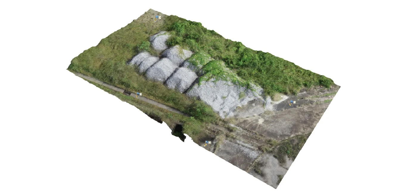
Volume survey of a ballast stockpile
A 3D model of the stockpile built from aerial images, and volume calculation.
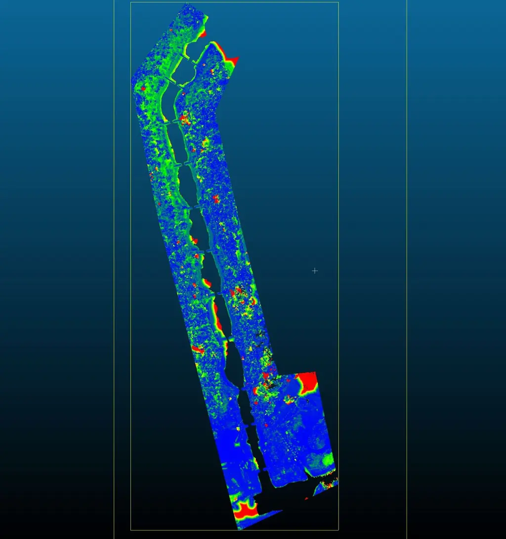
Riverbank erosion monitoring with LiDAR
Comparison of two point clouds acquired months apart to measure how far the banks have receded.
Mapping the shores of Petit-Saut
Two maps of the lake shores to study how they change over time.
Mapping Maripasoula
Two high-resolution georeferenced maps for an engineering firm, for the town’s development plans.
Antenna geolocation in Trois-Sauts
A mission to the most remote village in French Guiana, on the Oyapock river, seven to nine hours away by dugout canoe.
Tell us about your project
Location, area or structure, expected deliverables and timing: with these details we can propose a method and a quote.
97310 Kourou
French Guiana
Route des Trois-Îlets
97229 Les Trois-Îlets
Martinique
20030-041 Rio de Janeiro – RJ
Brazil