
- Home
- Mission log
Mission log
Our missions since September 2023, month by month, in French Guiana, the Caribbean and Brazil.
October 2026
Time-lapse and filming at the Sainte-Anne hybrid plant
Time-lapse unit installed for the duration of the hybrid plant construction, first series of shots on 7 October 2026, after footage of the site in October 2025.
Second mission at the Juquiá complex: faces of Serraria
From 5 to 8 October 2026: upstream face of Serraria on the 6th in the rain, with nine flight plans, downstream face on the 7th with seventeen flight plans; on the 8th the automatic spillway gates were open and the downstream face under water, so the upstream face was flown again and the mission stopped. The rest of the campaign is postponed to the 2027 dry season; the three Salto do Iporanga orthophotos have been produced.
Read the articlePhoto coverage of a water tower and a drinking-water intake
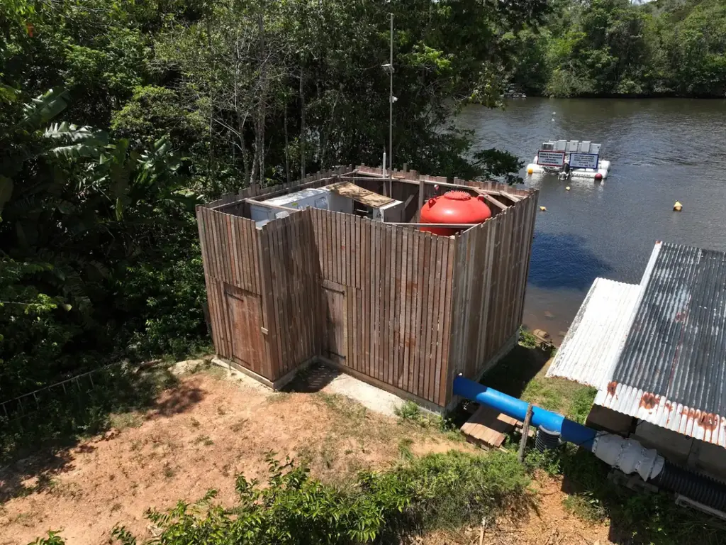
On 12 October 2026, the water tower under construction in Montsinéry-Tonnégrande; on the 15th, the Comté intake in Roura: pumping station, floating intake and surroundings. Photos delivered the same day each time, as JPG and RAW.
Photogrammetric inspection of launch complex structures
2026 orthophoto campaign: eight sectors and 6,545 hectares
Eight perimeters and 6,545 hectares in Cayenne, Kourou, Macouria, Matoury and Saint-Laurent-du-Maroni, ordered on 2 October 2026, with 10 cm orthophotos required by the specifications. First sector delivered, Sud-Bourg in Matoury (147 ha): four flights on 16 October, 1,909 photos at 3.88 cm per pixel, 3.7 cm planimetric error on five independent check points, orthophotos and reports delivered on 19 October.
- 6 545 ha
- 8 sectors
- 3,7 cm check-point error
Trial analysis of the submerged trees of the Petit-Saut lake
A 3 ha test plot chosen by the operator to assess the submerged timber resource by drone; mission scheduled for 22 October 2026.
Corporate film for the Petit-Saut sawmill
Shoots from January to August 2026, from the lake to the sawmill output; 40-second short version in September, full film delivered on 14 October 2026.
Read the articleSecond LiDAR and photogrammetric survey of the Macouria solar plant site
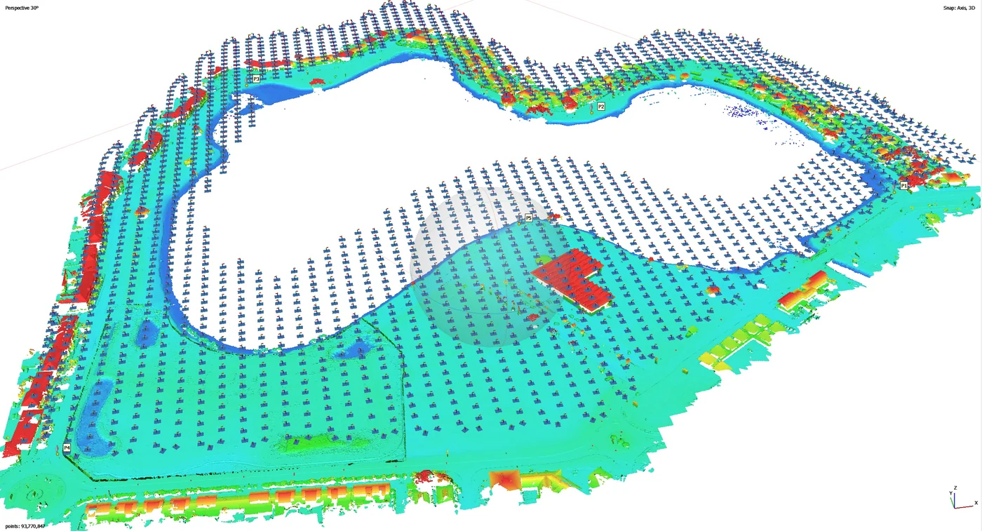
On 2 October 2026, after topsoil stripping: 8.78 hectares, 517 points per m², 2.97 cm vertical error for LiDAR and 3.07 cm horizontal error for the orthophoto on five check points; deliverables online on 6 October.
- 517 points per m²
- 2,97 cm vertical error
September 2026
First LiDAR and photogrammetric survey of the Macouria solar plant site
On 1 September 2026, after clearing: 9 hectares, sixteen targets including ten check points, 1.95 cm vertical error for LiDAR and 2.40 cm horizontal error for the orthophoto; delivered on 3 September, vectorised power lines in DWG on the 14th.
- 1,95 cm vertical error
- 16 targets
Erosion monitoring of the Canal de l’Ouest and Bois Chaudat lake
First of eight campaigns scheduled up to February 2028: flight on 15 September 2026 at low tide, 12 mm orthophoto, mud islets in the northern part of the lake mapped at 22 mm and 34 photos taken from fixed viewpoints; delivered on 17 September, with three Sentinel Cloud accounts.
- 12 mm/px
- 34 reference photos
Survey of 2.8 km of the Fouillée creek
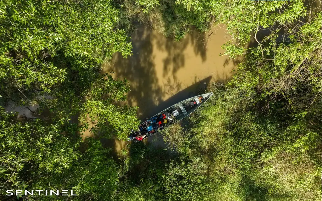
On 10 September 2026, from the roundabout and then by dugout canoe down to the mouth: 15 mm orthophoto of a 50 m strip on either side of the axis, plan of debris jams and bank access points, video of the stretch; delivered on 15 September with twelve months of online access.
- 2,8 km
Orthophoto of 12.5 hectares of the Saint-Pierre coastline
On 21 September 2026, from the Fort district to the sub-prefecture: twelve ground targets, 1,305 images taken at 65 m, orthophoto delivered at 2 and 5 cm the next day, 1.78 cm planimetric accuracy.
- 12.5 ha
- 1.78 cm accuracy

Thermal survey of a 1,152 kWp plant on three roofs in Matoury
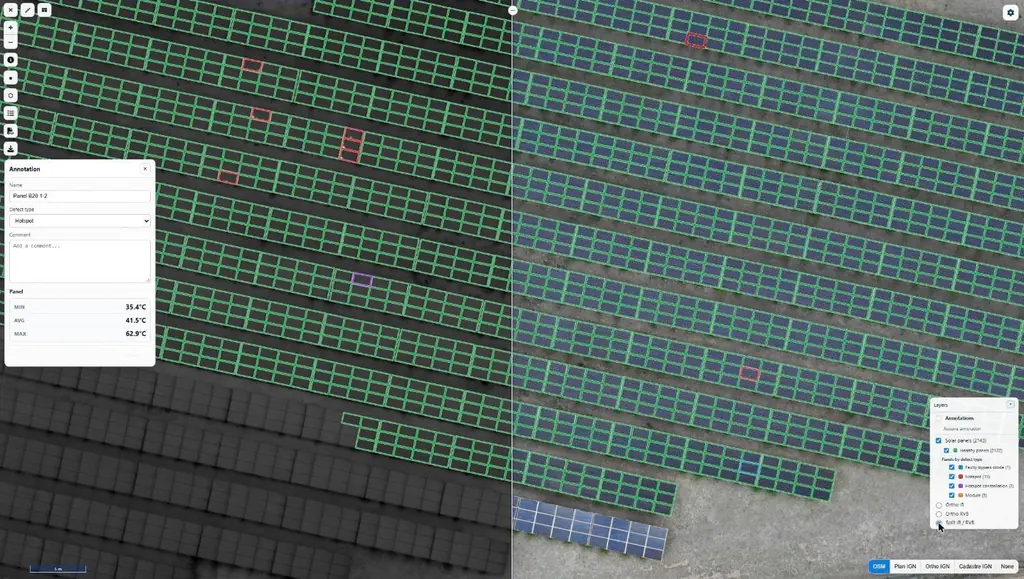
Purchase order received on 10 September 2026, flights on the 17th over the roofs of three commercial buildings in the Larivot area: 3,523 panels checked; deliverables and Sentinel Cloud access on the 21st.
- 3 523 panels
- 3 roofs
One-day individual remote course: Open category and photogrammetry
On 24 September 2026 by video call: Open category rules, daylight flying hours in French Guiana, airspace and aeronautical information, flight areas drawn in Google Earth Pro, then automatic flight plans in the afternoon.
Client accounts on Sentinel Cloud
Local authorities, plant operators and engineering firms consult their orthophotos, thermal surveys and 3D models online; 19 organisations and 29 projects in October 2026.
- 29 projects
- 19 organisations
Recruiting drone pilots in French Guiana and Martinique
Inspection and overview of an industrial building
Acquisition on 14 September 2026 by our partner Antilles Drone, results delivered the next day.
Measurement of a specialised care home building
Distance between the lines of coach screws measured for each roof, flown as low as possible; delivered on 17 September 2026.
Read the articlePhotogrammetry of three industrial sites for photovoltaic projects
Three captures on 24 September 2026, digital products delivered on the 29th; plans with axes and spacings checked against the panel layout, finalised on the 30th.
Read the articleTwenty buildings surveyed, including fourteen housing estates owned by one landlord
Order of 23 July 2026: fourteen housing estates in Fort-de-France, Le Lamentin, Ducos and the south of Martinique, and six other buildings, three in Martinique and three in French Guiana, surveyed for rooftop solar projects; files delivered in August and September.
- 20 buildings
August 2026
Photogrammetric survey of a pontoon on the RD9, Mana road
Orthophoto delivered on 24 August 2026 to the roads department.
Diagnosis of eight ground-mounted photovoltaic plants in Guadeloupe
Eight ground-mounted plants exporting all their output, flown from 3 to 5 August 2026 with additional flights on the 13th: 18,671 panels in infrared at 3 cm and visible at 1 cm, under 1,000 to 1,267 W/m²; a detailed report, a summary and a plan per plant, approved on 19 August.
- 18 671 panels
- 8 plants
CATS practical exam for two firefighters
On 26 August 2026 on the Matiti field: flights with our fleet, a demonstration of what the drones can do, a regulatory refresher, then the practical exam at the end of the morning.
- 2 firefighters
Monitoring of the GRESS 2 & 3 wind farm works resumed
Order from Albioma on 1 June 2026, after it took over the project: visits to Macouba on 21 July, the day set for unloading two blades at Fond Potiche, to the Grand Port of Fort-de-France on 23 July, then to Macouba on 1 and 18 August.
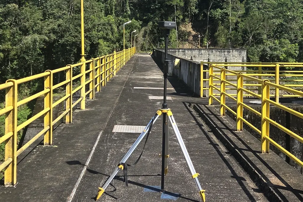
First mission on the seven dams of the Juquiá complex
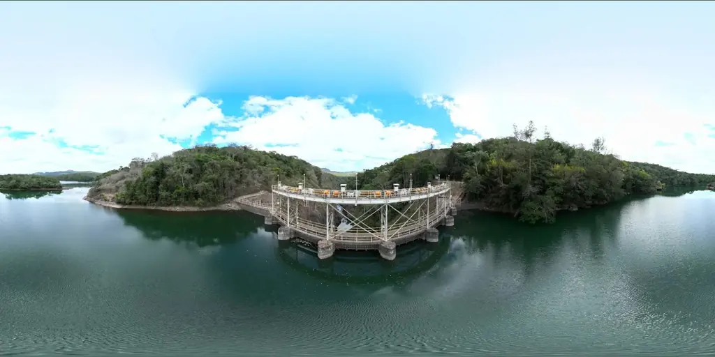
From 17 to 21 August 2026: general aerial views of the seven plants, França, Fumaça, Barra and Porto Raso on the 17th, Salto do Iporanga on the 18th, Serraria on the 19th, Alecrim on the 20th, and detailed acquisition of Salto do Iporanga, upstream face on the 19th and downstream face on the 21st, GNSS base on the operator’s crest benchmarks; reconnaissance report delivered on 1 September.
- 7 dams visited
New virtual tour of the Petit-Saut sawmill and lake
May 2026 version with 35 panoramas, five videos and ten albums, extended following the operator’s feedback; version 2 online on 24 August with 360° videos.
- 35 panoramas
July 2026
Two-year contract for the seven dams of the Juquiá complex
Technical proposal validated in April, contract signed in July 2026: detailed survey of the faces and crests of seven dams with crests of 140 to 265 m, six on the Juquiá-Guaçu river and Salto do Iporanga on the Assungui river, anomaly mapping, 3D models and web tool, then a follow-up survey.
Read the articleIntroductory course in drone piloting and photogrammetry
From 6 to 9 July 2026, four trainees: Open category (A1/A3 and A2), with the A2 online course and exam alongside, then photogrammetry through to processing in Agisoft Metashape, QGIS and Global Mapper. Practice flights over one of the agency’s plots at Wayabo.
- 4 trainees
- 4 days
Four-day photogrammetry course
From 30 June to 3 July 2026, for the two staff of the authority’s GIS department: photogrammetry plus the A2 subcategory of the Open category, added at the department’s request.
- 2 staff
- 4 days
Online tools to prepare the remote pilot certificate
Two places on the online course and exam for the A2 subcategory (C2-class drones) for the authority’s staff, July 2026.
Photogrammetric survey and stockpile volumes on the sawmill platforms
Survey of the northern and southern platforms on 21 July 2026: orthophoto and 3D model shared online, stockpile outlines drawn by the operator, three volume plans (northern, central and southern areas), continuing the site monitoring begun in March 2023.
Read the articleNew Matrice 400 drone in the fleet
Safety parachute for specific-category operations, presentation film shot in September.
Read the articlePhoto report on the laying of the first stone of the new justice complex
On 6 July 2026: aerial views of the site and ground photos of the ceremony, 407 shots, 180 selected and delivered to the main contractor.
22 mm orthophoto of a project plot in Sinnamary
Georeferenced orthophoto, topographic survey and DWG plans delivered on 18 July 2026; a second plot in Wayabo surveyed at 37 mm with a surface model and contour lines.
Photos and 3D model of a school complex for an architecture competition
Oblique flights at 80 m with terrain following and 80% overlap; photos and 3D model of the future school site delivered to the practice in July 2026.
Thermal survey of the Bellefontaine plant, beneath medium-voltage lines
Medium-voltage lines on 27 m pylons above the plant: LiDAR survey on 17 July 2026 for the terrain model, then infrared and visible flights on 20 July, at 30 m above the terrain; 8,996 panels checked; results delivered and published on Sentinel Cloud on 30 July.
- 8 996 panels
- 30 m above the terrain
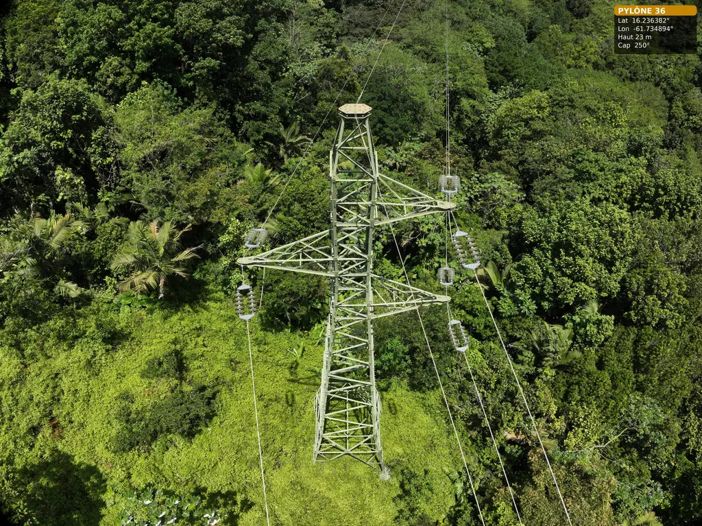
Second day on the 63 kV Bouillante – Sainte-Rose line: pylon 36 completed
On 15 July 2026, with Antilles Drone: 178 photos of pylon 36, from the general views and access to the three arms, with the earth-wire anchorage and the spans towards pylons 35 and 37. Deliverable for pylons 36 to 38 handed over on 16 July.
- 178 photos
Eighth visit to the Larivot bridge works
On 23 July 2026; the ninth of the eleven visits ordered is scheduled for 29 October 2026, and the following ones will be used for the interviews of the end-of-works film.
Read the article
June 2026
Fault check after an outage on a 90 kV line: supports 50 to 60, then 66 and 94
Request received on 1 June 2026 in the late afternoon, flights the next morning: photos of supports 50 to 60, then 66 and 94, and two cable defects positioned in the 94–95 span, delivered in KML and GeoJSON the same day.
- < 25 h between request and results
Detailed inspection of pylons on the 63 kV Bouillante–Sainte-Rose line
On 2 June 2026, with Antilles Drone and an Omexom employee for access, on the Trace des Contrebandiers: pylon 37 fully covered at the top of the hill, pylons 36 and 38 photographed from a distance from that position. Pylon 36 was completed on 15 July.
Read the article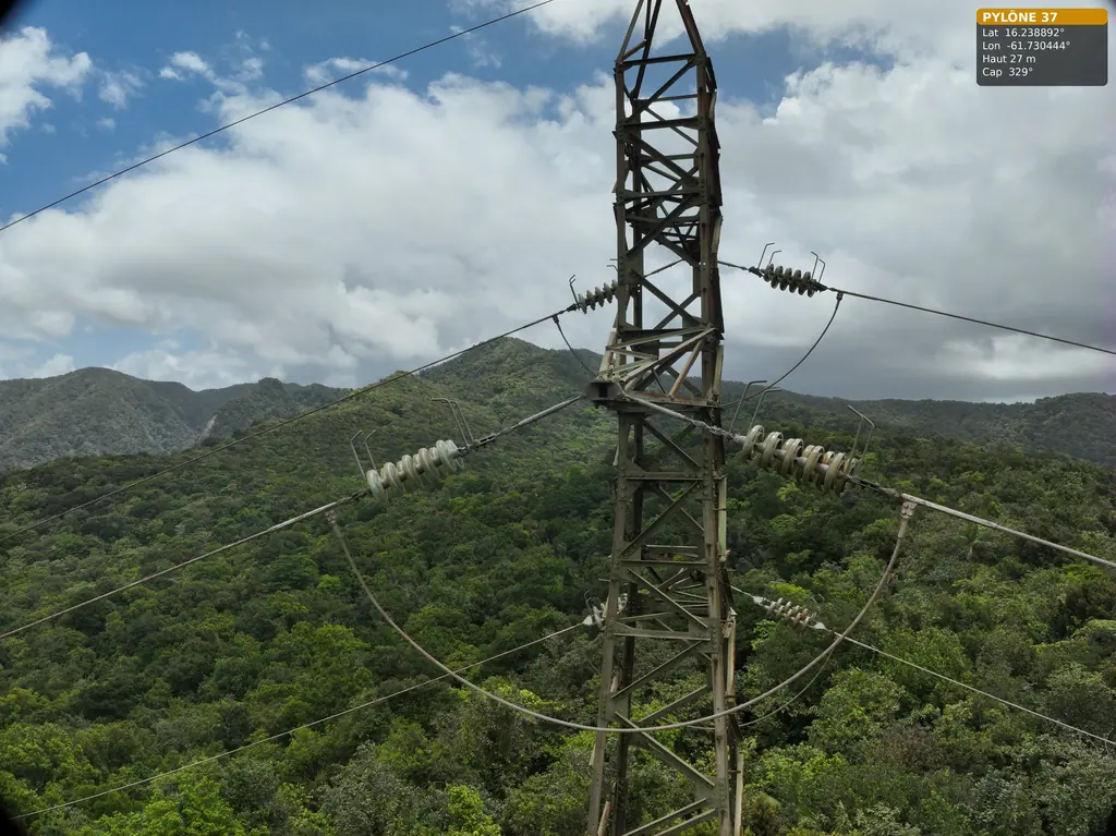
34 rooftop solar plants thermally surveyed in two weeks
From 10 to 23 June 2026, 32 plants in Martinique and 2 in French Guiana, in rounds of no more than four neighbouring sites: overview photos and thermal images for the installer, acquisitions for its analysis platform; mission closed on 24 June.
- 34 plants
Thermal survey of the Le Carbet solar plant
On 17 June 2026, visible flights at 1.5 cm and infrared at 3 cm per pixel under 1,128 W/m²: 2,143 panels checked one by one; report delivered on 18 June.
- 2 143 panels
- 3 cm per pixel in infrared
Arrival of the Zenmuse L3 LiDAR and field validation
Test datasets, a quality report comparing three processing methods and checks on the Petit-Saut road and in Matiti.
Read the article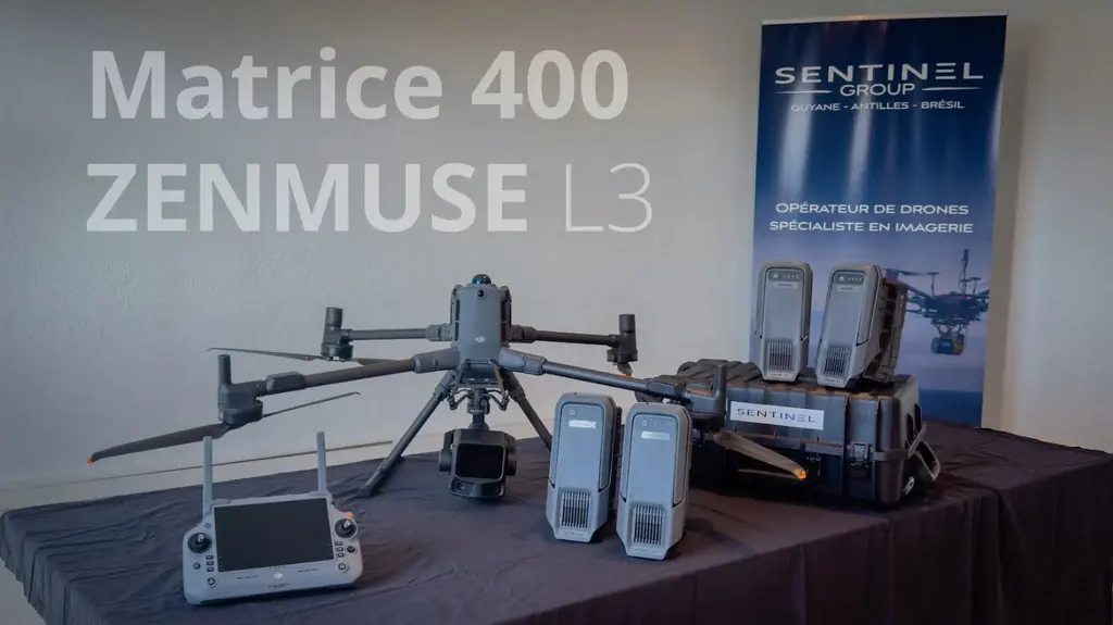
Roof orthophotos of three medical-social establishments
Roof dimensions (2D and 3D lengths, slopes, spot heights) for photovoltaic projects on a shelter, an institute and a sheltered workshop: a first site delivered before 30 June, two captures on 30 June, everything delivered on 1 July 2026.
Read the articleInspection of five wooden-pole supports of a 90 kV line at Matiti
On 3 June 2026, between supports 43 and 47: two pylons and three portal frames photographed in detail, 511 photos, 106 annotated anomalies (30 corrosion, 30 nesting, 14 structural cracks, 5 bolting, 26 others, mostly termites) rated 7 low, 97 medium and 2 high. PDF report, Excel table and Sentinel Cloud access delivered on 5 June.
- 511 photos
- 106 anomalies
May 2026
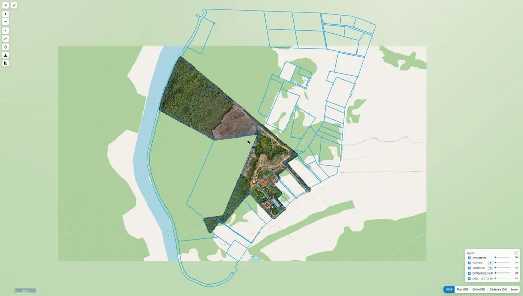
Orthophoto and surface model of 66 hectares at Pointe Combi
Acquisition from 12 to 14 May, delivery on the 19th: orthophoto, 7.2 cm surface model, footprint and cadastral parcels available on Sentinel Cloud.
- 66 ha
- 7,2 cm
Photogrammetry of Schœlcher town centre
Flights on 7 May 2026; tiled 3D model in Cesium 3D Tiles format delivered on 13 May, high-definition version on 18 May.
High-resolution LiDAR and photogrammetry survey of a plot
Photo report on the Cité Gobert housing estate
Ordered by the social landlord on 19 May 2026, photos delivered on 28 May.
April 2026
LiDAR survey beside the runway at Grand-Case aerodrome
Wooded area of about 8 hectares beside the runway: control points on 13 April 2026, photogrammetry and LiDAR flights on the 14th and 15th at no more than 30 m, in coordination with the AFIS; 3 cm orthophoto, ground points at 2 m spacing and existing drawing re-registered in RGAF09 delivered on 17 April.
Read the article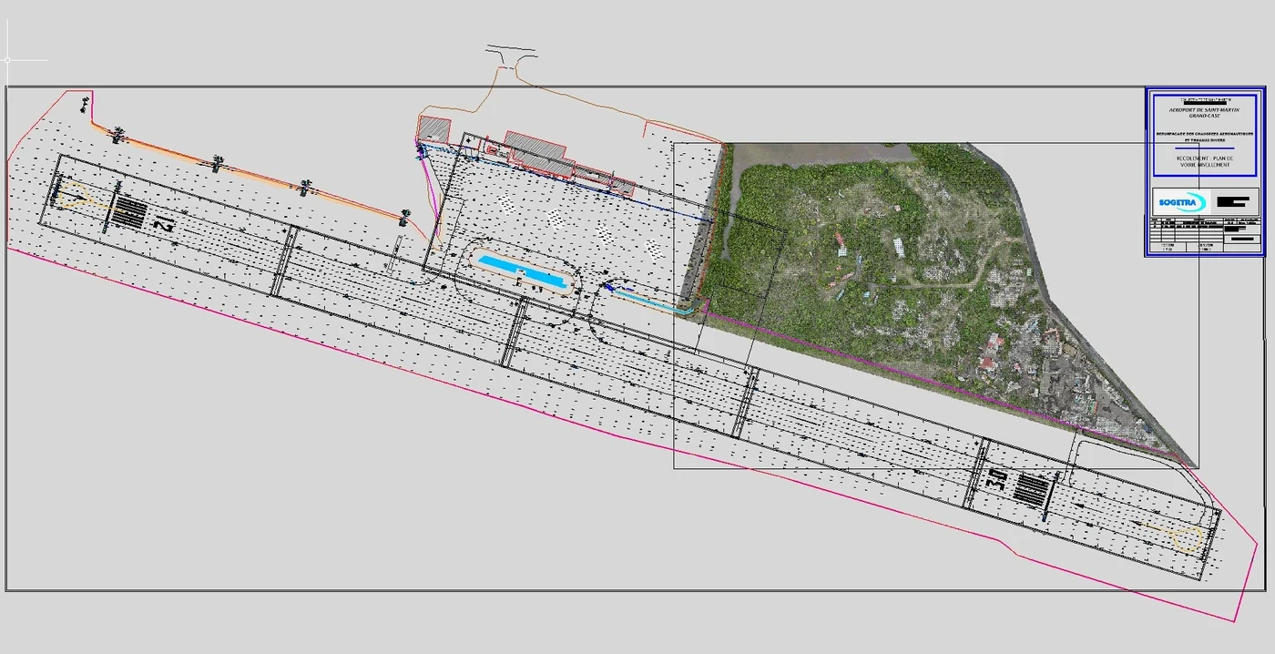
Building measurements for rooftop photovoltaic projects
Housing estates and commercial buildings surveyed by photogrammetry before installation, from January to June: eight sites in French Guiana and Martinique, including housing estates, a freight warehouse and a vehicle inspection centre.
Read the article
Photogrammetric survey of 680 hectares around the sounding rocket launch complex
On 15 and 16 April 2026: 25,928 oblique and vertical images at 120 m, a 667-million-point cloud, a 274-million-face mesh, a 3.48 cm orthophoto and contour lines, for a low-level wind simulation.
- 680 ha
- 25 928 images
Photogrammetric survey of the Jacarandas residence
Fieldwork from 7 to 9 April 2026, data delivered on 13 April.
LiDAR and high-resolution photogrammetry of a one-hectare plot
10,282 m² surveyed for a civil-works contractor.
3D survey of a commercial roof at Madiana for a repowering study
Two plants on the same roof: a high-resolution 3D model viewable online to measure rail spacing, a lightweight 3DS model including the nearby vegetation for the shading study, then an orthophoto; ordered on 27 March, results delivered from 1 to 3 April 2026.
March 2026
360° photos of a telecommunications site
360° shots of one of the operator’s sites in Saint-Laurent-du-Maroni on 17 March 2026, at the time agreed with its team; deliverable handed over the next day.
Read the articleConvention film of the Larivot bridge works
Filming on 24 February and 3 and 4 March 2026: interviews, pre-shift briefing, safety talk, crews heading to the site by boat; four-to-five-minute film delivered in two versions, on 13 and 20 March, for the company’s convention.
Read the article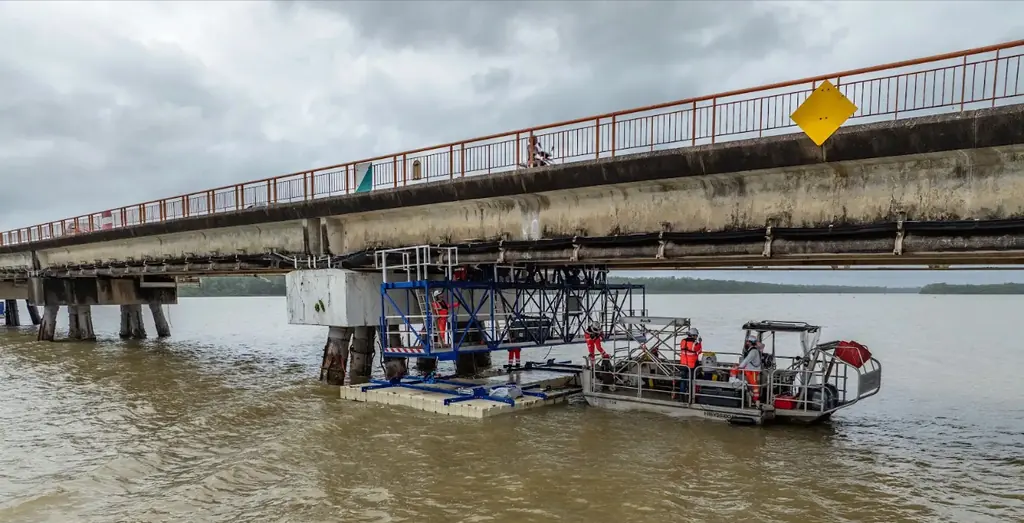
Visual inspection and measurement of the roofs of three buildings
Ahead of the re-roofing of three buildings of an annex of the authority in Cayenne: acquisition on 23 March 2026 over the waterproofed flat roofs and the shingle roofs on timber frames, overhangs and junctions included. 1 cm orthophoto, digital surface model, 3D model, plan and inspection photos delivered on 26 March.
Third volume survey of the Kourou biomass plant stockpiles
From 9 to 13 March 2026, 16 mm orthophoto, after the April and October 2025 visits.
Three-day photogrammetry course in Kourou
From 23 to 25 March 2026, for a Guianese company’s drone pilot.
February 2026
Photogrammetry of the Route du Tigre for a widening study
Survey area close to a no-fly zone: technical file and coordination with the authorities before the flight.
3D model of Cayenne hospital delivered in 24 hours
Oblique photos the same day, a low-resolution model online the next day and then a high-resolution version, for an architecture competition.
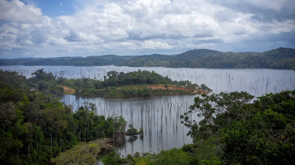
Read the articleNight-time primate detection by thermal camera on the Petit-Saut lake
Ten flights on the evening of 25 February 2026 and from 4:30 am on the 26th, over islands where monkeys were known to be present, to measure the time and number of passes needed for detection; thermal, visible and screen videos per flight, positions in KML.
- 10 flights
Orthophoto of 327 hectares of the Jarry-Houëlbourg wetland
Flight plan and targets prepared by Sentinel, notifications filed on 5 February, targets laid out on 13 February 2026 and flights on the 14th and 15th by Antilles Drone (seven hours of flight): 15,445 images at 2.36 cm per pixel, 3.64 cm root-mean-square error on six check points; deliverables handed over on 22 February.
- 327 ha
- 2,36 cm per pixel
1 cm orthophotos and volume surveys of the waste sites of four Maroni villages
From 2 to 4 February 2026, five areas in Grand-Santi, Maripasoula, Papaïchton and Loka, positions recomputed on the permanent GNSS network. Volume plans delivered on 10 February, with a written caveat on the reliability of volumes under vegetation; 1 cm orthophotos sent on the 11th.
- 4 villages
- 1 cm per pixel
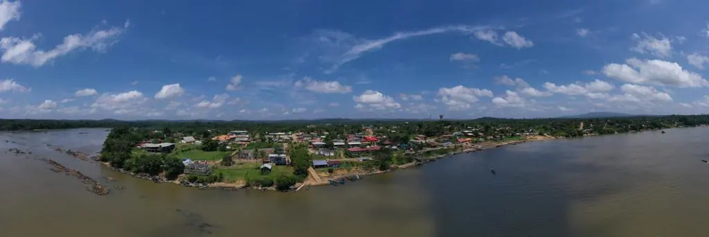
Survey and thermal survey of a rooftop plant before rewiring
About a hundred modules removed to install smoke-vent frames: survey on 9 February 2026, orthophoto, plan and 3D model delivered on the 12th, then thermal survey on 17 April once production had resumed, and DWG plans in July.
Read the articleInspection and measurement of the roofs of two housing estates
For the social landlord, the Pépites and Onozo estates: photo report, roof plans and measurements delivered on 13 and 17 February 2026.
Roof measurement of a housing estate for a photovoltaic project
Balaou estate: acquisition in early February 2026, roof plan delivered on 4 February as a layered georeferenced PDF, completed version on 20 April.
LiDAR ground points at 15 cm spacing for the earthworks studies
The roads and utilities designer noticed height differences between the 2024 and 2025 surveys: his calculations relied on the 2024 photogrammetric contours, which follow the canopy in wooded areas. On 12 February 2026, delivery of the LiDAR ground points over his two 8 m check strips.
Read the article
January 2026
LiDAR survey of 23 hectares for an agrivoltaic project in Baillif
Favourable opinion from the Departmental Council on 12 January 2026 for flying near Baillif aerodrome; LiDAR acquisition on 16 January by Antilles Drone, delivery on the 19th: contour lines at 1 m intervals and ground points at 50 cm spacing, in RGAF09 / IGN 88.
Four long-term time-lapses on a launch-site construction project
Cameras installed for three months on viewpoints agreed with the client, monthly photo monitoring of the site.
Unloading of the bus rapid transit vehicles filmed at the port of Dégrad-des-Cannes
On 20 January 2026, for the urban community’s communication department: unloading of the Yanéo network buses at the port terminal, then their transfer to the Maringouins maintenance and depot centre; flights coordinated with the harbour master’s office, the prefecture and the civil aviation authority.
Topographic survey of 4.7 hectares at Belle-Humeur
Quote approved on 21 January, acquisition on the 27th, delivery on the 28th.
Measurement and diagnosis of the post office and nursery roofs
Orthophoto from 25 m altitude and DWG plans delivered on 14 January 2026.
Thermal survey of the Grand Port Maritime’s photovoltaic roofs
Three areas and about 1.6 ha of panels, flights at 25 m, visible and infrared orthophotos delivered between 19 and 23 January 2026.
- 1,6 ha of panels
2026 volume survey of two biomass plots
Four volume computations delivered on 19 January 2026, one year after the first campaign.
December 2025
Thermal survey of rooftop panels on a bank headquarters
Infrared and visible thermal survey of the rooftop panels of a bank’s head office, late November 2025, for an installer; data put online on 1 December.
Second thermal survey of the SOCOGAR rooftop plant in Jarry
On Saturday 13 December 2025, with all inverters feeding in: visible and infrared orthophotos, report and multi-layer defect plan delivered on 15 December.
Read the articleRD5 and RD11 road corridors in LiDAR and photogrammetry
2.95 km over a 38 m width along the RD5 for a chartered surveyor, then 8 km in LiDAR and 7.6 km in photogrammetry between Saint-Laurent and Saint-Jean du Maroni for the local authority and its engineering firm: classified clouds, ground points every 50 cm, TIFF and ECW orthophotos.
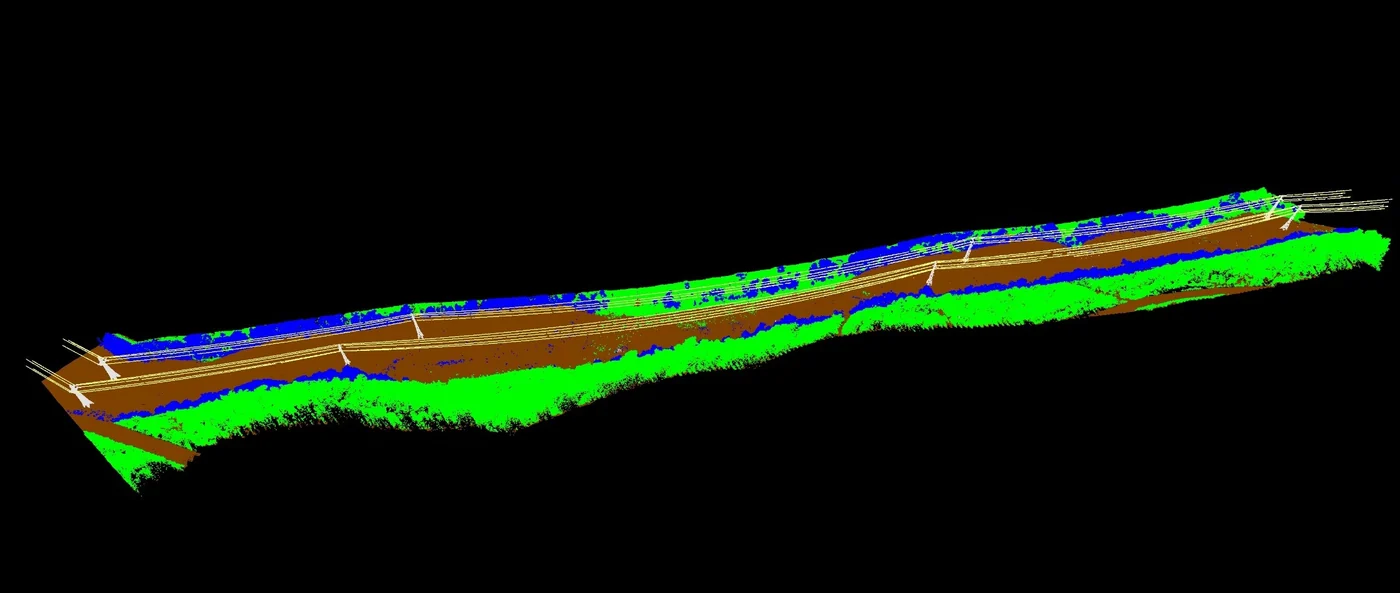
Positions and elevations of the concrete footings of a solar plant
1,472 concrete footings surveyed over two hectares, once the modules and structures had been removed: 2 mm per pixel orthophoto, centre point and height of each footing in DWG and A0 plan delivered on 23 December.
- 1 472 footings
- 2 mm per pixel
Photos of the Enfant Perdu lighthouse from a boat
On 9 December 2025, for the Lighthouses and Beacons unit: take-offs from the bow platform of an 8 m launch, as the islet cannot be landed on, and inspection photos delivered the same day. The Île Royale lighthouse had been photographed in March 2024 for the same department.
Read the article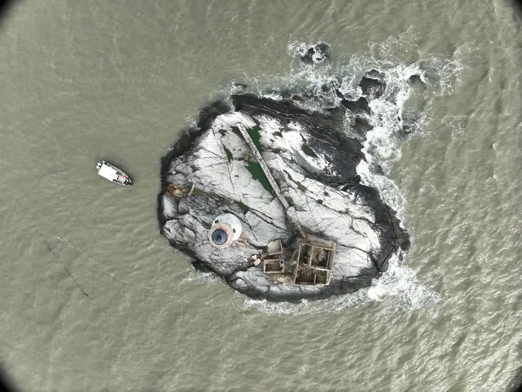
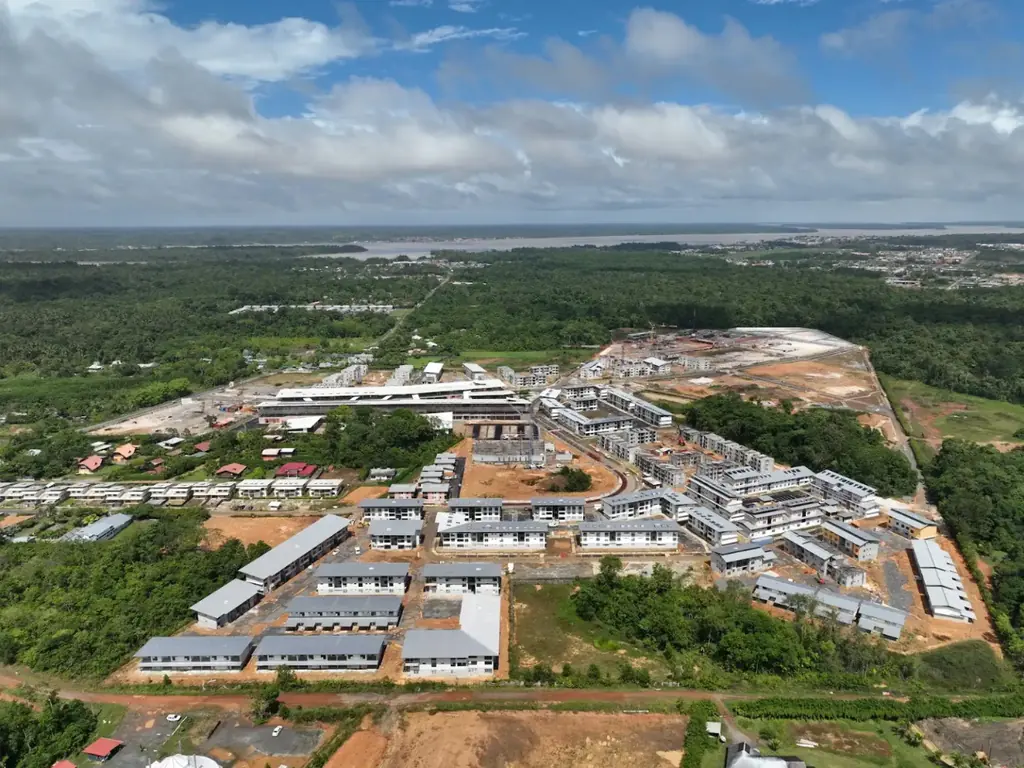
Photo coverage of the Balaté Nord housing construction site
Second of three visits, after the first homes were handed over in November: homes completed, under construction and just started, and eye-level videos inside the residences. First visit in January 2025, third in early March 2026 along two flight paths drawn by the client.
Orthophoto of five hectares of nursery for an architect
Two plots surveyed on 11 December 2025.
- 5 ha
Refresher course for the authority’s drone pilots
From 16 to 18 December 2025, plus a CATT-to-CATS course for a consultancy.
Time-lapse of the Petit-Saut sawmill, July to November 2025
Camera installed on 1 July 2025 for three months, extended at the operator’s request until 18 November; edit with its logo and the months on screen delivered on 12 December, final version on the 15th.
November 2025
Thermal survey of a photovoltaic plant in Le Moule
Ready-to-fly thermal missions sent to Antilles Drone on 3 November (34 m, 3 cm per pixel, visible at 1.92 cm), flights on the 5th under 906 W/m², report on the 7th: 7,704 modules checked and compared with the 2022 campaign.
- 7 704 modules
- 3 cm per pixel in infrared
Virtual tours of the Coco Banane and Savane des Pères plants
Two days of capture in early November: 12 panoramas at Coco Banane, 14 at Savane des Pères, tours online on 10 November; 2 cm orthophotos and source files handed over on the 18th, colour-graded footage for the client’s communication.
- 26 panoramas
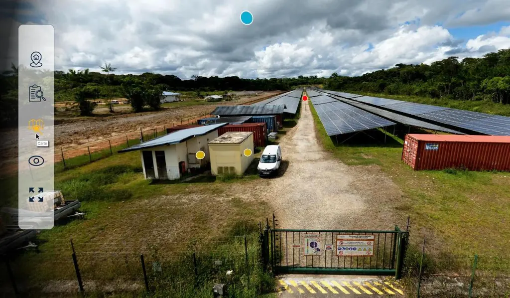
Two time-lapses during cell filling and an orthophoto of the Apatou waste collection centre
Two solar-powered cameras installed in Saint-Laurent in early November 2025, on the sorting platform and at the back, by the cells: images from 4 November 2025 to 25 March 2026, edit delivered on 3 April. On 4 November, a 1 cm orthophoto and plan of the Apatou waste collection centre.
Read the articleHigh-resolution LiDAR and photogrammetry of two plots
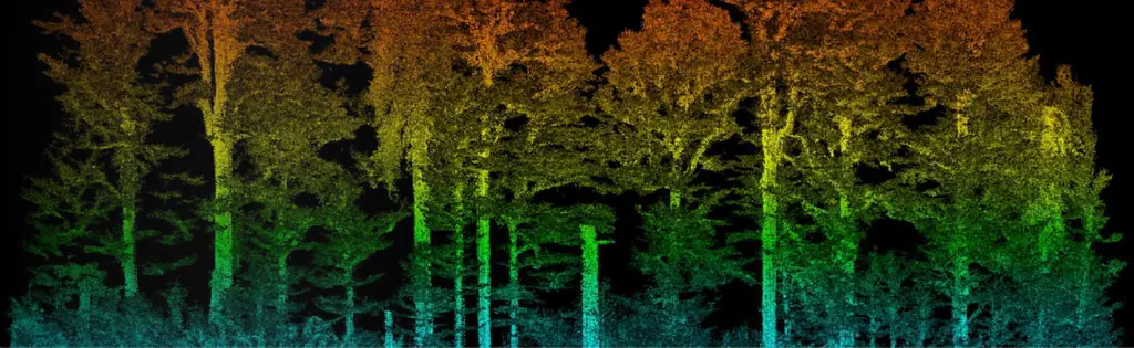
Inventory of trees taller than 2.5 m on 1.8 fully wooded hectares: 669 million LiDAR points, heights and crowns delivered as DWG.
- 669 M points
Divers filmed on the Larivot bridge works
Fourth visit, on 26 November 2025, postponed from October to film the divers at work; photos delivered the next day.
Read the articlePhotogrammetry of a medical-social institute roof for a photovoltaic project
Flight on 27 November 2025, delivery on 1 December.
Drone pilot and cine drone provided for a film shoot
Two full days of shooting in November and December 2025.
Six fire-service drone pilots and CATT-to-CATS upgrades
November 2025: course for six fire-service drone pilots, upgrades for the volcano observatory and a consultancy, theory exam.
- 6 drone pilots
Photo report on the Pépites housing estate
Shots taken on 26 November 2025 and delivered the same day; the estate’s roof was then inspected and measured in February 2026.
Jet guide and deflector inspected after the fourth Ariane 6 launch
The same imagery after the November 2025 flight: jet guide outside and inside, then the deflector.
October 2025
A 44-panorama virtual tour and video for the inauguration of the Petit-Saut sawmill and energy hub
Tour plan agreed with both operators, 44 aerial and ground panoramas of the plant and the sawmill, nine albums from the 2023–2025 site monitoring, offline version for the event screen; video edited from the construction archive, delivered on 13 October for the inauguration on the 14th.
- 44 panoramas
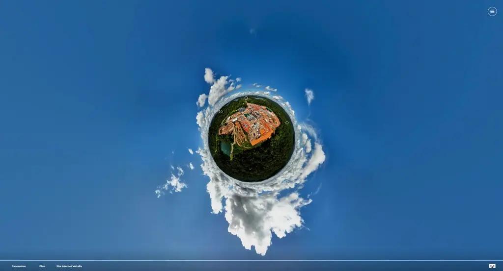
Photogrammetric survey of the Kourou biomass plant
3D survey of an industrial building by photogrammetry
Support for a geotechnical mission on national road 2
Orthophoto of 27 hectares of Pointe des Sables, Le Vauclin
On 15 October 2025: eleven targets (four for control, seven for checking), flight at 90 m with terrain following and a cross grid, 2.9 cm orthophoto and 3.55 cm planimetric accuracy, delivered the next day with the processing report; surface model added on 21 October.
- 27 ha
- 3.55 cm accuracy
Elevation survey of the Prêcheur river mouth during the lahar crisis
Targets laid and measured on 22 and 23 October 2025 in a hard-to-reach riverbed, flights on the 23rd: 2,778 images over 32 hectares, 3.7 cm orthophoto, surface model on a 20 cm grid, 3.72 cm planimetric accuracy on five check targets; delivered on 28 October.
- 32 ha
- 2,778 images
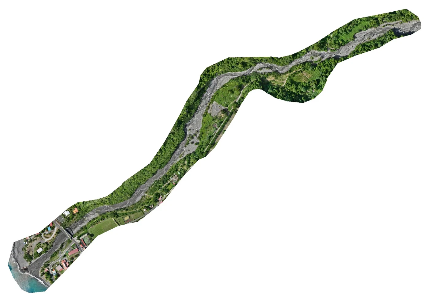
LiDAR and orthophoto of 48 hectares of forest in Sinnamary
On 17 October 2025, for the Espace-Dev unit, after the Approuague survey in July: crossed flight lines, 3 cm orthophoto, 20 cm terrain, surface and height models and ground and above-ground clouds delivered on 21 October.
- 48 ha
- 20 cm models
Roof diagnosis of a local-authority building
6 mm per pixel orthophoto and plan delivered on 20 October 2025.
Roof inspection and 3D model of the Mont Lucas 3 housing estate
Flights in mid-October 2025, on a date given to the landlord so that tenants could be informed; inspection photos, 1 cm orthophoto, dimensioned plans and an online 3D model for measurements, delivered on 22 October.
Drone-pilot courses for research laboratories and local authorities
Drone-pilot course in Kourou from 17 to 29 October 2025 for two laboratories, piloting courses for a municipality and for the Water Office.
Shading surveys of two roofs in Ducos
On 3 October 2025, including the building that houses the installer’s offices: oblique flight plan at 80 m above ground with terrain following and 75% overlap, a 3D model and four photos per site, delivered on 7 October.
Photogrammetry course dedicated to three of the authority’s drone pilots
From 20 to 22 October 2025, a three-day programme revised for the authority, ending with a half-day on its own use cases; certificates of attendance sent on 23 October.
- 3 drone pilots
September 2025
End of the monthly monitoring of the Petit-Saut sawmill works: 31 visits
One photo visit a month from 6 March 2023 to 23 September 2025, northern and southern platforms, in JPEG and RAW; this archive was used for the albums and video of the inauguration.
- 31 monthly visits
3D model of 53 hectares of central Fort-de-France
Flights on 15 and 16 September 2025 for an urban planning project, after clearance from the sensitive sites overflown; tiled 3D model delivered on 18 September and integrated without difficulty by the client in November. The centre of Schœlcher followed in 2026.
- 53 ha
Elevation survey of 6.7 hectares in Le Carbet
LiDAR and photogrammetry over five plots, with a painted ground control point.
Hydrogen burn pond igniters checked at every launch preparation
Seven thermal camera visits between February 2025 and April 2026, at each phase of Ariane 6 launch preparations on the ELA4.
Images of the Petit-Saut biomass plant for Voltalia’s communication
A selection of views extracted from the August 2025 360° panoramas, then full-resolution files for the inauguration’s printed visuals.
Fourth campaign on the Peti dam
From 22 to 24 September 2025: 2,037 photos in 21 flights and 12.7 km flown, 7 orthophotos totalling 3.9 gigapixels, 71 plates including 68 comparison plates; six new or longer cracks since 2024, downstream-face stability confirmed since the 2022 baseline.
- 2 037 photos
- 6 new cracks
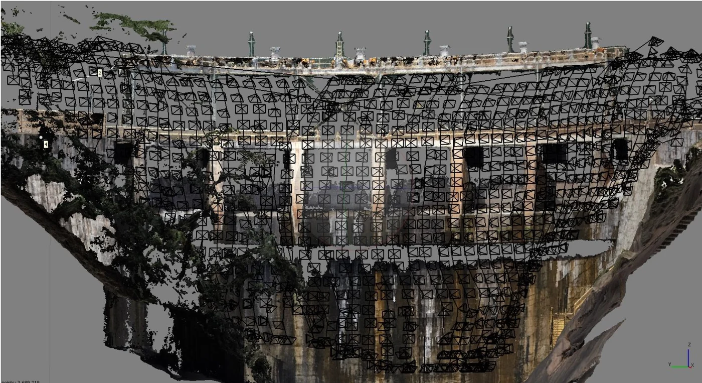
Measuring a building’s height by drone
Aerial photo report for an architecture practice in Le Marin
Aerial photos of the town delivered to the practice in September 2025, for an architecture project.
Aerial photos of properties for an estate agency
First property photographed on 15 September 2025 in Ducos, then further requests in Le Diamant, Le Robert and Case-Pilote.
CATS drone-pilot course and exam for the ONF territorial unit
From 8 to 19 September 2025.
Drone equipment and operations manual for an urban community
Drafting of the operations manual tailored to the authority’s missions, September and October 2025.
Time-lapse of a kit villa assembly
Unit installed for the duration of the structure assembly and removed on 24 September 2025, once it was complete; video delivered at the end of September.
August 2025
Thermal survey of the SOCOGAR photovoltaic plant in Jarry
248 kWp rooftop plant with 758 modules: flight plan designed by Sentinel and capture by our partner Antilles Drone, visible at 35 m for 1 cm per pixel and infrared at 30 m in crossed grids; report on 29 August, second visit on 13 December 2025 with the plant producing.
- 758 modules
Drone surveillance of the Baccha Festival
On Saturday 9 and Sunday 10 August 2025, afternoon and evening, at Pointe Faula: flights at 50 m maximum in the S3 scenario, notified to the civil aviation authority, with images relayed to the security command post and the police.
Photogrammetric survey of a mutual insurance building’s roof
Acquisition on 8 August 2025 by our partner Antilles Drone, processing and delivery on the 13th.
Photogrammetry course for three Guianese companies
From 4 to 6 August 2025, for trainees from a digitisation contractor, a logistics company and a mining operator. The mining operator had sent its needs for the final half-day: topographic monitoring of the pit, bench slopes, a platform to be levelled.
Upgrading drone pilots from the CATT to the CATS
From 5 to 7 August 2025.
GNSS reference points on two former mining sites
On 28 August then 11 September 2025, for drone monitoring of sites under rehabilitation: a georeferenced point measured on each site and support for the ONF team’s first flights.
Nineteen buildings surveyed in French Guiana, including ten housing estates in Saint-Laurent-du-Maroni
Order of 22 July 2025: eighteen housing estates and one other building, in Cayenne, Saint-Laurent-du-Maroni, Rémire-Montjoly and Matoury, surveyed for rooftop solar projects; files delivered in August.
- 19 buildings
Introductory photogrammetry course for five trainees
From 11 to 13 August 2025: four staff members of the Centre Martinique urban community and an agronomist from the sugar cane technical centre; certificates of attendance sent on 14 August.
- 5 trainees
- 3 days
Tenth version of the biomass plant construction virtual tour
27 panoramas and a site plan, online on 1 September 2025: the last version before the inauguration tour.
- 27 panoramas
ELA4 jet guide inspected after the third Ariane 6 launch
Outside and inside of the jet guide in 360° views, over its full height.
July 2025
LiDAR and orthophoto of 16 hectares of forest from a dugout canoe, on the Approuague
On 16 July 2025, for the Espace-Dev unit: take-offs from the canoe, 3 cm orthophoto, 10 cm surface model, 50 cm terrain model and canopy height model delivered on 21 July.
- 16 ha
- 3 cm per pixel
Thermal survey of the rooftop plant of the Territorial Archives
Defect plan delivered on 28 July 2025.
Grouped mission requests with the civil aviation authority
Multi-site operating mode presented to the DSAC for campaigns covering dozens of sites.
1 cm orthophoto and roof inspection of the Le Carbet hospital
Acquisition on 5 July 2025: georeferenced orthophoto, inspection photos, overview views and plan delivered to the engineering firm.
Roof inspection of a port warehouse for a photovoltaic project
Flights on 22 and 23 July 2025 under a specific authorisation.
Roof photography in the Canal Leroy area
On 7 July 2025, under an exemption, as the town of Kourou lies in a regulated zone; further visits in August.
60 more rooftop plants modelled in 3D for shading studies
Second order, flown from 24 June to 18 July 2025 and delivered on 19 July: a 3D model and four oblique photos per plant, as for the first 162; French Guiana was finished by 7 July.
- 60 plants
CATS upgrade course and practical session at Matiti
From 15 to 17 July 2025, a CATT-to-CATS upgrade course for staff of the National Forests Office and the French Guiana Water Office; from 21 July, a further session with flight exercises on the Matiti field.
3 cm orthophoto of the Petit-Saut biomass plant
Capture on 25 July 2025, orthophoto in EPSG 2972 and site plan.
- 3 cm per pixel
Divers and platforms on the Larivot bridge works
Third visit, on 2 July 2025: anodes fitted by divers and work from the rolling and floating platforms.
Read the articleLa Marie estate: phases 2 and 3
Flights from 30 June to 4 July 2025, delivered on 4 July.
Read the articleDrone surveillance of the Wet Island concerts in Le Lorrain
From Saturday 19 July 2025 at 4 pm to Sunday the 20th at 1 am, at the Le Lorrain municipal stadium, at the prefecture’s request: day and night flights at 50 m maximum in the S3 scenario, with no overflight of third parties and one drone in the air at a time.
Inspection of the ELA4 deflector
Close-up photos of the deflector of the Ariane 6 launch complex.
June 2025
Thermal surveys of the Sioulé and Toucan 2 plants
162 rooftop solar plants modelled in 3D for shading studies
From 12 May to 19 June 2025, 118 plants in Martinique, 33 in Guadeloupe and 11 in French Guiana: for each, a 3D model in 3DS format covering a 100 m radius and four oblique photos showing where the shade comes from.
- 162 plants
Combined 3D and 360° virtual tour
Photogrammetric model and panoramas in a single tour, hosted for a year for each client.
Additional survey on Île Royale and Devil’s Island
Photogrammetric survey of an industrial site for a photovoltaic project
Flight on 25 June 2025 over a bottling plant, at the installer’s request.
Thermal survey of two photovoltaic roofs in Le Lamentin
2,640 modules on a warehouse and a store: visible (1.5 cm) and infrared (4 cm) orthophotos, multi-layer defect plan in PDF and DWG, report on 7 July 2025.
- 2 640 modules
Digital twin of the inside of the ELA4 flame trenches
Full photogrammetric survey of both flame trenches: digital twin, eight orthophotos at about 1.5 mm per pixel of the walls, floors and ceilings, and a web interface to measure and overlay surveys.
- 8 orthophotos
- 1,5 mm per pixel
May 2025
Photo survey after a sawmill fire
Photos and orthophoto for the loss assessment.
Filming and editing of a motorcycle run in Cacao
Two roof inspections for photovoltaic projects
Flights on 19 May 2025, deliverables handed over on the 26th.
Video footage of the Soula media library and the Concorde Nord development zone
Capture of a telecom site for its digital twin
On 28 May 2025, with an agent of the operator on site: photogrammetric orbits around the water tower that carries the antennas, four 25-photo panoramas above and below the top, indoor and outdoor 360° tours. 3D model then computed by the operator’s digital-twin contractor.
Read the articlePhotos, orthophoto and plan of the Suzini tennis club
On the morning of 23 May 2025, despite changeable weather; delivered on 27 May.
ELA4 flame trench concrete walls compared with their November 2023 state
Photos of 7 May 2025 retaken position by position and compared with those of November 2023; the report of 15 May locates the deterioration that appeared on the walls of the east and west trenches.
April 2025
3D survey of the roofs and façades of the Thorailles estate (168 homes)
Flights from 28 April 2025, after tenants had been notified: 3D model of the whole estate, then façade flights programmed on that model; clouds by zone filtered at 10 cm and plan on 16 May, DWG at 10 and 20 cm on 28 May, for the waterproofing renewal.
Read the articleRoof surveys for a solar installer
Orders of 2, 8 and 17 April 2025: nine buildings surveyed, eight in Martinique and one in French Guiana, including a roof in Le Robert ahead of the renewal of its plant; more than 1,000 sites surveyed for the installer since 2020.
- 1 000+ sites since 2020
LiDAR and RGB topographic survey
First stockpile survey at the Kourou biomass plant
On 7 April 2025: 14 mm orthophoto and volume plan; second visit on 6 October 2025.
Seven visits to the GRESS 2 & 3 wind farm site
Aerial and ground shots on 24 and 25 February, 5, 13 and 24 March, 7 and 23 April 2025; 4K rushes and a photo deliverable for the year.
- 7 visits
March 2025
Photos then a virtual tour of the Saut Maman Valentin hydroelectric plant
Virtual tour published online in June 2025 and hosted for the client.
Drone pilot courses in French Guiana
Two three-week sessions between February and March.
Sentinel selected for a lot of the UGAP drone-services framework
Public buyers can order our services through the purchasing agency; kick-off meeting on 26 March 2025.
RTK photogrammetric survey of Kourou beach at low tide
Vertical and 45° oblique imagery from 80 m, finer than 2.5 cm per pixel with 80% overlap in both directions, positioned by RTK on the Kourou GNSS antenna; raw data delivered to BRGM, which carried out the processing.
- 2,5 cm per pixel at most
Point clouds of the La Marie estate, first phase
Acquisition at the end of February 2025, results presented by video call on 10 March; colourised XYZ clouds, one file per building, and a plan naming each building delivered on 14 March to the architects, who work in ArchiCAD.
Read the articleLiDAR survey of a project site near Galisbay port
On 18 and 19 March 2025, over the project’s priority area, without the port, the batteries having been shipped without using aircraft. Deliverables from 31 March to 3 April: digital terrain and surface models at 15 cm, ground and above-ground point clouds, DWG drawings of the ground points.
- 15 cm model spacing
ELA4 jet guide inspected after the second Ariane 6 launch
Outside of the jet guide and inside in 360° views over its full height; photos and mosaics viewable in a web interface.
February 2025
Thermal survey of a photovoltaic roof in Schœlcher
Flights in early February 2025 for an inspection body: visible and thermal orthophotos, then an inspection report dated 17 February covering 216 modules (445 m²), with two hotspots reported.
- 216 modules
LiDAR and RGB survey in Trois-Îlets
LiDAR and photogrammetric survey of 33 partly wooded hectares: digital surface, terrain and height models and orthophoto delivered on 12 February 2025, then the orthophoto as ECW and uncompressed TIFF on 19 February.
Dredging and travelling gantries filmed on the Larivot bridge
Second of eleven visits, on 20 February 2025, once the dredging machine was back: dredging, installation of the travelling gantries under the beams and a new jetty at the port; photos delivered the next day.
Read the article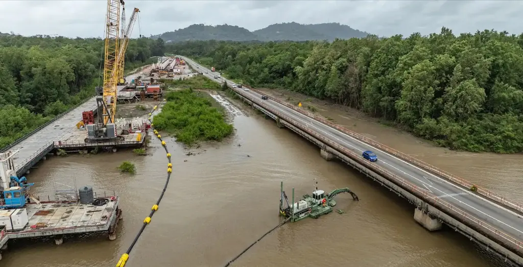
First web interface delivered for a dam inspection
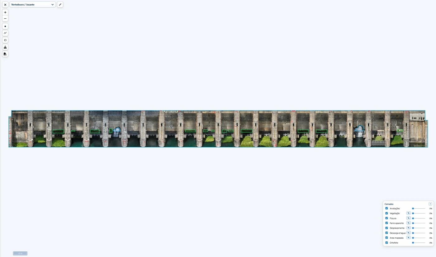
On 18 February 2025, with the plant report: the 9 orthophotos with their anomalies positioned, 4 3D models (powerhouse, spillway, two trunnion beams) and the virtual tour, available online for one year; a video tutorial was added after the technical meeting on 21 February.
- 9 orthophotos online
- 4 3D models
January 2025
Drone inspection of a hydroelectric plant on the São Francisco river
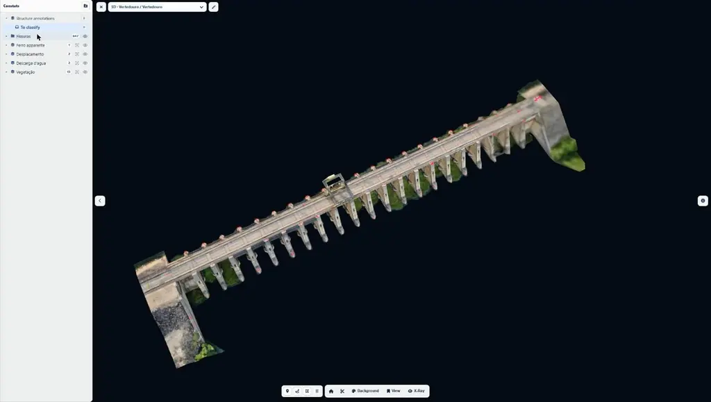
From 21 to 24 January 2025, after the site safety induction: 11,809 photos in 33 flights and 66.5 km flown, including close-range flights less than 4 m from the faces; 9 orthophotos (46 gigapixels), two 3D models, a virtual tour and 2,492 mapped anomalies, delivered with a web interface.
- 11 809 photos
- 2 492 anomalies mapped
Volumes of three biomass stockpiles
Two sugar-cane bagasse stockpiles and one green-waste stockpile: orthophoto, control points and volume plans.
LiDAR and RGB topographic survey in Macouria
December 2024
LiDAR and photogrammetry of two sites in Guadeloupe
Two sites surveyed by LiDAR for a photovoltaic developer, at Gissac, in Sainte-Anne, and Durival: missions prepared by Sentinel and flown in mid-December 2024 by Antilles Drone, with six ground control points; processing and a plan of each site by Sentinel.
Second thermal survey of the Creuilly photovoltaic plant in Le Moule
Flights carried out on 19 December 2024 by our partner Antilles Drone, processing by Sentinel. The plant had first been inspected in October 2022; a third campaign followed in November 2025.
Read the articleFour updates in 2024 of the biomass plant construction virtual tour
March, May, August and December 2024 versions, each rebuilt from a new photo campaign on the site.
- 4 versions in 2024
November 2024
Photogrammetry of 30.5 hectares near Galisbay port
Agreement request to Grand-Case aerodrome through the CLEARANCE portal, 2 h 06 flight plan computed for 1.5 cm per pixel, ground control in RGAF09; orthophoto in three tiles and virtual tour published online.
- 30,5 ha
LiDAR survey of a wooded plot in Saint-Joseph
From 14 to 18 November 2024: flight at 70 m with 70% side overlap, at 2 m/s, over rugged terrain; terrain model under the vegetation for a development project.
Orthophotos of the three lakes of Kourou
Request of 11 October 2024; one flight plan per lake, a corridor on Bois Diable, a full grid on Marie-Claire, a crossed grid around Bois Chaudat without flying over the water, and control points measured on the ground. Delivered on 28 November: three orthophotos at 13 mm, three at 39 mm and three surface models.
- 13 mm/px
- 3 lakes
Fourteen months of time-lapse on the Balata bus rapid transit works
Upgrade of the RN2 between Balata and the PROGT roundabout: five days of aerial and ground filming from July 2024 to June 2025, two time-lapse cameras from 8 November 2024 to 31 December 2025, two edits delivered in June and October 2025, cumulative time-lapse delivered on 9 January 2026.
- 14 months of time-lapse
- 2 cameras
- 5 filming days
Three-day photogrammetry course in Martinique
From 5 to 7 November 2024, for drone pilots based on the island: image capture, processing and certificates of attendance handed out at the end of the session.
2 cm orthophoto of the Vieux Bourg port and the Îles du Salut boarding area
Photogrammetric survey in late November 2024 for an environmental laboratory: 2 cm per pixel orthophoto of the Kourou port and the boarding area for the islands.
- 2 cm per pixel
October 2024
LiDAR survey of 125 hectares of the relegation heritage of Saint-Jean-du-Maroni
For the regional historic monuments service, from 23 to 25 October 2024: 25 ground points per m² required, 25 cm terrain and surface models, 3 cm orthophoto and a classified cloud in sixteen tiles, delivered by 7 November to delimit the buildings of the former camp to be protected.
- 125 ha
- 25 cm terrain model
First visit to the Larivot bridge repair works
On 8 October 2024, first of the eleven visits ordered by the company repairing the bridge: video rushes for the edit. Flights inside the Cayenne airport control zone, with air traffic control approval for the week of 7 to 11 October and a call to the tower before and after the mission.
Read the articleTwo drone-pilot courses with field practice at Matiti
Sessions on 30 September and 14 October 2024, field day accompanied by the military control centre.
Update of a farm’s plot plan
Photogrammetric flights at 120 m on 29 and 30 October, under special authorisation, to update the plan drawn up in 2020.
Three-day photogrammetry course
From 29 to 31 October 2024, for four trainees including two staff members of the National Forests Office: capture flights on the mornings of the 29th and 30th, then processing in Agisoft Metashape on each trainee’s computer.
- 4 trainees
LiDAR and photogrammetric survey of Devil’s Island
Monitoring of the Saint-Laurent-du-Maroni waste storage facility works
Eight visits from 11 October 2024 to 6 July 2026 (December 2024, March, June and November 2025, January, April and July 2026): each time, photos from the same viewpoints, two 360° panoramas, a hyperlapse and a vulture series; a 3 cm orthophoto and a plan since December 2024.
- 8 visits
- 3 cm per pixel
Photos, orthophotos and videos of the Kourou estuary mudflats
For a shorebird study: two visits, on 31 October over both banks and on 7 November 2024 over the right bank, at times chosen according to the tides and the bird migration.
- 2 visits
September 2024
Inspection of 1,262 supports along 128 km of medium-voltage lines
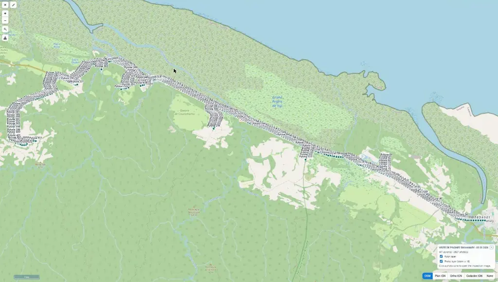
Four lots: Galion, in Montsinéry-Tonnegrande (397 supports), Mana (246), Sinnamary – Iracoubo (484) and Saint-Georges (135). From 17 September, 19 flying days and 7,854 photos, about six per support following the operator’s method, up to 99 supports in one day.
- 1 262 supports
- 128 km
- 7 854 photos
Roof inspection of a housing complex
Residents notified in advance, flight on 3 September, images online on the 5th for the engineering firm and the landlord.
1:500 topographic plan of the Corossony photovoltaic plant
On 5 September 2024: 15 mm orthophoto, then tables, modules, cable trays, fences, substations and contour lines drawn on the plan, with a photo report on the fences.
- 15 mm
- 1/500 plan scale
Second LiDAR survey and volume of earth removed since 2023
New survey of part of the 2023 site: 1,340 m³ of cut and 67 m³ of fill computed by comparing the two surveys, scaled P15 cross-section, 1 m contour lines around the upper embankment and a 50 cm point grid, delivered on 18 September 2024.
- 1 340 m³ of cut
- 67 m³ of fill
August 2024
Third campaign on the Peti dam
From 26 to 28 August 2024: 1,610 photos of the downstream face and 832 of the upstream face from 5 m away, 2023 and 2024 campaigns registered on the 2022 reference; four new cracks, cumulative length almost unchanged.
- 4 new cracks
625-hectare orthophoto around the village of Saint-Élie
Acquisition on 28 August 2024: 5,211 photos and a 3.5 cm orthophoto, registered on a base station and five control points measured by precise point positioning (PPP), with no permanent GNSS network station within 20 km.
- 625 ha
- 3,5 cm per pixel
LiDAR under forest cover for a forestry plan
Terrain model cleaned of artefacts and SHP contour lines, to lay out the logging tracks.
Night surveillance flights over a concert
On 14 August 2024: hovering night flights from cordoned-off areas outside the stadium, with no overflight of the audience; images relayed to the police and the security company, under prefectoral authorisation; the video link had been tested a month earlier.
Flying and photogrammetry course
Time-lapse of the sawmill’s southern platform, April to August 2024
Site camera installed on 2 April 2024; one- and two-minute edits delivered on top of the monthly photo visits.
July 2024
Drone-pilot course from 1 to 12 July 2024
LiDAR and photogrammetric survey of Île Saint-Joseph
Flame trenches, jet guide and deflector inspected after the first Ariane 6 launch
After the July 2024 maiden flight: concrete walls of the flame trenches, sprinkler nozzles, jet guide in 360° views over its full height and deflector, with mosaics viewable in a web interface.
June 2024
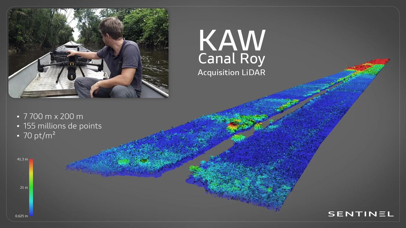
LiDAR survey of 7.7 km of the Roy canal from a pirogue
In late June 2024, under a prefectoral authorisation to fly over the Kaw-Roura marshes nature reserve: a 7,700 m by 200 m corridor, 155 million points at 70 points/m², classified ground and above-ground; models delivered from 8 to 11 July 2024.
- 7,7 km
- 155 M points
- 70 pts/m²
Two-week pilot course and CATS upgrades
From 17 to 29 June 2024, then sessions to move from the old certificate to the CATS for the island’s pilots.
Hydrogen burn pond igniters checked before the first Ariane 6 launch
Two thermal camera visits, on 12 and 24 June 2024.
May 2024
3D survey of 7 hectares of buildings in Le Robert
Moulin à Vent estate: oblique flight at 60° and 30 m with terrain following, 80/80 overlap, for a social landlord, its architect and its engineering firm; 1,059 roof inspection photos delivered at the end of May, point cloud redelivered on 1 m and 50 cm grids.
- 7 ha
- 1 059 photos
Stockpile volumes of two quarries, with ground targets
Flights over the Gravillonord and Blanchard quarries in May, June, August and November 2024; one set of moved targets forced a third visit, after which ten painted targets were installed permanently.
Photo report and film of the bus rapid transit works on ten sectors
Aerial photography in April 2024 of the bus rapid transit works, from the Maringouins sector to boulevard Mandela and place de la République; photos sorted by sector in early May, video edit finalised in August 2024.
April 2024
Wind-turbine blade inspection at Serra do Mel
Familiarisation with SupAirVision’s blade-inspection protocols in Rio Grande do Norte, then a first mission on the Serra do Mel wind farm for an energy producer.
Online 3D model of a solar plant
First photogrammetric model shared on a web viewer, before the Sentinel Cloud platform opened.
LiDAR survey of the Savane des Pères
March 2024
Annual photogrammetric survey of the reservoir and islet
Campaign of the monitoring started in October 2020: acquisition on 11 March 2024, point cloud, terrain and surface models, 50 cm contour lines, 3 cm orthophoto and a plan of the footprints from 2020 to 2024. The emerged area of the islet increased, a sign of a lower water level than during the previous surveys.
Roof measurements for two photovoltaic projects
Two roofs of a business park photographed on site by Antilles Drone, photogrammetric processing, plan and measurements by Sentinel; same service on a medical centre in Rémire-Montjoly.
First campaign for a photovoltaic plant operator
Preparation by video call, mission in the week of 11 March, additional flights in early April: thermal survey of La Trinité (4,082 modules checked, with strings switched off on purpose to test their identification) and inspection of the other plants.
- 4 082 modules
- 10 090 m² of panels
Drone imagery of the Île Royale lighthouse
On 6 March 2024, during the detailed inspection of the lighthouse by Cerema: photos of the inaccessible parts, sorted by face and element, from the pillars to the dome.
Read the articleImagery of the Cayenne mudflats for shorebird monitoring
Four visits, on 26 and 28 March then 24 and 25 April 2024, in coordination with the Cayenne control tower: imagery at 30, 60 and 90 m, including an infrared series at 90 m.
- 4 visits
3 cm orthophoto and point cloud of a precast yard at Cogneau-Larivot
Flights from 12 to 14 March 2024; 3 cm orthophoto, point cloud and plan delivered to the contractor on 14 March.
February 2024
Elevation deliverable on the client’s DWG plan
Elevations extracted from the digital terrain model and placed directly on the base plan provided.
Volume of a biomass stockpile spotted on the virtual tour
Volume requested by the client on 19 February 2024 after viewing the construction virtual tour: flight on 21 and 22 February registered on its GNSS base, plan delivered on the 23rd.
Final version of the Sinnamary bridge works film
Film with interviews, edited from aerial and ground footage of the works; first version delivered in February 2023, final version in February 2024.
Orthophotos and terrain models of two planned solar sites
Flights from 15 to 20 February 2024; for one site in Montsinéry and one in Roura, orthophoto, terrain model and 1 m contour lines delivered on 20 February.
January 2024
Survey of an embankment collapse on the Apatou road
At km 16 of the RD11: point cloud, surface model, DWG contour lines, longitudinal and cross profiles fitted to the collapse, delivered in four days to a geotechnical engineering firm.
Antenna-height panoramas of candidate sites
For each location, the drone climbs to the antenna heights under study and photographs the full horizon: seven locations between January and April 2024 in Rémire-Montjoly, at Palika and along the RN2, where the first location was photographed at five heights, from 48 to 60 m, with oblique photos for landscape integration.
Read the articleLiDAR and photographic survey for a partner operator
Raw data delivered to the client, who does the processing itself.
Aerial photos of rooftop photovoltaic plants for communication
Top-down view, overall and close-up photos of each site: a roof in Kourou in late December 2023, then schools and guesthouses in Mana and Javouhey on 12 January 2024.
December 2023
Orthophoto coverage of 12,647 hectares of inhabited French Guiana
From 4 December 2023 to 1 March 2024: eight sectors at 3.5 cm per pixel, 343 flights, 184,464 photos, 50 ground control and 26 check points; ECW and JP2 orthophotos accepted on 7 March 2024.
- 12 647 ha
- 184 464 photos
- 343 flights

Photo and video monitoring of the GRESS 2 & 3 wind farm resumed
In December 2023 the project owner relaunched the photo and video record of the works, followed since 2022; one visit followed in 2024 when the ships carrying the turbine components were unloaded, then seven in 2025.
RTX/PPP positioning tests
Measured accuracy of 1.1 cm in X, 1.6 cm in Y and 7 mm in Z, for missions without an RTK network.
Photographic survey of a telecommunications tower
Panoramas at 33 and 35 m on the Parc Lindor site: for each height, eight views oriented every 45°, a vertical view and two stitched half-panoramas.
Read the article
November 2023
Emergency drone support during a vegetation fire
Locating hotspots, infrared flights to detect residual heat and mapping of the burnt area over two days.
LiDAR and photogrammetry survey of three areas, including the former Diamant site
Orthophotos from 3 to 50 cm resolution, 1 m contour lines (terrain and surface) and point clouds delivered in DWG.
Orthophotos and thermography of two ground-mounted plants
Toucan 2 and Sioulé plants: orthophoto and thermal imaging, campaigns repeated in 2025.
Thermal surveys of two photovoltaic plants
Order of 10 November 2023: thermal survey and orthophoto of the Morne Étoile plant handed over on 22 November, orthophoto of the Le Lorrain solar farm on the 29th.
Film shoot with interviews in a school in Soula
Orthophoto and virtual tour of two project plots
Go-ahead on Tuesday, flight on Saturday, delivery the following Wednesday: orthophoto, oblique photos and a small online virtual tour.
Thermal surveys of ground-mounted plants for a partner operator
Visible and thermal orthophotos of several plants, delivered on the partner’s analysis platform with quality control of the flight lines; flights postponed in the rainy season when irradiance drops below 600 W/m².
Photogrammetry and LiDAR survey of Île Royale
LiDAR and photogrammetric survey of Île Royale; Devil’s Island and Saint-Joseph followed in 2024.
LiDAR survey of a site: 1 m contour lines and a 50 cm point grid
For Neova and its architects: ground contour lines every 1 m and a point every 50 cm, in DWG and TXT, delivered on 17 November 2023; new survey in September 2024.
Time-lapse of a showroom construction site
Time-lapse unit on the showroom construction site; 30- and 45-second edits, static and with zoom, delivered on 24 November 2023, final version on the 28th.
First survey of the inside of the ELA4 flame trenches
Photos of the concrete walls on all four faces of both flame trenches, the sprinkler nozzles, the jet guide, outside and inside, and the deflector; this first inspection also set the limits of the equipment in these enclosed volumes.
October 2023
LiDAR and photogrammetry on an active quarry and two project sites
Colourised LiDAR acquisitions and ground control points in Kourou, then at Roche Tablon (Roura); stockpile volumes computed.
Long-endurance Boréal drone campaign for the State in French Guiana
Six weeks of operations from Mana with M3 Systems: night flights over the Maroni river with the border police, maritime surveillance, environmental police and civil protection.
Read the articlePlan of plots with measurement of cleared areas
Flight on 27 October 2023, orthophoto and area calculations delivered in November.
Orthophoto of 815 hectares and LiDAR of 223 hectares in Saint-Laurent-du-Maroni
Flights in October 2023 near the aerodrome, authorised outside its opening hours: 3.2 cm orthophoto, 50 cm terrain, surface and height models, contour lines in DWG and SHP, layers of buildings, roads, water and forest; delivered on 24 November 2023.
- 815 ha of orthophoto
- 223 ha of LiDAR
Panoramas at 18 and 35 m for a telecom site at Mont Lucas
On 12 and 13 October 2023, in an urban area: stitched panoramas at 18 and 35 m, the first of ten locations photographed for the operator until April 2024.
Read the article
September 2023
Second annual campaign on the Peti dam
From 12 to 15 September 2023: 1,649 photos of the faces from 6.5 m away, face orthophotos registered on the 2022 baseline (4,052 cracks); 22 new or longer cracks and 54 more visible ones recorded.
- 22 new cracks
- 0,8 mm per pixel
Pre-installation roof surveys in Martinique
Orders of 7, 18 and 28 September 2023: six buildings surveyed in Le Lorrain, Le Lamentin, Sainte-Marie, Gros-Morne and Le Robert, with oblique photos and a photogrammetric survey to prepare each panel layout.
Second crack-monitoring campaign on 14 concrete test blocks
From 18 to 20 September 2023, at Furnas’ concrete ageing station: 4,200 photos 40 cm from the faces, 68 orthomosaics at 0.15 mm per pixel and 1,184 crack measurements, compared with the 2022 campaign.
- 0,15 mm per pixel
- 1 184 measurements
Photogrammetric survey of quay no. 2 and verticality check of the piles
Piles photographed less than a metre above the water under the deck, 3D model and verticality analysis handed to the experts: “the result is impressive, great work”, wrote the port’s technical department.
Four LiDAR intercalibration flights over the Paracou research station
Flights at 65, 80, 95 and 110 m above the forest, taking off from a gap at the foot of the flux tower, to compare our scanner with the research institute’s.
- 4 flight heights
Photogrammetric flight over a quarry for stockpile volumes
Fixed points set up on site, photos uploaded to the client’s processing portal; repeated several times in 2024 on the Blanchard and Gravillonord quarries.
June 2023
ELA4 hydrogen burn pond igniters checked during the Ariane 6 tests
Seven thermal camera visits between 23 June and 14 December 2023, during the Ariane 6 tests on its launch complex.
- 7 visits
September 2019
360° panoramas for the simulation of a telecom antenna
On 11 September 2019, on the Route des Plages, inside the airport control zone and in liaison with the tower: flights within a cylinder of 100 m radius up to 50 m high, 360° panoramas stitched the next day.
March 2019
Position and height of telecom antennas on four sites along the Oyapock
Between Saint-Georges and Camopi: overall views, photogrammetry, 3D model and orthophoto plan of each site, with the relative height of the antennas and towers. At Saint-Georges the antenna was measured at 59.2 m and its position computed to a hundredth of an arc second.
- 4 sites
- 59,2 m Saint-Georges antenna
No mission matches these filters.
Tell us about your project
Location, area or structure, expected deliverables and timing: with these details we can propose a method and a quote.
97310 Kourou
French Guiana
Route des Trois-Îlets
97229 Les Trois-Îlets
Martinique
20030-041 Rio de Janeiro – RJ
Brazil