
- Home
- Projects
- Guiana Space Centre
- Salvation Islands: LiDAR and photogrammetry of the three islands
Salvation Islands: LiDAR and photogrammetry of the three islands
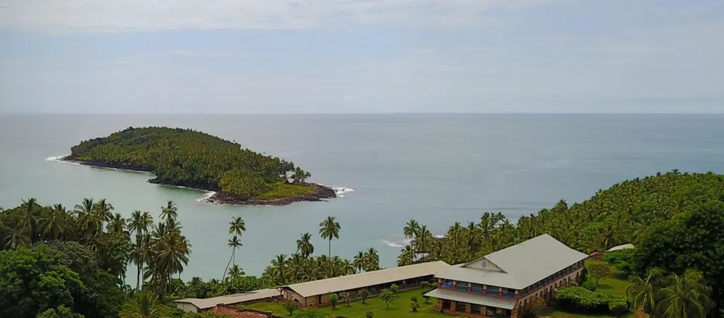
For CNES, which manages the site, LiDAR and photogrammetric surveys of Île Royale, Île Saint-Joseph and Devil’s Island, from 2023 to 2025.
Background
The Salvation Islands belong to CNES, which manages their heritage: buildings of the former penal colony, vegetation, networks. It needed a topographic base of the three islands, under dense vegetation, to manage the site.
What we did
Each island was surveyed under a waiver, by LiDAR and photogrammetry. For each one we delivered a point cloud classified ground and above-ground, a digital terrain model beneath the vegetation and an orthophoto.
5 related missions in the log
Additional survey on Île Royale and Devil’s Island
2 cm orthophoto of the Vieux Bourg port and the Îles du Salut boarding area
Photogrammetric survey in late November 2024 for an environmental laboratory: 2 cm per pixel orthophoto of the Kourou port and the boarding area for the islands.
- 2 cm per pixel
LiDAR and photogrammetric survey of Devil’s Island
LiDAR and photogrammetric survey of Île Saint-Joseph
Photogrammetry and LiDAR survey of Île Royale
LiDAR and photogrammetric survey of Île Royale; Devil’s Island and Saint-Joseph followed in 2024.
Other projects
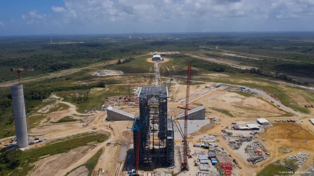
The Ariane 6 launch complex construction, filmed and photographed from 2018 to 2021
From 2018 to 2021, aerial photo and video campaigns on the ELA4 construction site: fourteen films published by the Guiana Space Centre, photos used by ESA, Espace & Exploration and Latitude 5.
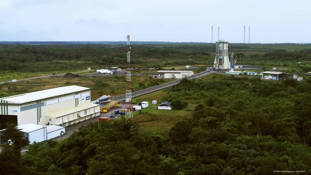
Launch campaigns: fifteen launches covered in Kourou from 2017 to 2019
Aerial photography of the launch complexes during Ariane 5, Soyuz and Vega campaigns, within the windows authorised by the base: fifteen launches from December 2017 to December 2019.
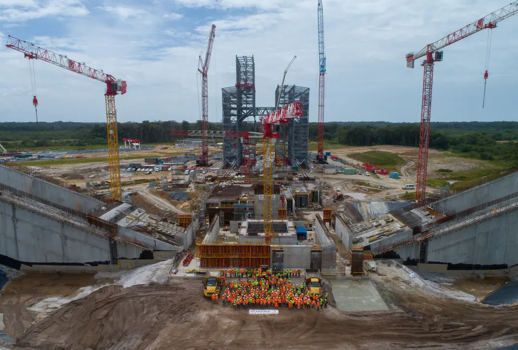
Flame trenches of the Ariane 6 launch complex: inspections and a digital twin at 1.5 mm per pixel
Since November 2023 we have photographed the inside of the two flame trenches of the ELA4, which carry the engine exhaust away at lift-off. In 2025 a photogrammetric survey turned them into a digital twin and eight orthophotos at about 1.5 mm per pixel.
Tell us about your project
Location, area or structure, expected deliverables and timing: with these details we can propose a method and a quote.
97310 Kourou
French Guiana
Route des Trois-Îlets
97229 Les Trois-Îlets
Martinique
20030-041 Rio de Janeiro – RJ
Brazil