
Quay no. 2 at Dégrad-des-Cannes: pile verticality from 4,410 photos
Photogrammetry under the deck, at low tide and from a boat: 3D model of the quay, ortho-façade and tilt of the piles, delivered less than a month after the flights.
Background
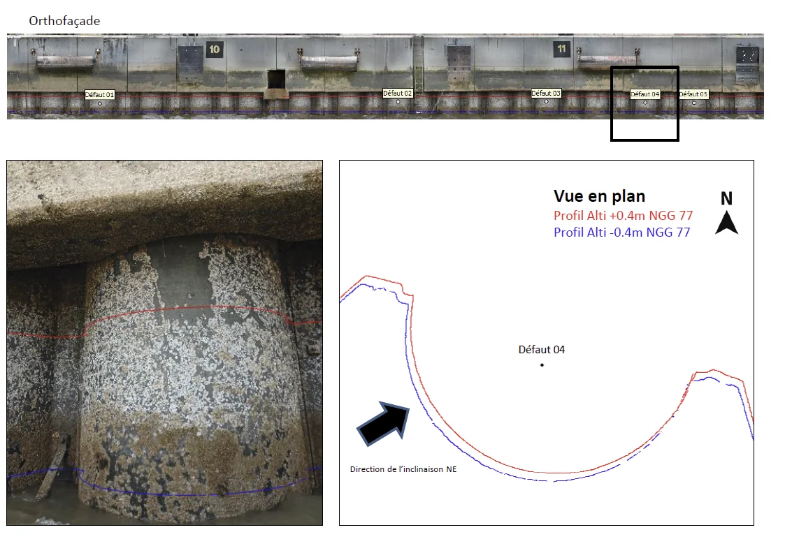
The Grand Port Maritime de la Guyane wanted to know the tilt of the piles supporting quay no. 2 at Dégrad-des-Cannes, in absolute terms and relative to one another. The piles can only be seen at low tide, under the deck, over a short height.
What we did
The port reserved the berth for the flights and arranged for the emerged part of the piles to be cleaned with a high-pressure jet to remove concretions and shells. The flights were carried out from a boat leaving the Dégrad-des-Cannes marina, at low tide on 2 and then 3 August 2023: the first produced the 3D model of the 200 m quay, which was used to prepare the close-range flight plan of the following day. In total, 4,410 photos taken with a 45 Mpx full-frame sensor, at 0.5 mm per pixel on average, and control points measured by GNSS. On the part of the quay framed by these points, two horizontal profiles at +0.4 m and −0.4 m NGG 77 were extracted from the model for each pile: their offset gives the direction and amount of tilt. Delivered on 29 August 2023: ortho-façade, PDF and DWG layouts, summary presentation.
In the mission log
Photogrammetric survey of quay no. 2 and verticality check of the piles
Piles photographed less than a metre above the water under the deck, 3D model and verticality analysis handed to the experts: “the result is impressive, great work”, wrote the port’s technical department.
Other projects

12,647 hectares of orthophotos at 3.5 cm for EPFA Guyane
From 4 December 2023 to 1 March 2024, eight sectors photographed at 3.5 cm per pixel, from Cayenne to Cacao: 343 flights, 184,464 photos, 50 ground control points and 26 check points. A second 6,545-hectare campaign began on 16 October 2026; its first sector was delivered on 19 October.
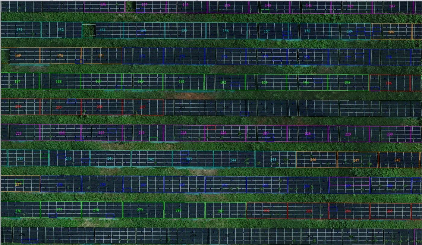
Corossony solar plant: 1,472 concrete footings surveyed at 2 mm per pixel before repowering
A 1:500 topographic plan of the plant in operation in September 2024, then the position and height of each of the 1,472 footings kept for the new structures, in December 2025.
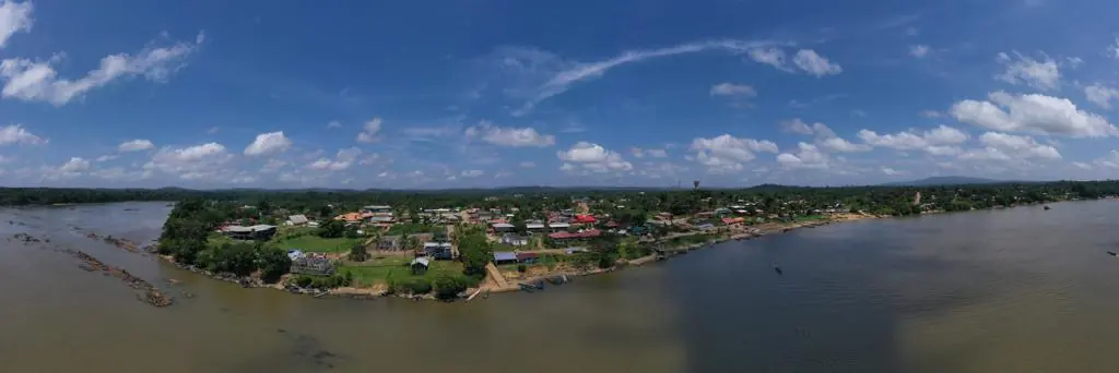
Waste in western French Guiana: eight visits in Saint-Laurent, four Maroni villages at 1 cm
Since October 2024, photos taken from the same viewpoints at every visit to the Saint-Laurent-du-Maroni waste storage facility, with a 3 cm orthophoto and a plan since December 2024; in February 2026, the waste sites of four river villages surveyed at 1 cm.
Tell us about your project
Location, area or structure, expected deliverables and timing: with these details we can propose a method and a quote.
97310 Kourou
French Guiana
Route des Trois-Îlets
97229 Les Trois-Îlets
Martinique
20030-041 Rio de Janeiro – RJ
Brazil