
Canal de l’Ouest and Bois Chaudat lake: 34 reference photos and a 12 mm orthophoto to monitor erosion
In Kourou, the Canal de l’Ouest links the Kourou river to Bois Chaudat lake. For the Savanes community of municipalities, responsible for aquatic environments and flood prevention, these are two flood-management structures whose bank erosion needs monitoring. In November 2024 we had mapped the town’s three lakes at 13 mm per pixel. In April 2026 the authority asked us to set up this monitoring on the canal and the lake.
An orthophoto and comparable photos
The authority wanted observations precise enough to assess and follow the evolution of the banks over time. It had considered two options: an orthophoto at each intervention, or a series of photos taken from identical angles each time. The monitoring adopted combines both, over a total length of 3.4 km along the canal and the lake. The schedule has eight campaigns, from September 2026 to February 2028, two to three months apart. The photogrammetry flights are always carried out at low tide; for the first campaign, the authority also wanted to observe the mud banks that had formed in the northern part of the lake and to calculate their area.
Viewpoints fixed once and for all
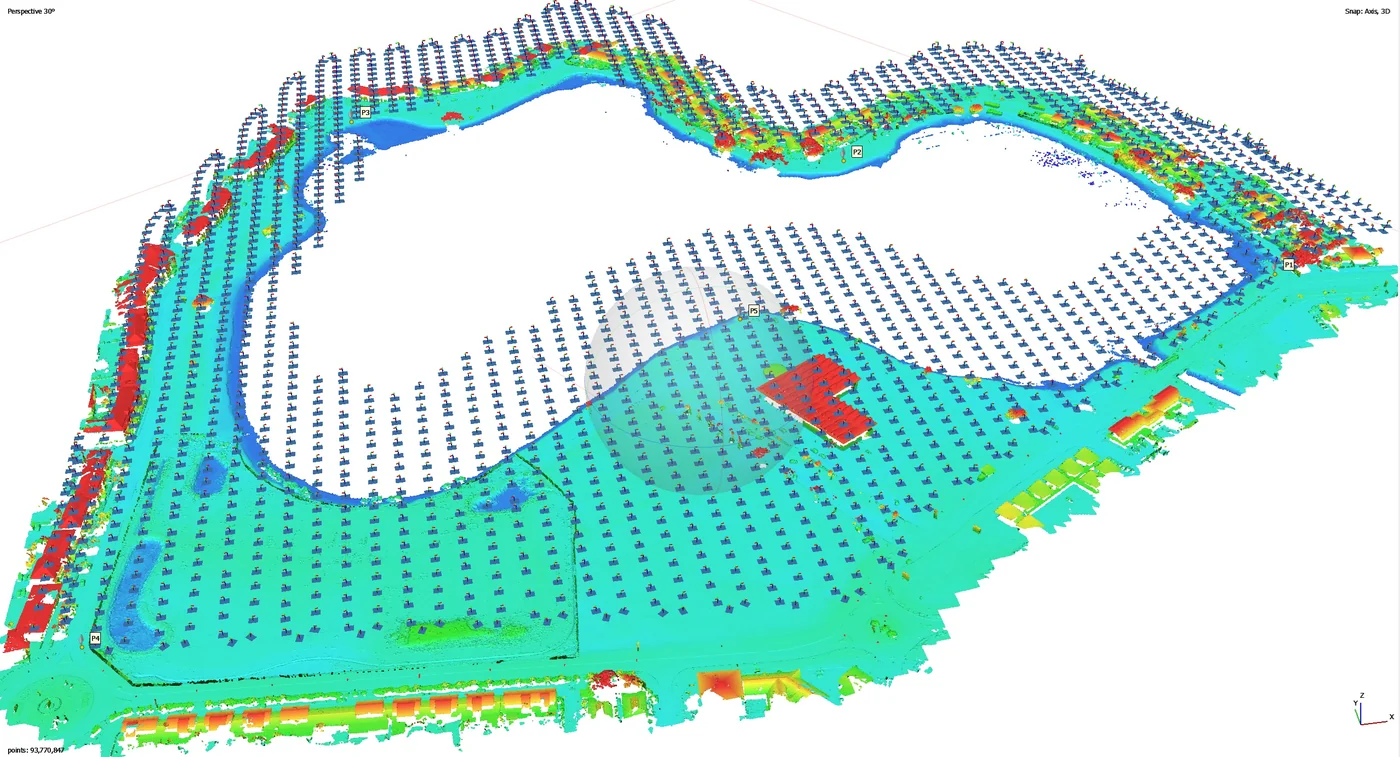
The positions and angles of the reference photos were defined with the authority at a preparation meeting, to serve for every campaign: 34 viewpoints, 24 around the lake and 10 along the canal, stored in a KML file. At each campaign the drone returns to the same positions with the same angle, and the photos can be compared one by one.
On 15 September 2026, in the early afternoon, at low tide, the team carried out the photogrammetric flight and the 34 reference photos. At the authority’s request, the mud islets in the northern part of the lake were also photographed and mapped separately, to measure their area.
Delivered in two days
The deliverables were handed over on 17 September: the 12 mm per pixel orthophoto, the plan of Bois Chaudat lake and the canal, the 22 mm orthophoto and plan of the mud islets, and the photos of the 34 viewpoints with their KML file. The mud banks show on the orthophoto as long as they lie within 25 m of the shoreline axis. Three Sentinel Cloud accounts were opened for the authority’s staff, who view the orthophoto in a browser.
Next steps
The September campaign serves as the baseline. The seven that follow, from December 2026 to February 2028, will return to the same 34 viewpoints, always at low tide.


