
- Home
- Saint-Martin
- Saint-Martin
Saint-Martin
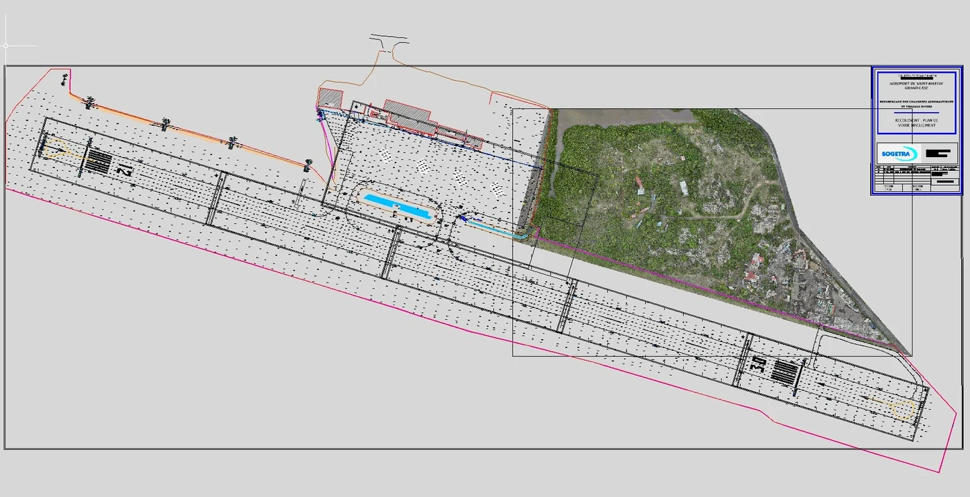
In Saint-Martin we work from Martinique. For an energy company, we surveyed a site in the port of Galisbay by photogrammetry in early November 2024 (1.5 cm per pixel), then by LiDAR on 18 March 2025 to recover the ground beneath the vegetation. In April 2026, for the operator of Grand-Case aerodrome, we surveyed a wooded area north-west of the runway by LiDAR and photogrammetry ahead of its extension project: flights on 14 and 15 April from outside the platform, at 30 m maximum, in liaison with the AFIS and with an observer from Tilaya Drones, then delivery on 17 April of a DWG tied to the existing runway survey.
Key facts
| Port of Galisbay | Photogrammetry in early November 2024 (25° oblique views, 1.5 cm per pixel), LiDAR on 18 March 2025, ground points delivered in DWG |
|---|---|
| Grand-Case aerodrome (TFFG) | Wooded area north-west of runway 12/30: flights on 14 and 15 April 2026 at 30 m at most, DWG, orthophoto and LiDAR points delivered on 17 April |
| Missions listed | 4 |
On the map
4 missions at this location
LiDAR survey beside the runway at Grand-Case aerodrome
Wooded area of about 8 hectares beside the runway: control points on 13 April 2026, photogrammetry and LiDAR flights on the 14th and 15th at no more than 30 m, in coordination with the AFIS; 3 cm orthophoto, ground points at 2 m spacing and existing drawing re-registered in RGAF09 delivered on 17 April.
Read the articleLiDAR ground points at 15 cm spacing for the earthworks studies
The roads and utilities designer noticed height differences between the 2024 and 2025 surveys: his calculations relied on the 2024 photogrammetric contours, which follow the canopy in wooded areas. On 12 February 2026, delivery of the LiDAR ground points over his two 8 m check strips.
Read the articleLiDAR survey of a project site near Galisbay port
On 18 and 19 March 2025, over the project’s priority area, without the port, the batteries having been shipped without using aircraft. Deliverables from 31 March to 3 April: digital terrain and surface models at 15 cm, ground and above-ground point clouds, DWG drawings of the ground points.
- 15 cm model spacing
Photogrammetry of 30.5 hectares near Galisbay port
Agreement request to Grand-Case aerodrome through the CLEARANCE portal, 2 h 06 flight plan computed for 1.5 cm per pixel, ground control in RGAF09; orthophoto in three tiles and virtual tour published online.
- 30,5 ha
Other locations
Tell us about your project
Location, area or structure, expected deliverables and timing: with these details we can propose a method and a quote.
97310 Kourou
French Guiana
Route des Trois-Îlets
97229 Les Trois-Îlets
Martinique
20030-041 Rio de Janeiro – RJ
Brazil