
Galisbay, Saint-Martin: 30.5 hectares by photogrammetry, then the ground by LiDAR for the earthworks
In Saint-Martin, next to Galisbay port, Albioma is preparing a project on a hill covered with dense vegetation, between the road and the sea. In September 2024 the company asked us to map the site for its studies. The area lies within the surroundings of Grand-Case aerodrome: before flying, we needed a prefecture receipt, then an agreement request to the aerodrome through the CLEARANCE portal, filed on 15 October 2024.
November 2024: orthophoto and virtual tour
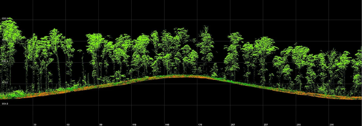
The flight plan, computed for 1.5 cm per pixel, included images tilted at 25°; ground control was measured in RGAF09. The surveyed footprint covers 30.5 hectares. The orthophoto was published online in three tiles, together with a virtual tour of the site. A limitation appeared during processing: under vegetation this dense, photogrammetry captures the tops of the trees, and the contour lines derived from it describe the canopy.
March 2025: LiDAR
Albioma ordered a LiDAR survey on 5 February 2025. The batteries of the LiDAR drone are not accepted on aircraft: their transport, entrusted to a carrier, set the survey date. It took place on 18 and 19 March 2025 over the project’s priority area, without the port, with additional flights on the second morning. The deliverables, handed over between 31 March and 3 April, included a digital terrain model and a digital surface model at 15 cm, the ground and above-ground point clouds, and DWG drawings of the ground points at 50 cm spacing, lighter to handle than the 15 cm spacing.
During the same campaign we took the photographs requested by the design office for the project’s visibility study: views from the site towards the four cardinal points, from the sea towards the hill and from the road.
February 2026: differences explained
A year later the earthworks studies were progressing. The roads and utilities designer, based in Guadeloupe, noticed height differences between the two versions of the survey. In a video call the cause was identified: his calculations relied only on the 2024 contour lines, interpolated between one another. In wooded areas these contours follow the canopy, and the interpolation produced aberrant results where the road meets the vegetation.
The designer then specified his needs on two test zones, 8 m wide strips along the road verge and the outer edge of the roundabout. On 12 February 2026 we delivered the ground points from the 2025 LiDAR, at 15 cm spacing, over these two areas.
Two months later we surveyed another wooded area of the island by LiDAR, beside the runway of Grand-Case aerodrome.


