
- Home
- Martinique
- Eastern and central Martinique
Eastern and central Martinique
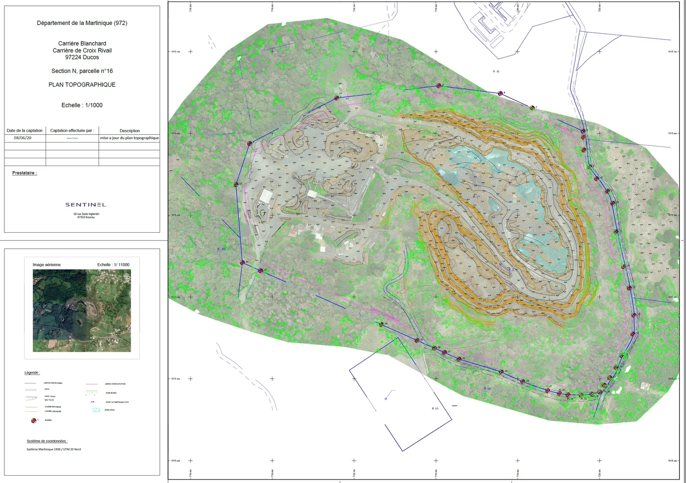
On the Atlantic side and in the hills: thermal survey of the rooftop plant in La Trinité (4,082 modules) and LiDAR under forest cover for a forestry plan, 3D survey of 7 hectares of buildings in Le Robert (1,059 oblique photos), orthophoto of 27 hectares of Pointe des Sables, in Le Vauclin, for the State services (eleven targets, 3.6 cm planimetric accuracy), LiDAR of a sloping wooded plot in Saint-Joseph, roof measurements of the post office and a nursery in Le François, quarry volumes in Ducos.
Key facts
| Missions listed | 13 |
|---|
On the map
13 missions at this location
Measurement and diagnosis of the post office and nursery roofs
Orthophoto from 25 m altitude and DWG plans delivered on 14 January 2026.
Orthophoto of 27 hectares of Pointe des Sables, Le Vauclin
On 15 October 2025: eleven targets (four for control, seven for checking), flight at 90 m with terrain following and a cross grid, 2.9 cm orthophoto and 3.55 cm planimetric accuracy, delivered the next day with the processing report; surface model added on 21 October.
- 27 ha
- 3.55 cm accuracy
Shading surveys of two roofs in Ducos
On 3 October 2025, including the building that houses the installer’s offices: oblique flight plan at 80 m above ground with terrain following and 75% overlap, a 3D model and four photos per site, delivered on 7 October.
Aerial photos of properties for an estate agency
First property photographed on 15 September 2025 in Ducos, then further requests in Le Diamant, Le Robert and Case-Pilote.
Time-lapse of a kit villa assembly
Unit installed for the duration of the structure assembly and removed on 24 September 2025, once it was complete; video delivered at the end of September.
Drone surveillance of the Baccha Festival
On Saturday 9 and Sunday 10 August 2025, afternoon and evening, at Pointe Faula: flights at 50 m maximum in the S3 scenario, notified to the civil aviation authority, with images relayed to the security command post and the police.
La Marie estate: phases 2 and 3
Flights from 30 June to 4 July 2025, delivered on 4 July.
Read the articlePoint clouds of the La Marie estate, first phase
Acquisition at the end of February 2025, results presented by video call on 10 March; colourised XYZ clouds, one file per building, and a plan naming each building delivered on 14 March to the architects, who work in ArchiCAD.
Read the articleLiDAR survey of a wooded plot in Saint-Joseph
From 14 to 18 November 2024: flight at 70 m with 70% side overlap, at 2 m/s, over rugged terrain; terrain model under the vegetation for a development project.
LiDAR under forest cover for a forestry plan
Terrain model cleaned of artefacts and SHP contour lines, to lay out the logging tracks.
3D survey of 7 hectares of buildings in Le Robert
Moulin à Vent estate: oblique flight at 60° and 30 m with terrain following, 80/80 overlap, for a social landlord, its architect and its engineering firm; 1,059 roof inspection photos delivered at the end of May, point cloud redelivered on 1 m and 50 cm grids.
- 7 ha
- 1 059 photos
Stockpile volumes of two quarries, with ground targets
Flights over the Gravillonord and Blanchard quarries in May, June, August and November 2024; one set of moved targets forced a third visit, after which ten painted targets were installed permanently.
Photogrammetric flight over a quarry for stockpile volumes
Fixed points set up on site, photos uploaded to the client’s processing portal; repeated several times in 2024 on the Blanchard and Gravillonord quarries.
Tell us about your project
Location, area or structure, expected deliverables and timing: with these details we can propose a method and a quote.
97310 Kourou
French Guiana
Route des Trois-Îlets
97229 Les Trois-Îlets
Martinique
20030-041 Rio de Janeiro – RJ
Brazil