
- Home
- Martinique
- Northern Martinique
Northern Martinique
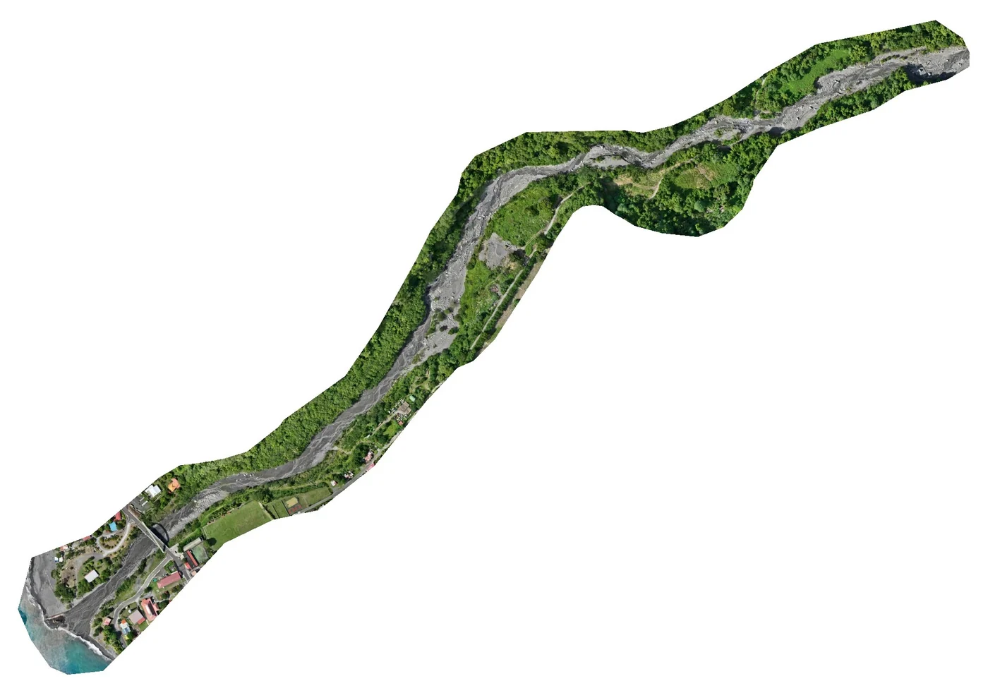
In northern Martinique we produced, in September 2026, the orthophoto of 12.5 hectares of the Saint-Pierre coastline, from the Fort district to the sub-prefecture, for the State services (12 ground targets, 1.8 cm planimetric accuracy), and in July 2026 the thermal survey of the Bellefontaine ground-mounted plant, 8,996 panels beneath medium-voltage lines, after a reconnaissance LiDAR survey. We follow the construction of the GRESS 2 & 3 wind farm in Macouba in photo and video, have carried out thermal surveys of plants in Le Lorrain and at Morne Étoile, and surveyed one hectare by LiDAR in Case-Pilote. In Le Prêcheur, on 23 October 2025, we surveyed the 32 hectares of the river mouth during the lahar crisis.
Key facts
| Saint-Pierre, September 2026 | 12.5 ha from the Fort district to the sub-prefecture, 1,305 images, 12 targets, 1.8 cm planimetric accuracy, oblique images and surface model |
|---|---|
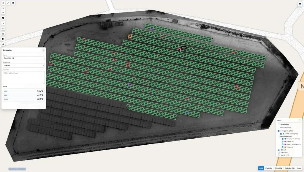
| Bellefontaine, July 2026 | 8,996 panels beneath medium-voltage lines: reconnaissance LiDAR on 17 July, thermal survey on the 20th, results online on the 30th |
| Missions listed | 9 |
On the map
9 missions at this location
Orthophoto of 12.5 hectares of the Saint-Pierre coastline
On 21 September 2026, from the Fort district to the sub-prefecture: twelve ground targets, 1,305 images taken at 65 m, orthophoto delivered at 2 and 5 cm the next day, 1.78 cm planimetric accuracy.
- 12.5 ha
- 1.78 cm accuracy

Monitoring of the GRESS 2 & 3 wind farm works resumed
Order from Albioma on 1 June 2026, after it took over the project: visits to Macouba on 21 July, the day set for unloading two blades at Fond Potiche, to the Grand Port of Fort-de-France on 23 July, then to Macouba on 1 and 18 August.
Thermal survey of the Bellefontaine plant, beneath medium-voltage lines
Medium-voltage lines on 27 m pylons above the plant: LiDAR survey on 17 July 2026 for the terrain model, then infrared and visible flights on 20 July, at 30 m above the terrain; 8,996 panels checked; results delivered and published on Sentinel Cloud on 30 July.
- 8 996 panels
- 30 m above the terrain
LiDAR and high-resolution photogrammetry of a one-hectare plot
10,282 m² surveyed for a civil-works contractor.
Elevation survey of the Prêcheur river mouth during the lahar crisis
Targets laid and measured on 22 and 23 October 2025 in a hard-to-reach riverbed, flights on the 23rd: 2,778 images over 32 hectares, 3.7 cm orthophoto, surface model on a 20 cm grid, 3.72 cm planimetric accuracy on five check targets; delivered on 28 October.
- 32 ha
- 2,778 images
Drone surveillance of the Wet Island concerts in Le Lorrain
From Saturday 19 July 2025 at 4 pm to Sunday the 20th at 1 am, at the Le Lorrain municipal stadium, at the prefecture’s request: day and night flights at 50 m maximum in the S3 scenario, with no overflight of third parties and one drone in the air at a time.
Seven visits to the GRESS 2 & 3 wind farm site
Aerial and ground shots on 24 and 25 February, 5, 13 and 24 March, 7 and 23 April 2025; 4K rushes and a photo deliverable for the year.
- 7 visits
Photo and video monitoring of the GRESS 2 & 3 wind farm resumed
In December 2023 the project owner relaunched the photo and video record of the works, followed since 2022; one visit followed in 2024 when the ships carrying the turbine components were unloaded, then seven in 2025.
Thermal surveys of two photovoltaic plants
Order of 10 November 2023: thermal survey and orthophoto of the Morne Étoile plant handed over on 22 November, orthophoto of the Le Lorrain solar farm on the 29th.
Tell us about your project
Location, area or structure, expected deliverables and timing: with these details we can propose a method and a quote.
97310 Kourou
French Guiana
Route des Trois-Îlets
97229 Les Trois-Îlets
Martinique
20030-041 Rio de Janeiro – RJ
Brazil