
Jarry-Houëlbourg: 327 hectares of wetland mapped at 2.36 cm per pixel
In Baie-Mahault, the Jarry-Houëlbourg wetland borders Guadeloupe’s main business district. Part of this land was transferred to the Conservatoire du littoral in 2010, and since 2016 the Conservatoire has been running the Ja-Riv project to take back and restore plots occupied by businesses. In January 2026 it issued a call for recent orthophotos of the wetland and of its interface with built-up areas: a reference state, at the right scale, of the edge between the mangrove and the warehouses.
An approved footprint, flights to prepare
Our bid was selected on 14 January. The Conservatoire sent us its target zones, to be widened by a 100 m buffer; the final footprint, approved on 26 January, covers about 327 hectares. The site lies inside the control zone of Pointe-à-Pitre airport and close to the N1 expressway. We prepared the flight plan and the target layout, then on 5 February filed the flight notifications for the weekend of the 15th.
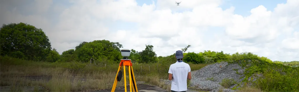
Acquisition was carried out by our Guadeloupe partner Antilles Drone: targets laid out on Friday 13 February 2026, flights on 14 and 15 February with a Matrice 4E. Seven hours of flight were needed. The 15,445 images were taken at 91.7 m above ground, i.e. 2.36 cm per pixel over 3.27 km².
Accuracy measured on the ground
The block was adjusted on nine ground control points and checked on six check points, all measured by GNSS in RGAF09 / UTM 20N with IGN 88 heights. The root-mean-square error is 3.47 cm on the control points and 3.64 cm on the check points, of which 2.41 cm in plan and 2.73 cm in height. The check points, which play no part in the adjustment, give the actual accuracy of the orthophoto.
Files on the scale of the site
Processing produced a dense cloud of 2.59 billion points, a 4.73 cm surface model (447 points per square metre) and an orthophoto of 145,563 by 81,247 pixels. To remain usable on an ordinary workstation, the orthophoto was delivered as tiles and as a 1.5 GB compressed file, with the surface model, an A0 plan and the processing report. Everything was handed over to the Conservatoire on 22 February.
The surface model gives the height of vegetation and buildings at every point: the edge of the mangrove, backfill and cleared areas can be read in relief as well as in the image. Repeated later on the same ground control, it will show what has changed.


