
Bellefontaine: 8,996 panels surveyed by thermography under medium-voltage lines
A 4.9 MWp ground-mounted plant beneath medium-voltage lines: LiDAR survey, flights at 30 m above the terrain, 8,996 panels checked one by one.
Background
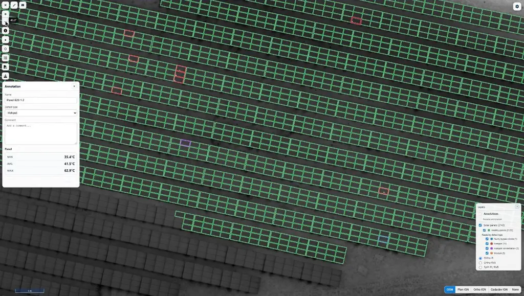
The Bellefontaine plant, on the Caribbean coast of Martinique, has 8,996 modules of 550 Wp mounted on 346 tables, i.e. 2.3 hectares of panels on a 3.9-hectare site. Medium-voltage lines run above it, carried by 27 m pylons, with cables coming down to 10 m above the ground. Its operator, Genergies, wanted the same panel-by-panel diagnosis as in Le Carbet a month earlier.
What we did
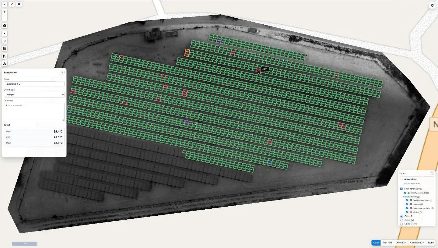
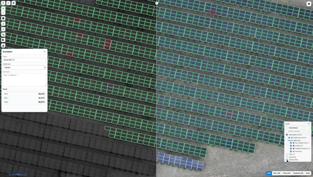
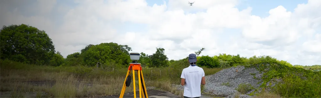
We usually fly these thermal surveys at 25 m. Here, a flight plan below the cables was ruled out, and flying above them required a precise plan, set on the relief and on the height of the pylons. On 17 July, a LiDAR and photogrammetric reconnaissance survey produced the digital terrain model of the site; on 20 July, the infrared and visible flights were flown at 30 m above that model, with side overlap raised to 85% in the flight plan so that every panel could be seen between the cables. Infrared resolution went from 3 to 4 cm per pixel without hindering the reading of defects, and processing removed the cables from the orthophotos as far as possible. The flights took place under 1,100 W/m² of irradiance; every panel showing an anomaly has its own record, classified by type of defect. Report approved on 28 July, delivered on the 30th and published on Sentinel Cloud.
In the mission log
Thermal survey of the Bellefontaine plant, beneath medium-voltage lines
Medium-voltage lines on 27 m pylons above the plant: LiDAR survey on 17 July 2026 for the terrain model, then infrared and visible flights on 20 July, at 30 m above the terrain; 8,996 panels checked; results delivered and published on Sentinel Cloud on 30 July.
- 8 996 panels
- 30 m above the terrain
Gallery
Other projects
Eleven solar plants in 2026: 33,333 panels checked one by one
June to September 2026: eleven plants surveyed by thermography for Genergies in Martinique, Guadeloupe and French Guiana: 33,333 panels checked one by one.
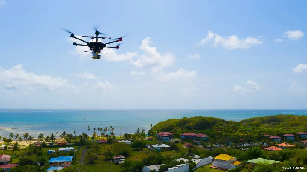
Martinique coastline: three precision surveys, from 1.78 to 3.72 cm
At Pointe des Sables in Le Vauclin and in Saint-Pierre for DEAL Martinique, at the mouth of the Prêcheur river for BRGM during the lahar crisis: three orthophotos whose accuracy was measured on independent targets, delivered between one and five days after the flights.
Jarry-Houëlbourg: 327 hectares of wetland in a 2.36 cm orthophoto
For the Conservatoire du littoral, the orthophoto and surface model of the Jarry-Houëlbourg wetland and its edge with the business district: 15,445 images taken over one weekend in February 2026, 3.64 cm root-mean-square error on six check points.
Tell us about your project
Location, area or structure, expected deliverables and timing: with these details we can propose a method and a quote.
97310 Kourou
French Guiana
Route des Trois-Îlets
97229 Les Trois-Îlets
Martinique
20030-041 Rio de Janeiro – RJ
Brazil