
- Home
- Projects
- Petit-Saut reservoir: 4,049 emerged stems located and measured by drone LiDAR in one flying day
Petit-Saut reservoir: 4,049 emerged stems located and measured by drone LiDAR in one flying day
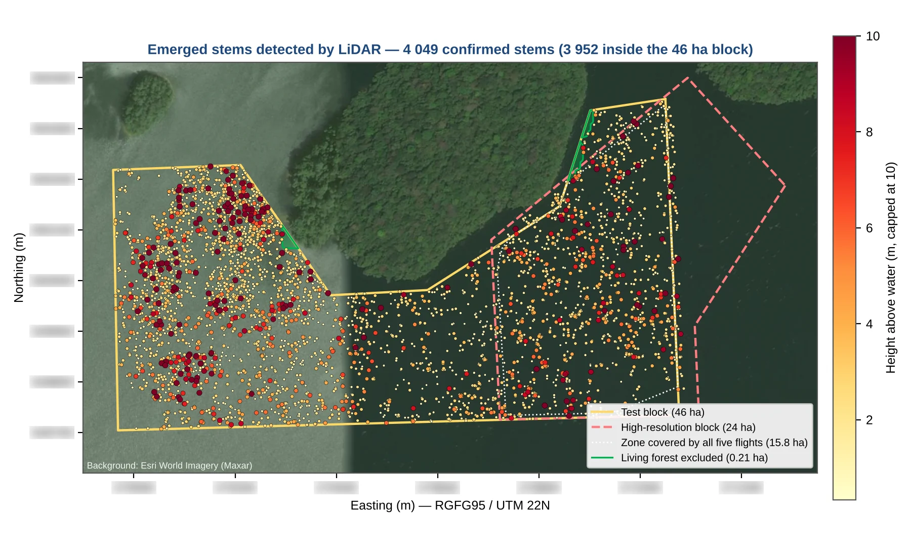
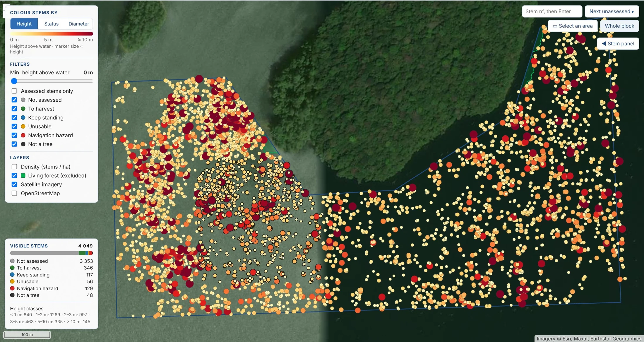
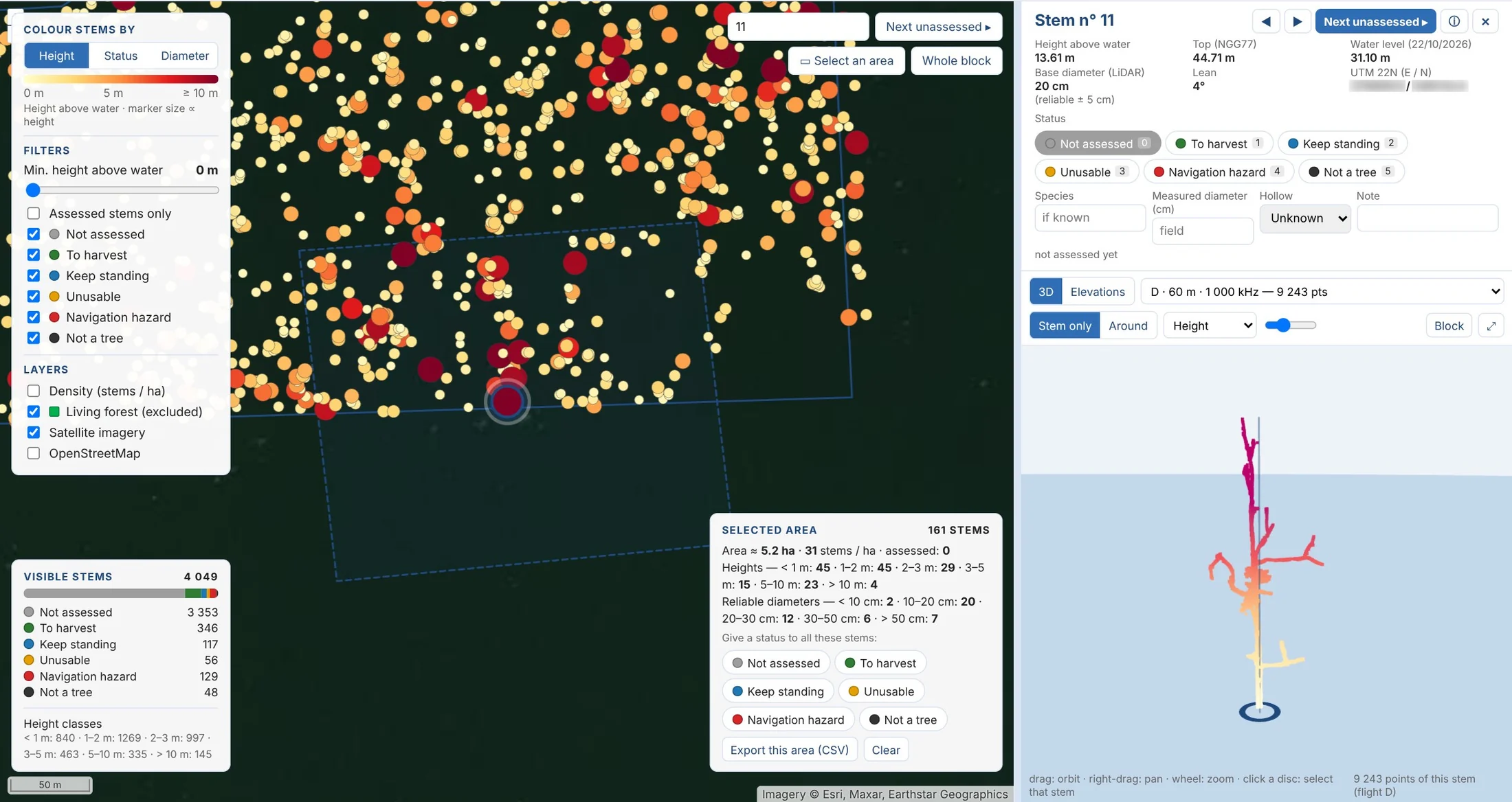
For a timber company working on the reservoir, we compared five LiDAR configurations and two photographic configurations on a 46 ha test block on 22 October 2026. Every emerged dead tree is located, its height above water measured, and a base diameter obtained for 88 % of them. The client received the GIS layers, the point clouds and a web page to browse, view in 3D and annotate each stem.
Background
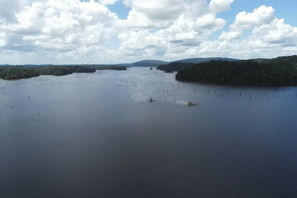
The impoundment of the Petit-Saut dam, from 1994, drowned a forest that had not been cleared. Thirty years later the dead trunks are still standing, and their emerged part is both a timber resource and a hazard to navigation. A timber company working on the reservoir asked us to test, on a representative block, what drone-borne sensors can deliver: a map of every emerged tree, its height above the water, its diameter if possible, and a comparison of the methods in quality and productivity. The site sets the rules: no ground control point can be placed on water, the aircraft must stay within sight of the pilot, and the reservoir level varies, and with it the number of visible trees. The 46 ha test block was chosen in a dense sector due for harvesting, so that the measurements can be checked on the trunks once they are cut.
What we did
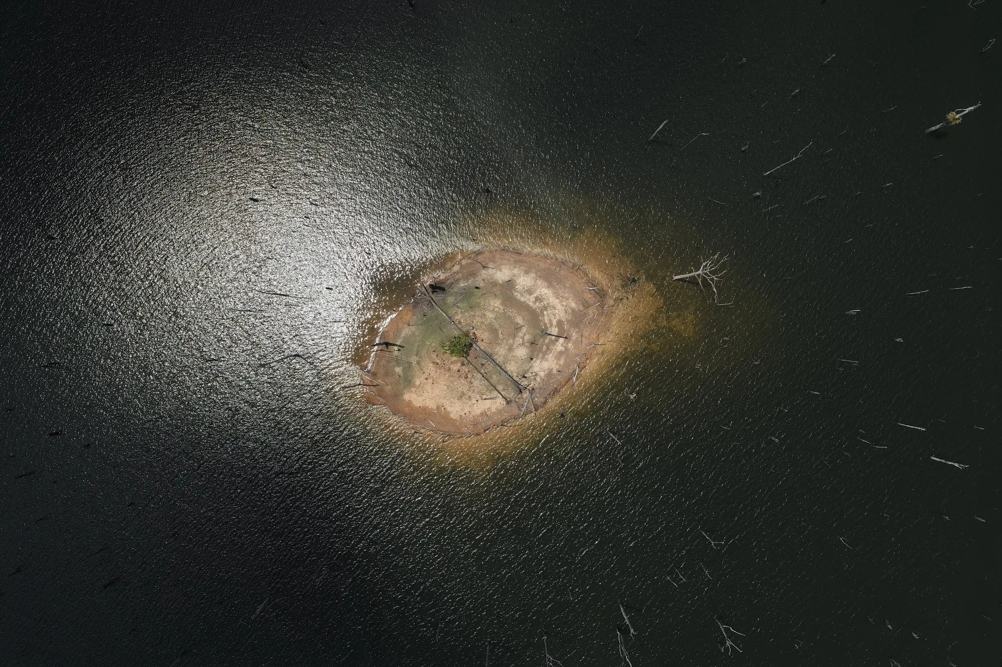
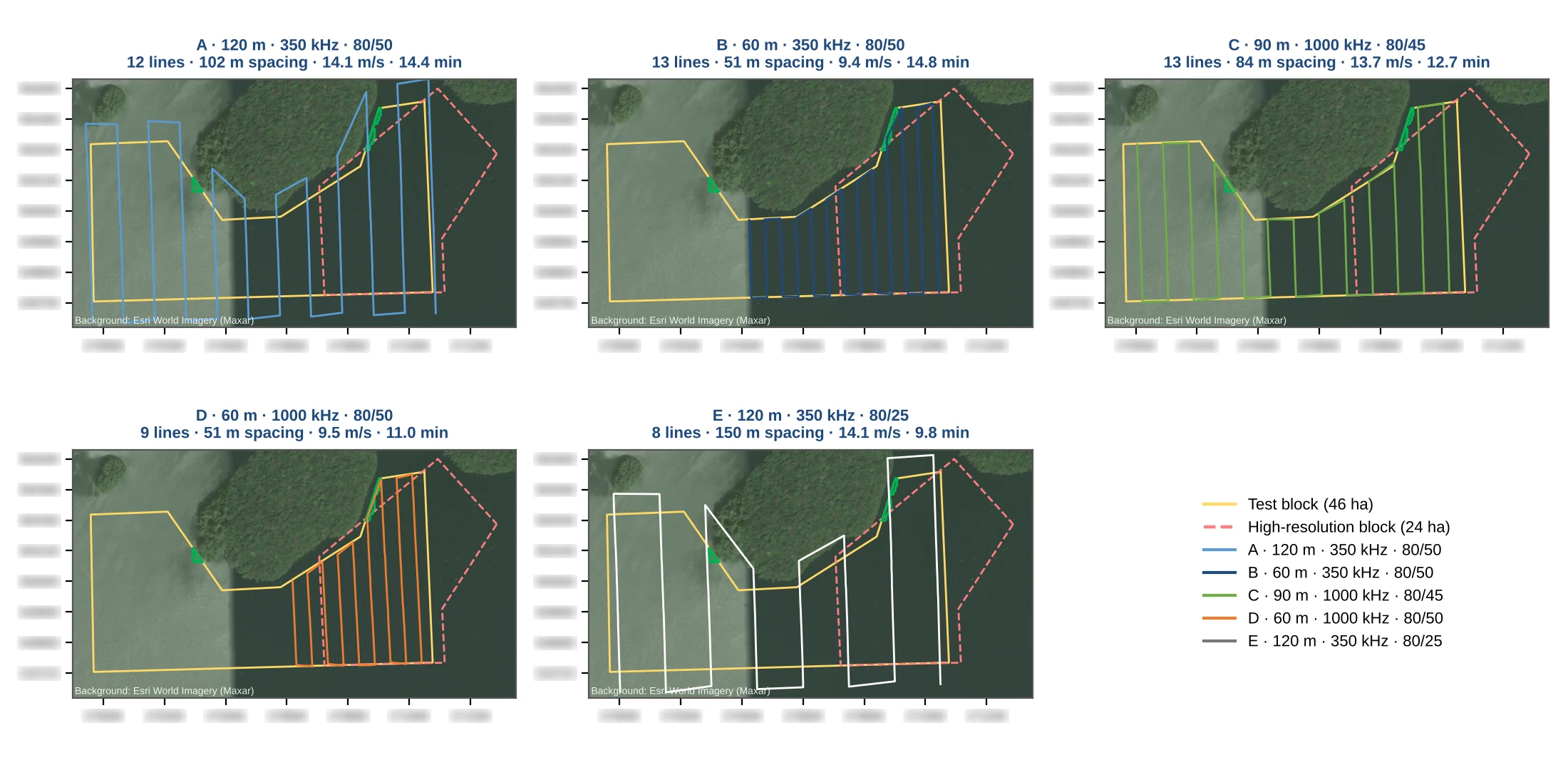
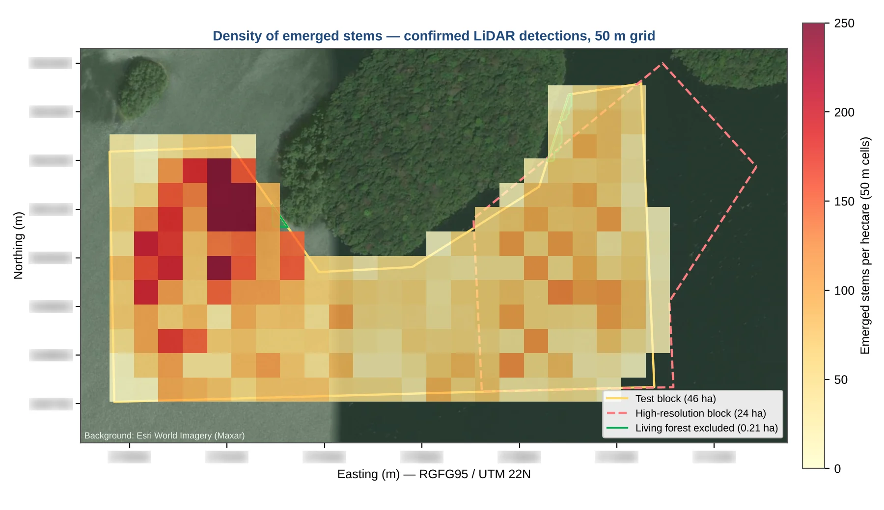
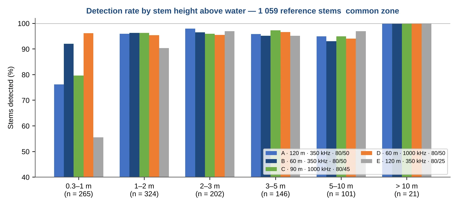
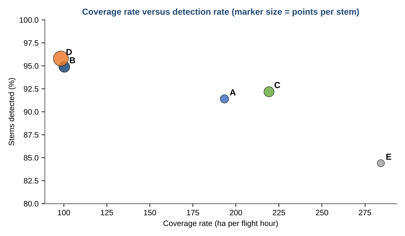
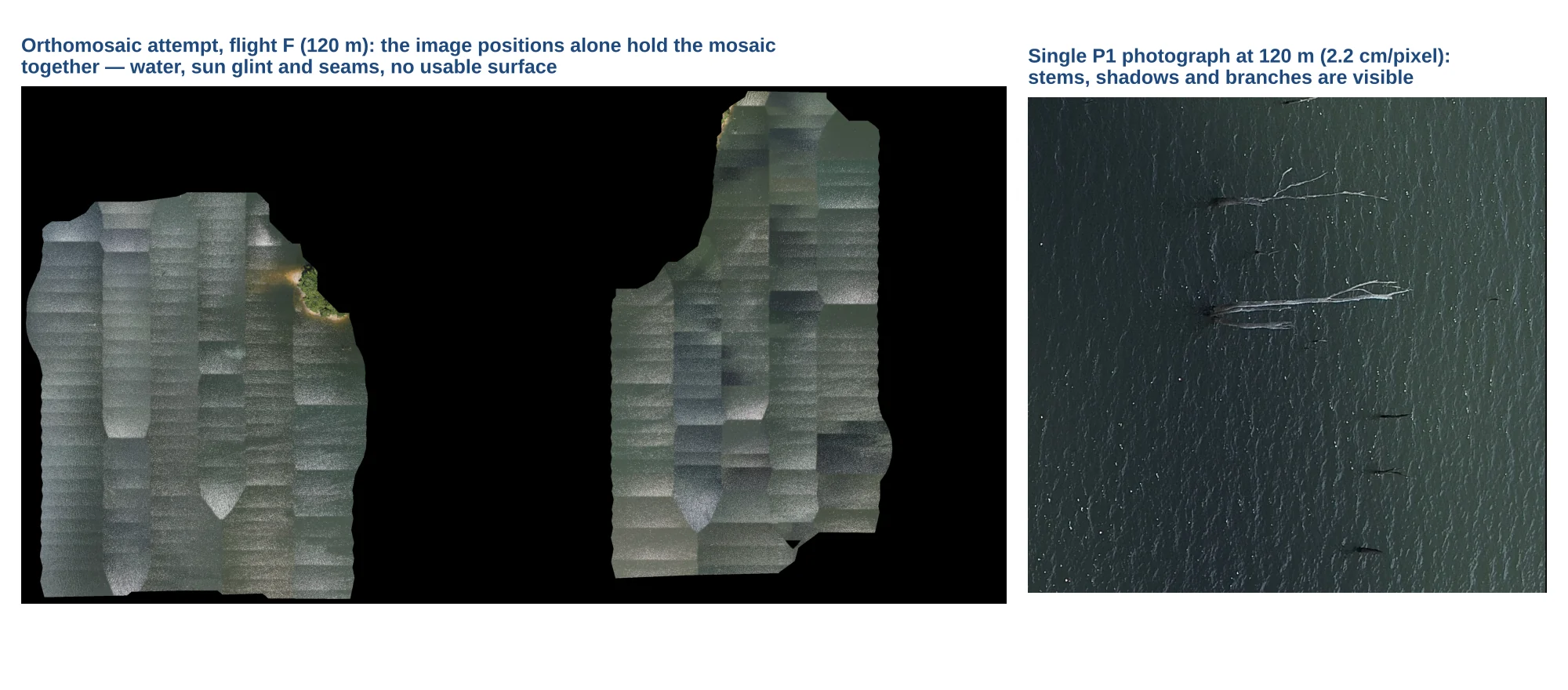
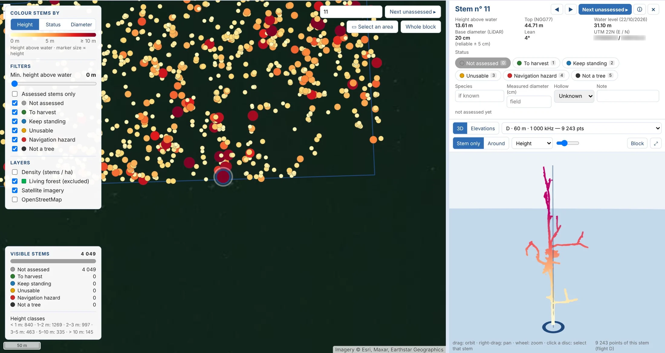
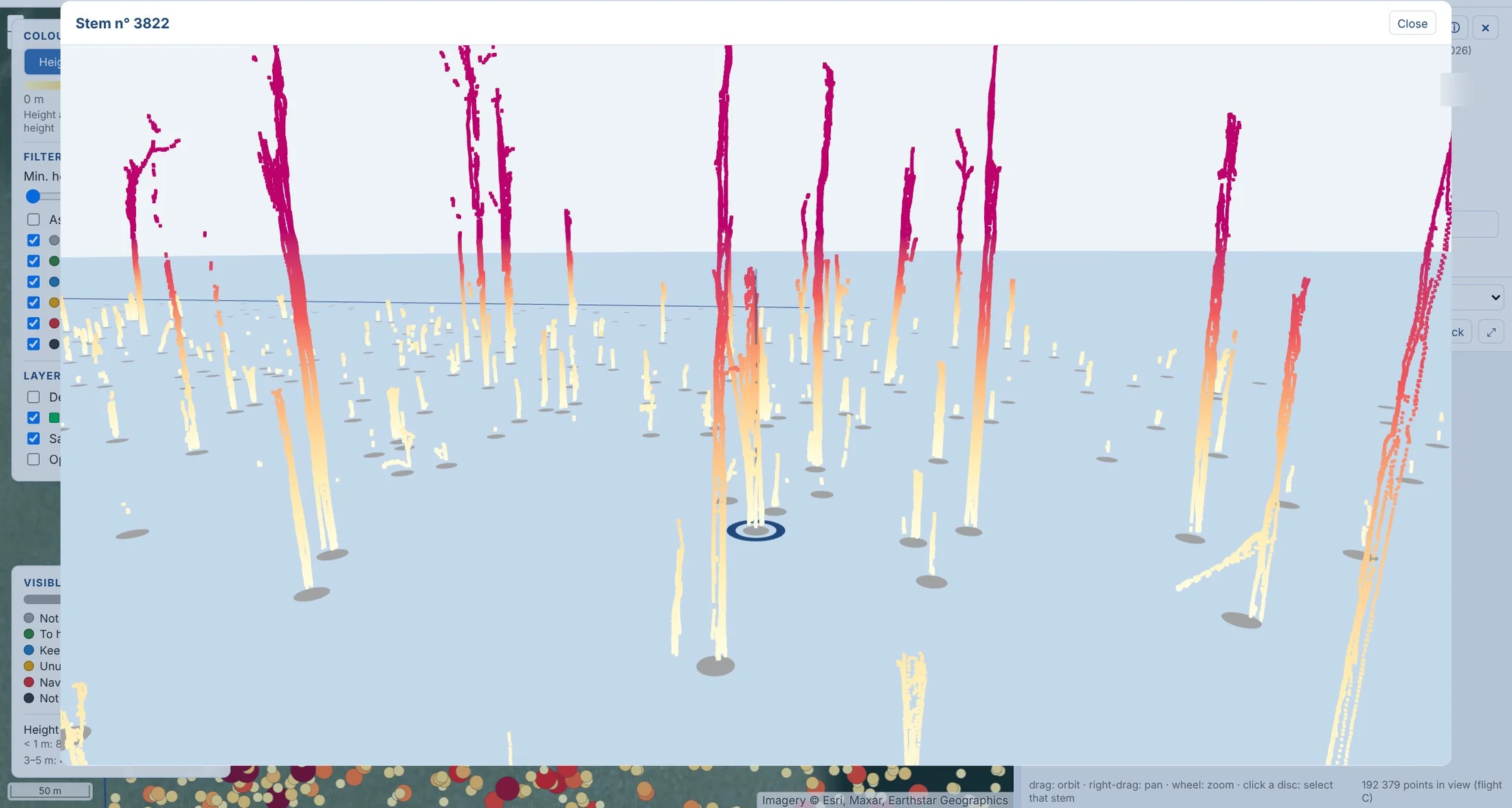
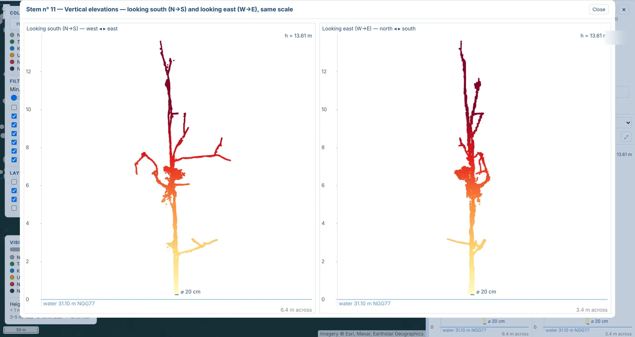
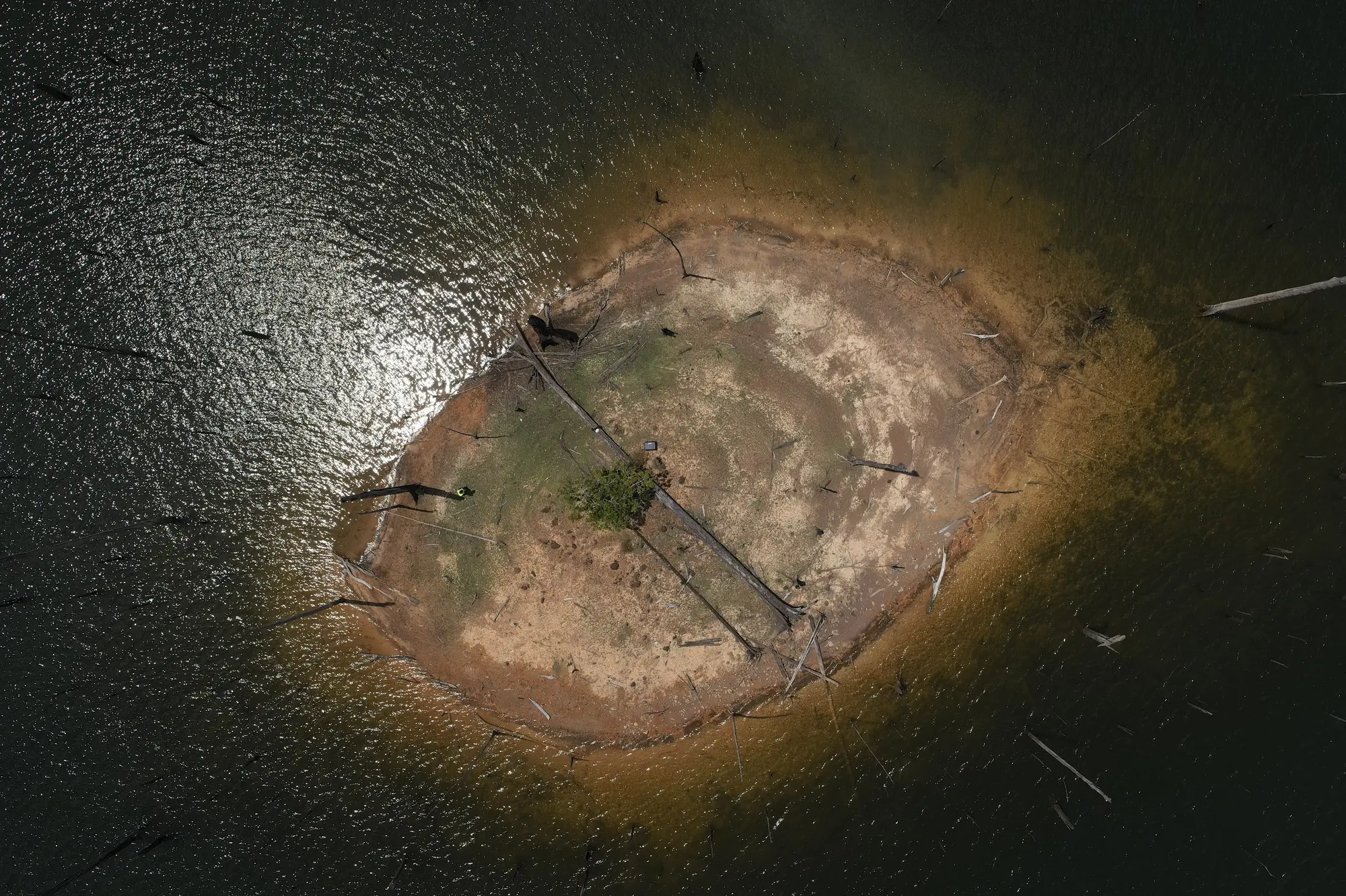
On 22 October 2026 a DJI Matrice 400 flew five LiDAR flights with a Zenmuse L3 and two photographic flights with a Zenmuse P1, from a small island in the middle of the stems, 450 m from the block. The LiDAR flights were made at 60, 90 and 120 m, at 350 or 1,000 kHz, with line spacings from 51 to 150 m: settings ranging from a detailed inventory, at 100 ha per flight hour, to fast reconnaissance, at 280 ha per hour. With no ground control possible, positioning relies on a Trimble R2 GNSS reference station on land and on post-processed kinematic (PPK) trajectories; the water level, 31.10 m NGG77 that day, is read directly in the point clouds. Our processing chain groups the laser returns above the water into objects and confirms a stem when at least two flights detect it at the same place: 4,049 confirmed stems, 3,952 of them inside the block, i.e. 85 per hectare on average and up to 300 locally. The height above water is measured for each one (median 1.9 m, 145 stems above 10 m, the tallest at 24.8 m) and a base diameter is obtained for 88 % of them by fitting a circle to the trunk points just above the water line. On the 15.8 ha covered by all five flights, the two 60 m flights detect 95 to 96 % of the reference stems, the 90 m flight 92 %, the 120 m flights 84 to 91 %; the difference is concentrated on the stubs below one metre. The two photographic flights, at 60 and 120 m, produced no usable 3D model, neither in DJI Terra nor in Agisoft Metashape: the water surface moves between two exposures and reflects the sun, and offers no tie points. The photographs, at 2 cm per pixel, remain a useful visual record. For the whole reservoir we recommend an inventory at 90 m and 1,000 kHz, about 220 ha per flight hour and in the order of 500 ha per day on the lake, followed by 60 m flights over the blocks to be harvested.
In the mission log
LiDAR inventory of the emerged stems of the Petit-Saut reservoir: 4,049 dead trees located and measured on a 46 ha test block
On 22 October 2026, five LiDAR flights and two photo flights from a small island, for a timber company working on the reservoir: height above water of every stem, base diameter for 88 % of them; GIS layers, point clouds and a web inventory page delivered.
- 4 049 stems
- 46 ha in one day
Gallery
Other projects

12,647 hectares of orthophotos at 3.5 cm for EPFA Guyane
From 4 December 2023 to 1 March 2024, eight sectors photographed at 3.5 cm per pixel, from Cayenne to Cacao: 343 flights, 184,464 photos, 50 ground control points and 26 check points. A second 6,545-hectare campaign began on 16 October 2026; its first sector was delivered on 19 October.
Corossony solar plant: 1,472 concrete footings surveyed at 2 mm per pixel before repowering
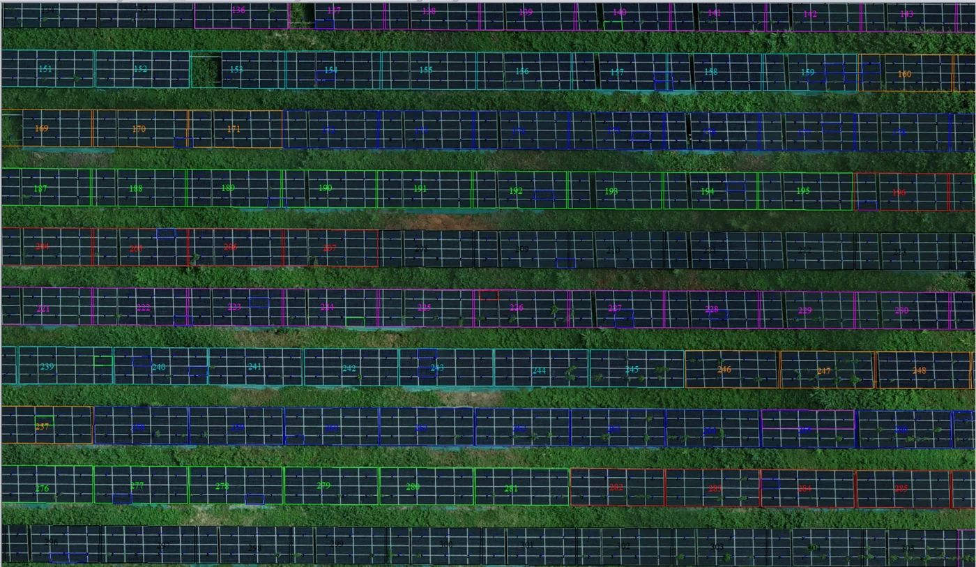
A 1:500 topographic plan of the plant in operation in September 2024, then the position and height of each of the 1,472 footings kept for the new structures, in December 2025.
Waste in western French Guiana: eight visits in Saint-Laurent, four Maroni villages at 1 cm
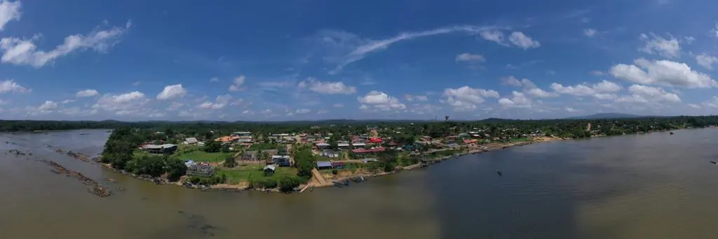
Since October 2024, photos taken from the same viewpoints at every visit to the Saint-Laurent-du-Maroni waste storage facility, with a 3 cm orthophoto and a plan since December 2024; in February 2026, the waste sites of four river villages surveyed at 1 cm.
Tell us about your project
Location, area or structure, expected deliverables and timing: with these details we can propose a method and a quote.
97310 Kourou
French Guiana
Route des Trois-Îlets
97229 Les Trois-Îlets
Martinique
Centro, 20030-041 Rio de Janeiro – RJ
Brazil