
Mana
A 6,333 km² municipality in western French Guiana, Mana includes part of the Amana and Trinité nature reserves. From October to November 2023 we operated the Boréal long-endurance drone there for six weeks, from Mana, for the State services, including night flights over the Maroni. Since October 2020 we have surveyed the reservoir and islet of the Saut Maman Valentin hydroelectric plant every year to monitor bank erosion (3 cm orthophoto, 50 cm contour lines), and we produced its virtual tour in 2025. We also inspected the 246 supports of the Mana lot of medium-voltage lines in 2024, photographed rooftop solar installations on schools and lodges in Mana and Javouhey, surveyed a pontoon on the RD9 for the territorial authority in August 2026 and, in October 2026, installed a time-lapse camera on the construction site of the Sainte-Anne hybrid power plant.
Key facts
| Saut Maman Valentin | Annual survey since October 2020: 3 cm orthophoto, 50 cm contour lines; virtual tour in 2025 |
|---|---|
| Missions listed | 7 |
On the map
7 missions at this location
Time-lapse and filming at the Sainte-Anne hybrid plant
Time-lapse unit installed for the duration of the hybrid plant construction, first series of shots on 7 October 2026, after footage of the site in October 2025.
Photogrammetric survey of a pontoon on the RD9, Mana road
Orthophoto delivered on 24 August 2026 to the roads department.
Photos then a virtual tour of the Saut Maman Valentin hydroelectric plant
Virtual tour published online in June 2025 and hosted for the client.
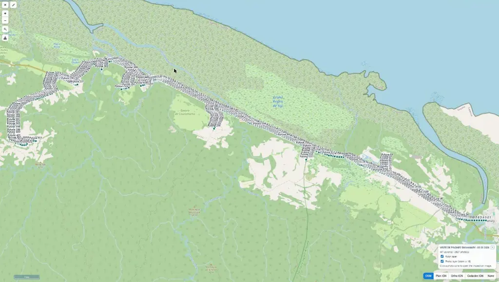
Inspection of 1,262 supports along 128 km of medium-voltage lines
Four lots: Galion, in Montsinéry-Tonnegrande (397 supports), Mana (246), Sinnamary – Iracoubo (484) and Saint-Georges (135). From 17 September, 19 flying days and 7,854 photos, about six per support following the operator’s method, up to 99 supports in one day.
- 1 262 supports
- 128 km
- 7 854 photos
Annual photogrammetric survey of the reservoir and islet
Campaign of the monitoring started in October 2020: acquisition on 11 March 2024, point cloud, terrain and surface models, 50 cm contour lines, 3 cm orthophoto and a plan of the footprints from 2020 to 2024. The emerged area of the islet increased, a sign of a lower water level than during the previous surveys.
Aerial photos of rooftop photovoltaic plants for communication
Top-down view, overall and close-up photos of each site: a roof in Kourou in late December 2023, then schools and guesthouses in Mana and Javouhey on 12 January 2024.
Long-endurance Boréal drone campaign for the State in French Guiana
Six weeks of operations from Mana with M3 Systems: night flights over the Maroni river with the border police, maritime surveillance, environmental police and civil protection.
Read the article
Tell us about your project
Location, area or structure, expected deliverables and timing: with these details we can propose a method and a quote.
97310 Kourou
French Guiana
Route des Trois-Îlets
97229 Les Trois-Îlets
Martinique
20030-041 Rio de Janeiro – RJ
Brazil