
- Home
- French Guiana
- Sinnamary
Sinnamary
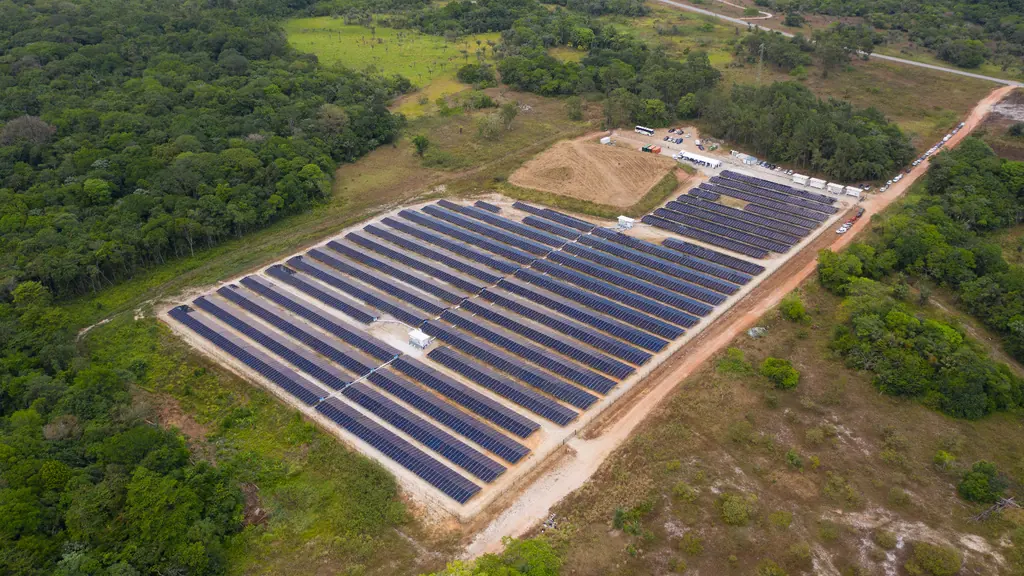
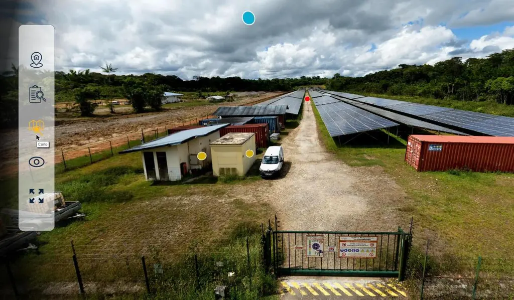
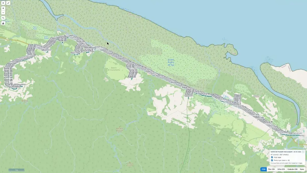
On the RN1 between Kourou and Iracoubo, Sinnamary stretches from the estuary to the savannas and the forest; the Petit-Saut dam, within the municipality, has its own page. In September 2023 we flew four LiDAR intercalibration flights there, at 65, 80, 95 and 110 m above the forest of the Paracou research station; in 2024 we inspected the 484 supports of the Sinnamary–Iracoubo lot of medium-voltage lines; drew the 1:500 plan of the Corossony solar plant in September 2024, then, in December 2025, once the modules had been removed, surveyed its 1,472 concrete footings at 2 mm per pixel; surveyed 48 ha of forest by LiDAR for the Espace-Dev research unit; covered 66 ha at Pointe Combi in May 2026; and produced the virtual tour of the Savane des Pères plant, whose construction site we had photographed and mapped before it was commissioned in 2019.
Key facts
| Paracou | 4 LiDAR intercalibration flights at 65, 80, 95 and 110 m, September 2023 |
|---|---|
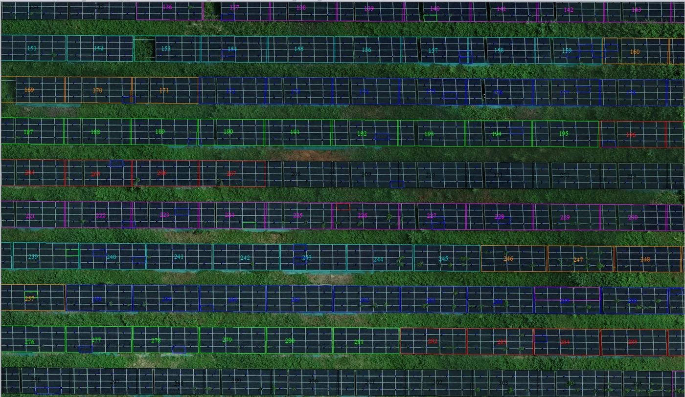
| Corossony | 1:500 plan and 15 mm orthophoto (2024); 1,472 concrete footings at 2 mm per pixel (2025) |
| Missions listed | 12 |
On the map
12 missions at this location
22 mm orthophoto of a project plot in Sinnamary
Georeferenced orthophoto, topographic survey and DWG plans delivered on 18 July 2026; a second plot in Wayabo surveyed at 37 mm with a surface model and contour lines.
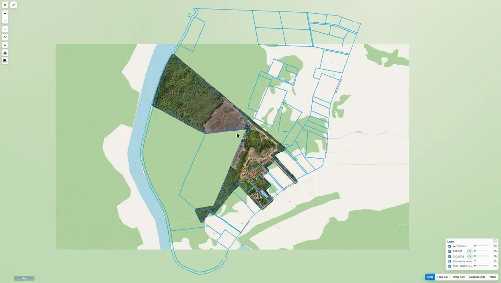
Orthophoto and surface model of 66 hectares at Pointe Combi
Acquisition from 12 to 14 May, delivery on the 19th: orthophoto, 7.2 cm surface model, footprint and cadastral parcels available on Sentinel Cloud.
- 66 ha
- 7,2 cm
Positions and elevations of the concrete footings of a solar plant
1,472 concrete footings surveyed over two hectares, once the modules and structures had been removed: 2 mm per pixel orthophoto, centre point and height of each footing in DWG and A0 plan delivered on 23 December.
- 1 472 footings
- 2 mm per pixel
Virtual tours of the Coco Banane and Savane des Pères plants
Two days of capture in early November: 12 panoramas at Coco Banane, 14 at Savane des Pères, tours online on 10 November; 2 cm orthophotos and source files handed over on the 18th, colour-graded footage for the client’s communication.
- 26 panoramas
LiDAR and orthophoto of 48 hectares of forest in Sinnamary
On 17 October 2025, for the Espace-Dev unit, after the Approuague survey in July: crossed flight lines, 3 cm orthophoto, 20 cm terrain, surface and height models and ground and above-ground clouds delivered on 21 October.
- 48 ha
- 20 cm models
Images of the Petit-Saut biomass plant for Voltalia’s communication
A selection of views extracted from the August 2025 360° panoramas, then full-resolution files for the inauguration’s printed visuals.
Capture of a telecom site for its digital twin
On 28 May 2025, with an agent of the operator on site: photogrammetric orbits around the water tower that carries the antennas, four 25-photo panoramas above and below the top, indoor and outdoor 360° tours. 3D model then computed by the operator’s digital-twin contractor.
Read the articleInspection of 1,262 supports along 128 km of medium-voltage lines
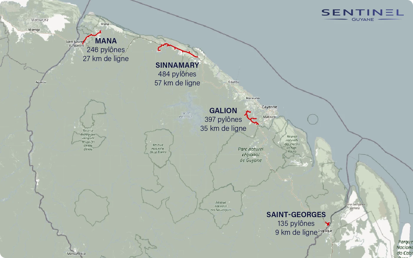
Four lots: Galion, in Montsinéry-Tonnegrande (397 supports), Mana (246), Sinnamary – Iracoubo (484) and Saint-Georges (135). From 17 September, 19 flying days and 7,854 photos, about six per support following the operator’s method, up to 99 supports in one day.
- 1 262 supports
- 128 km
- 7 854 photos
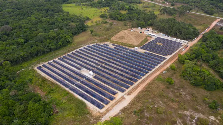
1:500 topographic plan of the Corossony photovoltaic plant
On 5 September 2024: 15 mm orthophoto, then tables, modules, cable trays, fences, substations and contour lines drawn on the plan, with a photo report on the fences.
- 15 mm
- 1/500 plan scale
Final version of the Sinnamary bridge works film
Film with interviews, edited from aerial and ground footage of the works; first version delivered in February 2023, final version in February 2024.
Plan of plots with measurement of cleared areas
Flight on 27 October 2023, orthophoto and area calculations delivered in November.
Four LiDAR intercalibration flights over the Paracou research station
Flights at 65, 80, 95 and 110 m above the forest, taking off from a gap at the foot of the flux tower, to compare our scanner with the research institute’s.
- 4 flight heights
Tell us about your project
Location, area or structure, expected deliverables and timing: with these details we can propose a method and a quote.
97310 Kourou
French Guiana
Route des Trois-Îlets
97229 Les Trois-Îlets
Martinique
20030-041 Rio de Janeiro – RJ
Brazil