
- Home
- French Guiana
- Kourou
Kourou
Our office is in Kourou. The town lies in a regulated zone: our flights there require an exemption. Outside the space base, we mapped the Bois Chaudat, Bois Diable and Marie-Claire lakes at 13 mm per pixel in November 2024, then started monitoring erosion of the Canal de l’Ouest and Bois Chaudat lake in September 2026, the first of eight campaigns planned up to 2028, for the Savanes community of communes; photographed the mudflats of the Kourou estuary for a shorebird study and surveyed the beach at low tide; covered the Pariacabo (524 ha) and Wayabo (3,856 ha) sectors for the public land agency; surveyed the Savane des Pères by LiDAR for the regional nature park; and measured the biomass plant stockpiles three times, in 2025 and 2026. The field days of our courses take place at the Matiti ground, in Macouria.
Key facts
| Office | 3 rue Gramme, 97310 Kourou |
|---|---|
| Constraint | Town in a regulated zone: flights by exemption only |
| Kourou lakes | Bois Chaudat, Bois Diable, Marie-Claire: 13 mm orthophotos in November 2024; Bois Chaudat lake at 12 mm and mud islets at 22 mm in September 2026 |
| Land sectors | Pariacabo: 524 ha, 8,414 photos, 3.5 cm per pixel; Wayabo: 3,856 ha, 55,395 photos (December 2023 – January 2024) |
| Missions listed | 24 |
On the map
24 missions at this location
2026 orthophoto campaign: eight sectors and 6,545 hectares
Eight perimeters and 6,545 hectares in Cayenne, Kourou, Macouria, Matoury and Saint-Laurent-du-Maroni, ordered on 2 October 2026, with 10 cm orthophotos required by the specifications. First sector delivered, Sud-Bourg in Matoury (147 ha): four flights on 16 October, 1,909 photos at 3.88 cm per pixel, 3.7 cm planimetric error on five independent check points, orthophotos and reports delivered on 19 October.
- 6 545 ha
- 8 sectors
- 3,7 cm check-point error
Erosion monitoring of the Canal de l’Ouest and Bois Chaudat lake
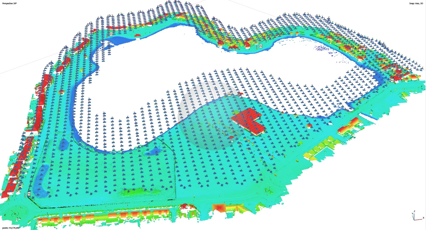
First of eight campaigns scheduled up to February 2028: flight on 15 September 2026 at low tide, 12 mm orthophoto, mud islets in the northern part of the lake mapped at 22 mm and 34 photos taken from fixed viewpoints; delivered on 17 September, with three Sentinel Cloud accounts.
- 12 mm/px
- 34 reference photos
Measurement of a specialised care home building
Distance between the lines of coach screws measured for each roof, flown as low as possible; delivered on 17 September 2026.
Read the articleIntroductory course in drone piloting and photogrammetry
From 6 to 9 July 2026, four trainees: Open category (A1/A3 and A2), with the A2 online course and exam alongside, then photogrammetry through to processing in Agisoft Metashape, QGIS and Global Mapper. Practice flights over one of the agency’s plots at Wayabo.
- 4 trainees
- 4 days
Online tools to prepare the remote pilot certificate
Two places on the online course and exam for the A2 subcategory (C2-class drones) for the authority’s staff, July 2026.
Third volume survey of the Kourou biomass plant stockpiles
From 9 to 13 March 2026, 16 mm orthophoto, after the April and October 2025 visits.
Three-day photogrammetry course in Kourou
From 23 to 25 March 2026, for a Guianese company’s drone pilot.
Photogrammetric survey of the Kourou biomass plant
Drone-pilot courses for research laboratories and local authorities
Drone-pilot course in Kourou from 17 to 29 October 2025 for two laboratories, piloting courses for a municipality and for the Water Office.
Roof photography in the Canal Leroy area
On 7 July 2025, under an exemption, as the town of Kourou lies in a regulated zone; further visits in August.
First stockpile survey at the Kourou biomass plant
On 7 April 2025: 14 mm orthophoto and volume plan; second visit on 6 October 2025.
RTK photogrammetric survey of Kourou beach at low tide
Vertical and 45° oblique imagery from 80 m, finer than 2.5 cm per pixel with 80% overlap in both directions, positioned by RTK on the Kourou GNSS antenna; raw data delivered to BRGM, which carried out the processing.
- 2,5 cm per pixel at most
Orthophotos of the three lakes of Kourou
Request of 11 October 2024; one flight plan per lake, a corridor on Bois Diable, a full grid on Marie-Claire, a crossed grid around Bois Chaudat without flying over the water, and control points measured on the ground. Delivered on 28 November: three orthophotos at 13 mm, three at 39 mm and three surface models.
- 13 mm/px
- 3 lakes
2 cm orthophoto of the Vieux Bourg port and the Îles du Salut boarding area
Photogrammetric survey in late November 2024 for an environmental laboratory: 2 cm per pixel orthophoto of the Kourou port and the boarding area for the islands.
- 2 cm per pixel
Two drone-pilot courses with field practice at Matiti
Sessions on 30 September and 14 October 2024, field day accompanied by the military control centre.
Update of a farm’s plot plan
Photogrammetric flights at 120 m on 29 and 30 October, under special authorisation, to update the plan drawn up in 2020.
Photos, orthophotos and videos of the Kourou estuary mudflats
For a shorebird study: two visits, on 31 October over both banks and on 7 November 2024 over the right bank, at times chosen according to the tides and the bird migration.
- 2 visits
Drone-pilot course from 1 to 12 July 2024
LiDAR survey of the Savane des Pères
Aerial photos of rooftop photovoltaic plants for communication
Top-down view, overall and close-up photos of each site: a roof in Kourou in late December 2023, then schools and guesthouses in Mana and Javouhey on 12 January 2024.
Orthophoto coverage of 12,647 hectares of inhabited French Guiana
From 4 December 2023 to 1 March 2024: eight sectors at 3.5 cm per pixel, 343 flights, 184,464 photos, 50 ground control and 26 check points; ECW and JP2 orthophotos accepted on 7 March 2024.
- 12 647 ha
- 184 464 photos
- 343 flights

RTX/PPP positioning tests
Measured accuracy of 1.1 cm in X, 1.6 cm in Y and 7 mm in Z, for missions without an RTK network.
Thermal surveys of ground-mounted plants for a partner operator
Visible and thermal orthophotos of several plants, delivered on the partner’s analysis platform with quality control of the flight lines; flights postponed in the rainy season when irradiance drops below 600 W/m².
LiDAR and photogrammetry on an active quarry and two project sites
Colourised LiDAR acquisitions and ground control points in Kourou, then at Roche Tablon (Roura); stockpile volumes computed.
Articles
Tell us about your project
Location, area or structure, expected deliverables and timing: with these details we can propose a method and a quote.
97310 Kourou
French Guiana
Route des Trois-Îlets
97229 Les Trois-Îlets
Martinique
20030-041 Rio de Janeiro – RJ
Brazil