
- Home
- French Guiana
- Matoury
Matoury
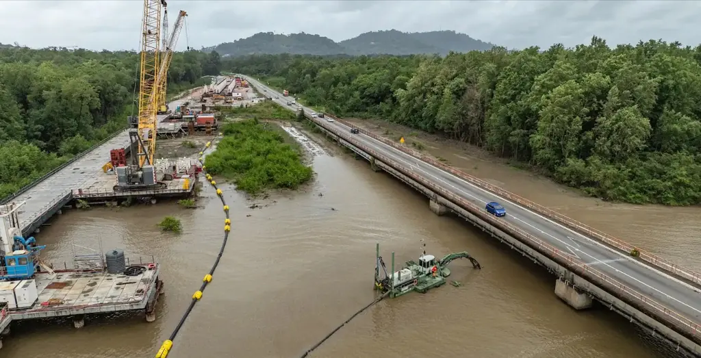
Matoury is home to Félix-Éboué airport: our flights there take place inside the control zone, with air traffic control approval and a call to the tower before and after each mission. Since October 2024 we have been filming the repair works on the Larivot bridge, a 1,225 m structure built between 1974 and 1976 on the RN1 between Matoury and Macouria: eleven visits ordered and a convention film delivered in March 2026. We also followed the RN2 upgrade at Balata for fourteen months with two time-lapse cameras, surveyed a precast yard at Cogneau-Larivot (3 cm orthophoto), covered for the public land agency the Cogneau-Lamirande sector (598 ha) during the 2023-2024 campaign, then the Sud-Bourg sector (147 ha), photographed on 16 October 2026 and delivered three days later, carried out thermography of a 1,152 kWp plant spread over three commercial roofs in September 2026, and in May 2023 searched the islets of the flooded savanna of the Mont Grand Matoury nature reserve for the agami heron.
Key facts
| Constraint | Félix-Éboué airport within the municipality: air traffic control approval and call to the tower |
|---|---|
| Larivot bridge | 1,225 m, 35 spans of 35 m; repair works filmed since October 2024 |
| Sud-Bourg, October 2026 | 147 ha for the public land agency: 1,909 photos at 3.88 cm per pixel, 3.7 cm planimetric error on five check points |
| Missions listed | 15 |
On the map
15 missions at this location
2026 orthophoto campaign: eight sectors and 6,545 hectares
Eight perimeters and 6,545 hectares in Cayenne, Kourou, Macouria, Matoury and Saint-Laurent-du-Maroni, ordered on 2 October 2026, with 10 cm orthophotos required by the specifications. First sector delivered, Sud-Bourg in Matoury (147 ha): four flights on 16 October, 1,909 photos at 3.88 cm per pixel, 3.7 cm planimetric error on five independent check points, orthophotos and reports delivered on 19 October.
- 6 545 ha
- 8 sectors
- 3,7 cm check-point error
Survey of 2.8 km of the Fouillée creek
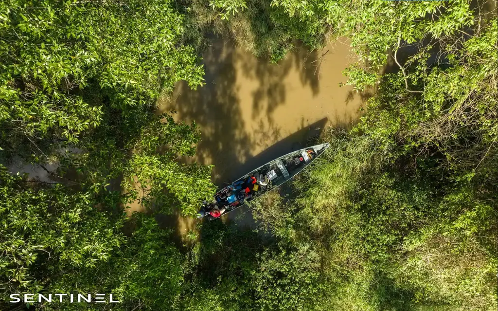
On 10 September 2026, from the roundabout and then by dugout canoe down to the mouth: 15 mm orthophoto of a 50 m strip on either side of the axis, plan of debris jams and bank access points, video of the stretch; delivered on 15 September with twelve months of online access.
- 2,8 km
Thermal survey of a 1,152 kWp plant on three roofs in Matoury
Purchase order received on 10 September 2026, flights on the 17th over the roofs of three commercial buildings in the Larivot area: 3,523 panels checked; deliverables and Sentinel Cloud access on the 21st.
- 3 523 panels
- 3 roofs
Eighth visit to the Larivot bridge works
On 23 July 2026; the ninth of the eleven visits ordered is scheduled for 29 October 2026, and the following ones will be used for the interviews of the end-of-works film.
Read the articleConvention film of the Larivot bridge works
Filming on 24 February and 3 and 4 March 2026: interviews, pre-shift briefing, safety talk, crews heading to the site by boat; four-to-five-minute film delivered in two versions, on 13 and 20 March, for the company’s convention.
Read the article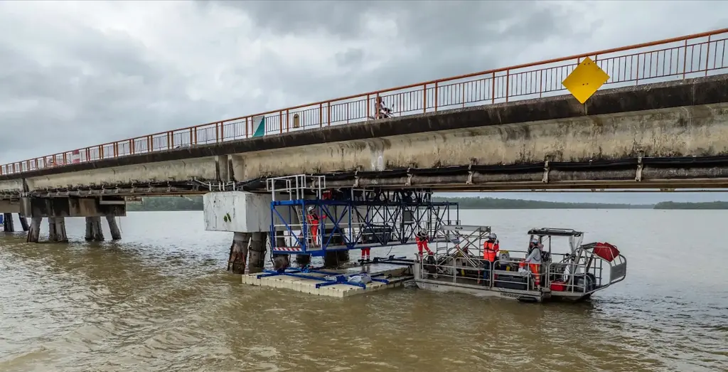
Divers filmed on the Larivot bridge works
Fourth visit, on 26 November 2025, postponed from October to film the divers at work; photos delivered the next day.
Read the articleDrone-pilot courses for research laboratories and local authorities
Drone-pilot course in Kourou from 17 to 29 October 2025 for two laboratories, piloting courses for a municipality and for the Water Office.
Nineteen buildings surveyed in French Guiana, including ten housing estates in Saint-Laurent-du-Maroni
Order of 22 July 2025: eighteen housing estates and one other building, in Cayenne, Saint-Laurent-du-Maroni, Rémire-Montjoly and Matoury, surveyed for rooftop solar projects; files delivered in August.
- 19 buildings
Divers and platforms on the Larivot bridge works
Third visit, on 2 July 2025: anodes fitted by divers and work from the rolling and floating platforms.
Read the articleDredging and travelling gantries filmed on the Larivot bridge
Second of eleven visits, on 20 February 2025, once the dredging machine was back: dredging, installation of the travelling gantries under the beams and a new jetty at the port; photos delivered the next day.
Read the articleFourteen months of time-lapse on the Balata bus rapid transit works
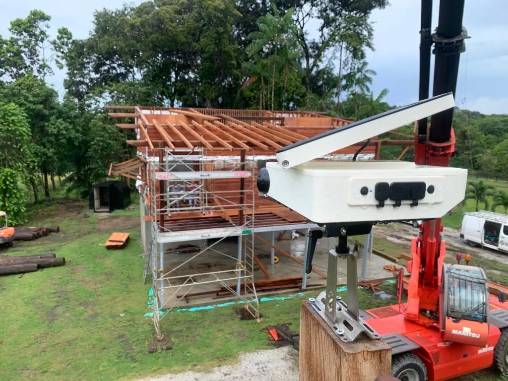
Upgrade of the RN2 between Balata and the PROGT roundabout: five days of aerial and ground filming from July 2024 to June 2025, two time-lapse cameras from 8 November 2024 to 31 December 2025, two edits delivered in June and October 2025, cumulative time-lapse delivered on 9 January 2026.
- 14 months of time-lapse
- 2 cameras
- 5 filming days
First visit to the Larivot bridge repair works
On 8 October 2024, first of the eleven visits ordered by the company repairing the bridge: video rushes for the edit. Flights inside the Cayenne airport control zone, with air traffic control approval for the week of 7 to 11 October and a call to the tower before and after the mission.
Read the article3 cm orthophoto and point cloud of a precast yard at Cogneau-Larivot
Flights from 12 to 14 March 2024; 3 cm orthophoto, point cloud and plan delivered to the contractor on 14 March.
Orthophoto coverage of 12,647 hectares of inhabited French Guiana
From 4 December 2023 to 1 March 2024: eight sectors at 3.5 cm per pixel, 343 flights, 184,464 photos, 50 ground control and 26 check points; ECW and JP2 orthophotos accepted on 7 March 2024.
- 12 647 ha
- 184 464 photos
- 343 flights

Time-lapse of a showroom construction site
Time-lapse unit on the showroom construction site; 30- and 45-second edits, static and with zoom, delivered on 24 November 2023, final version on the 28th.
Tell us about your project
Location, area or structure, expected deliverables and timing: with these details we can propose a method and a quote.
97310 Kourou
French Guiana
Route des Trois-Îlets
97229 Les Trois-Îlets
Martinique
20030-041 Rio de Janeiro – RJ
Brazil