
- Home
- French Guiana
- Saint-Laurent-du-Maroni
Saint-Laurent-du-Maroni
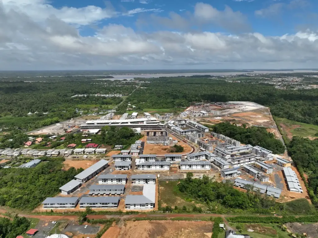
A little over 200 km from Kourou by the RN1, about three hours by road, Saint-Laurent-du-Maroni faces Albina, in Suriname. In October 2023 we produced an 815 ha orthophoto at 3.2 cm and a 223 ha LiDAR survey there for the public land agency, with flights near the aerodrome authorised outside its opening hours; in October 2024 we surveyed by LiDAR the 125 ha of the former relegation camp at Saint-Jean for the regional historic monuments service. Since October 2024 we have been monitoring the construction of the waste storage facility (eight visits, 3 cm orthophoto); we also surveyed an embankment collapse at PK16 of the Apatou road, the Apatou waste collection centre at 1 cm, and 8 km by LiDAR and 7.6 km by photogrammetry between Saint-Laurent and Saint-Jean, and photographed the Balaté Nord housing site and the laying of the foundation stone of the courthouse complex in July 2026.
Key facts
| Access from Kourou | 203 km by the RN1, about 3 h |
|---|---|
| Saint-Jean | 125 ha by LiDAR, 25 cm models, 3 cm orthophoto, October 2024 |
| Missions listed | 12 |
On the map
12 missions at this location
2026 orthophoto campaign: eight sectors and 6,545 hectares
Eight perimeters and 6,545 hectares in Cayenne, Kourou, Macouria, Matoury and Saint-Laurent-du-Maroni, ordered on 2 October 2026, with 10 cm orthophotos required by the specifications. First sector delivered, Sud-Bourg in Matoury (147 ha): four flights on 16 October, 1,909 photos at 3.88 cm per pixel, 3.7 cm planimetric error on five independent check points, orthophotos and reports delivered on 19 October.
- 6 545 ha
- 8 sectors
- 3,7 cm check-point error
Photo report on the laying of the first stone of the new justice complex
On 6 July 2026: aerial views of the site and ground photos of the ceremony, 407 shots, 180 selected and delivered to the main contractor.
360° photos of a telecommunications site
360° shots of one of the operator’s sites in Saint-Laurent-du-Maroni on 17 March 2026, at the time agreed with its team; deliverable handed over the next day.
Read the articleRD5 and RD11 road corridors in LiDAR and photogrammetry
2.95 km over a 38 m width along the RD5 for a chartered surveyor, then 8 km in LiDAR and 7.6 km in photogrammetry between Saint-Laurent and Saint-Jean du Maroni for the local authority and its engineering firm: classified clouds, ground points every 50 cm, TIFF and ECW orthophotos.
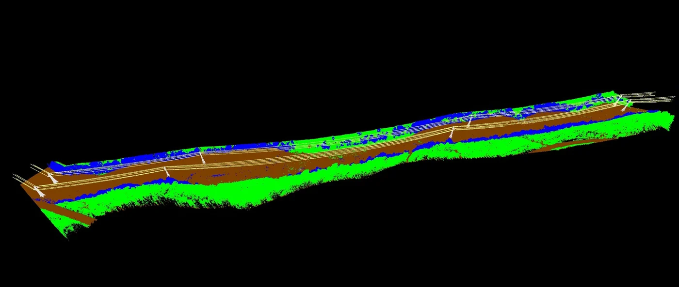
Photo coverage of the Balaté Nord housing construction site
Second of three visits, after the first homes were handed over in November: homes completed, under construction and just started, and eye-level videos inside the residences. First visit in January 2025, third in early March 2026 along two flight paths drawn by the client.
Two time-lapses during cell filling and an orthophoto of the Apatou waste collection centre
Two solar-powered cameras installed in Saint-Laurent in early November 2025, on the sorting platform and at the back, by the cells: images from 4 November 2025 to 25 March 2026, edit delivered on 3 April. On 4 November, a 1 cm orthophoto and plan of the Apatou waste collection centre.
Read the articleNineteen buildings surveyed in French Guiana, including ten housing estates in Saint-Laurent-du-Maroni
Order of 22 July 2025: eighteen housing estates and one other building, in Cayenne, Saint-Laurent-du-Maroni, Rémire-Montjoly and Matoury, surveyed for rooftop solar projects; files delivered in August.
- 19 buildings
LiDAR survey of 125 hectares of the relegation heritage of Saint-Jean-du-Maroni
For the regional historic monuments service, from 23 to 25 October 2024: 25 ground points per m² required, 25 cm terrain and surface models, 3 cm orthophoto and a classified cloud in sixteen tiles, delivered by 7 November to delimit the buildings of the former camp to be protected.
- 125 ha
- 25 cm terrain model
Monitoring of the Saint-Laurent-du-Maroni waste storage facility works
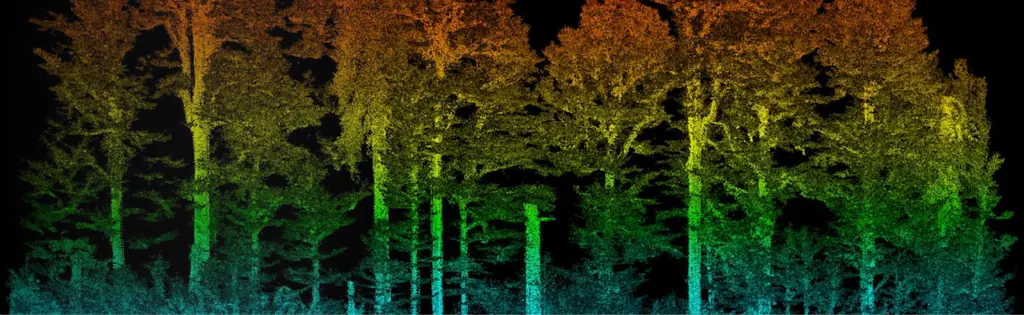
Eight visits from 11 October 2024 to 6 July 2026 (December 2024, March, June and November 2025, January, April and July 2026): each time, photos from the same viewpoints, two 360° panoramas, a hyperlapse and a vulture series; a 3 cm orthophoto and a plan since December 2024.
- 8 visits
- 3 cm per pixel
Survey of an embankment collapse on the Apatou road
At km 16 of the RD11: point cloud, surface model, DWG contour lines, longitudinal and cross profiles fitted to the collapse, delivered in four days to a geotechnical engineering firm.
Long-endurance Boréal drone campaign for the State in French Guiana
Six weeks of operations from Mana with M3 Systems: night flights over the Maroni river with the border police, maritime surveillance, environmental police and civil protection.
Read the articleOrthophoto of 815 hectares and LiDAR of 223 hectares in Saint-Laurent-du-Maroni
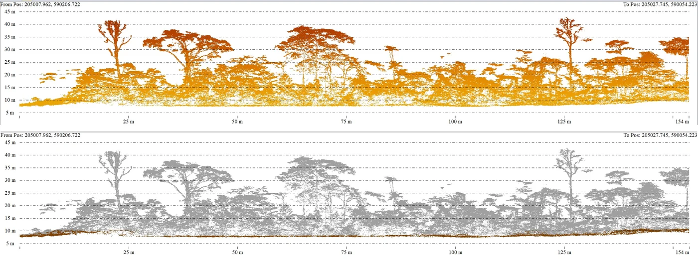
Flights in October 2023 near the aerodrome, authorised outside its opening hours: 3.2 cm orthophoto, 50 cm terrain, surface and height models, contour lines in DWG and SHP, layers of buildings, roads, water and forest; delivered on 24 November 2023.
- 815 ha of orthophoto
- 223 ha of LiDAR
Tell us about your project
Location, area or structure, expected deliverables and timing: with these details we can propose a method and a quote.
97310 Kourou
French Guiana
Route des Trois-Îlets
97229 Les Trois-Îlets
Martinique
20030-041 Rio de Janeiro – RJ
Brazil