
- Home
- French Guiana
- Macouria
Macouria
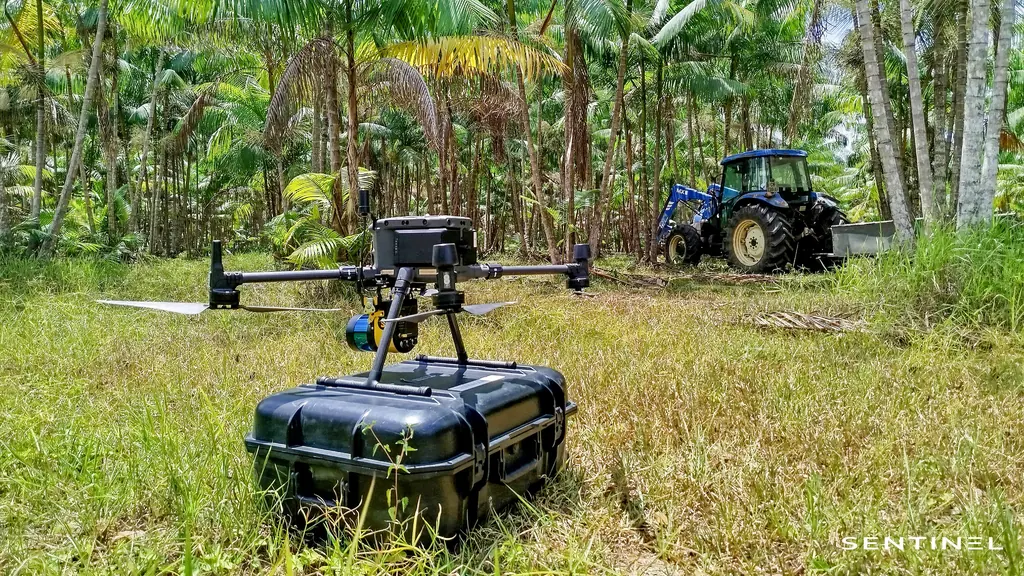
Between Cayenne and Kourou, Macouria concentrates solar, farming and land projects. In September 2026 we carried out there the first documented client mission of our Zenmuse L3 LiDAR, on a solar plant project (9 ha, sixteen RTK-measured targets); in June 2026 we inspected five wooden-pole supports of a 90 kV line near Matiti (511 photos, 106 anomalies recorded), after a fault check on the same line delivered less than 25 hours after the request; carried out thermography of the Toucan 2 and Sioulé ground-mounted plants; surveyed 2.95 km of the RD5 road by LiDAR; and covered the Soula, Sablance and Maillard (2,982 ha) and Sud-Bourg–Préfontaine (1,115 ha) sectors for the public land agency. The Matiti ground hosts the field days of our courses and the practical examinations.
Key facts
| 90 kV line, Matiti | June 2026: 5 wooden-pole supports, 511 photos, 106 anomalies (7 low, 97 medium, 2 high) |
|---|---|
| Matiti ground | Course field days and practical examinations |
| Missions listed | 19 |
On the map
19 missions at this location
2026 orthophoto campaign: eight sectors and 6,545 hectares
Eight perimeters and 6,545 hectares in Cayenne, Kourou, Macouria, Matoury and Saint-Laurent-du-Maroni, ordered on 2 October 2026, with 10 cm orthophotos required by the specifications. First sector delivered, Sud-Bourg in Matoury (147 ha): four flights on 16 October, 1,909 photos at 3.88 cm per pixel, 3.7 cm planimetric error on five independent check points, orthophotos and reports delivered on 19 October.
- 6 545 ha
- 8 sectors
- 3,7 cm check-point error
Second LiDAR and photogrammetric survey of the Macouria solar plant site
On 2 October 2026, after topsoil stripping: 8.78 hectares, 517 points per m², 2.97 cm vertical error for LiDAR and 3.07 cm horizontal error for the orthophoto on five check points; deliverables online on 6 October.
- 517 points per m²
- 2,97 cm vertical error
First LiDAR and photogrammetric survey of the Macouria solar plant site
On 1 September 2026, after clearing: 9 hectares, sixteen targets including ten check points, 1.95 cm vertical error for LiDAR and 2.40 cm horizontal error for the orthophoto; delivered on 3 September, vectorised power lines in DWG on the 14th.
- 1,95 cm vertical error
- 16 targets
CATS practical exam for two firefighters
On 26 August 2026 on the Matiti field: flights with our fleet, a demonstration of what the drones can do, a regulatory refresher, then the practical exam at the end of the morning.
- 2 firefighters
Fault check after an outage on a 90 kV line: supports 50 to 60, then 66 and 94
Request received on 1 June 2026 in the late afternoon, flights the next morning: photos of supports 50 to 60, then 66 and 94, and two cable defects positioned in the 94–95 span, delivered in KML and GeoJSON the same day.
- < 25 h between request and results
Inspection of five wooden-pole supports of a 90 kV line at Matiti
On 3 June 2026, between supports 43 and 47: two pylons and three portal frames photographed in detail, 511 photos, 106 annotated anomalies (30 corrosion, 30 nesting, 14 structural cracks, 5 bolting, 26 others, mostly termites) rated 7 low, 97 medium and 2 high. PDF report, Excel table and Sentinel Cloud access delivered on 5 June.
- 511 photos
- 106 anomalies
Topographic survey of 4.7 hectares at Belle-Humeur
Quote approved on 21 January, acquisition on the 27th, delivery on the 28th.
RD5 and RD11 road corridors in LiDAR and photogrammetry
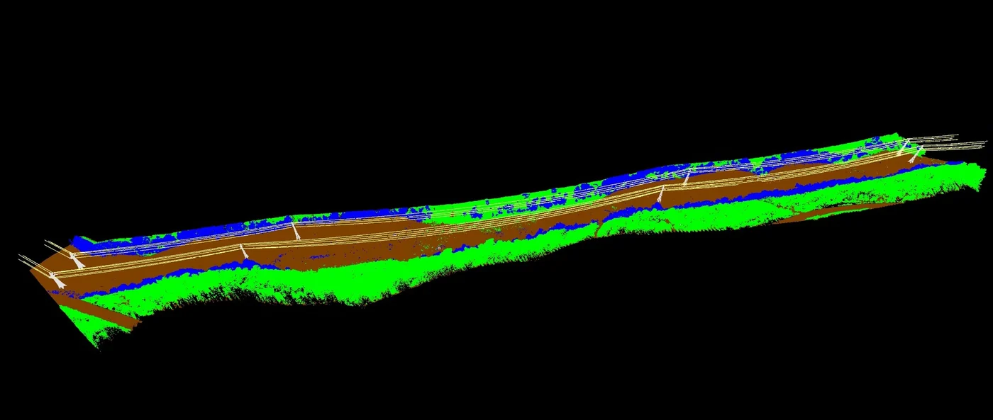
2.95 km over a 38 m width along the RD5 for a chartered surveyor, then 8 km in LiDAR and 7.6 km in photogrammetry between Saint-Laurent and Saint-Jean du Maroni for the local authority and its engineering firm: classified clouds, ground points every 50 cm, TIFF and ECW orthophotos.
Orthophoto of five hectares of nursery for an architect
Two plots surveyed on 11 December 2025.
- 5 ha
Thermal surveys of the Sioulé and Toucan 2 plants
Video footage of the Soula media library and the Concorde Nord development zone
LiDAR and RGB topographic survey
LiDAR and RGB topographic survey in Macouria
Two drone-pilot courses with field practice at Matiti
Sessions on 30 September and 14 October 2024, field day accompanied by the military control centre.
Orthophoto coverage of 12,647 hectares of inhabited French Guiana
From 4 December 2023 to 1 March 2024: eight sectors at 3.5 cm per pixel, 343 flights, 184,464 photos, 50 ground control and 26 check points; ECW and JP2 orthophotos accepted on 7 March 2024.
- 12 647 ha
- 184 464 photos
- 343 flights

Orthophotos and thermography of two ground-mounted plants
Toucan 2 and Sioulé plants: orthophoto and thermal imaging, campaigns repeated in 2025.
Film shoot with interviews in a school in Soula
Orthophoto and virtual tour of two project plots
Go-ahead on Tuesday, flight on Saturday, delivery the following Wednesday: orthophoto, oblique photos and a small online virtual tour.
Thermal surveys of ground-mounted plants for a partner operator
Visible and thermal orthophotos of several plants, delivered on the partner’s analysis platform with quality control of the flight lines; flights postponed in the rainy season when irradiance drops below 600 W/m².
Tell us about your project
Location, area or structure, expected deliverables and timing: with these details we can propose a method and a quote.
97310 Kourou
French Guiana
Route des Trois-Îlets
97229 Les Trois-Îlets
Martinique
20030-041 Rio de Janeiro – RJ
Brazil